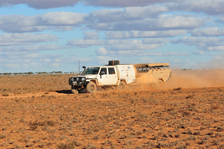
The convoy ground to a halt. Like normal, I was tail-end-Charlie and had no idea of what was happening up at the front of our group of travellers.
“Eh, Foss”, the CB chattered into life, “Can you come up here?”
“Sure,” I replied, as ‘Foss’ was what my son calls me and is short for ‘Fossil’; a loving term, I’m sure.
As I worked my way along the group and came over a low sand ridge, the reason for our unplanned stop became immediately apparent.
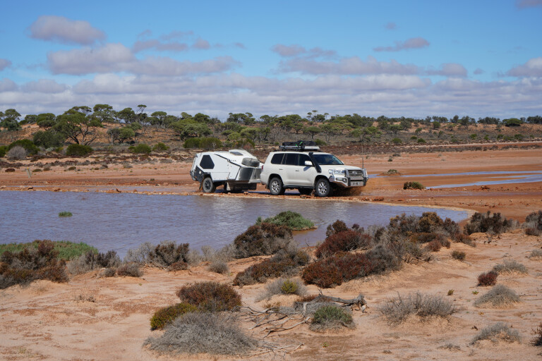
Across the track and spreading out as far as the eye could see, was a veritable sea of water. The blanket of water, dotted with spinifex close to shore while farther out only the taller trees stood above the liquid expanse, stretched away to the north and south and out of view.
While a couple of volunteers checked how deep the water was, Trent and I sent our drones for an aerial view to get a better idea of what was in front of us. It wasn’t good and while I love seeing water in desert country and the life it brings, this time it meant turning around and backtracking – something we hate to do!
Leaving Ceduna
Our latest desert sojourn with Moon Tours (www.moontours.com.au) had begun a week previously when we had met our group of fellow adventurers in Ceduna, South Australia.
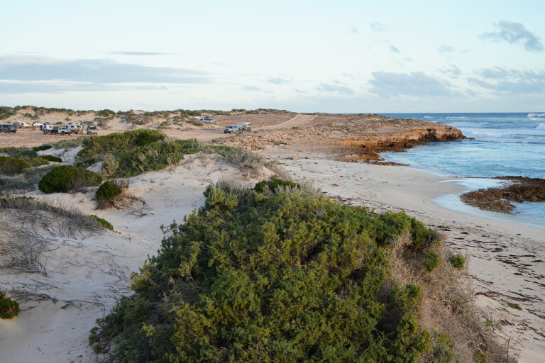
Our convoy then headed out via the sandy tracks and along the coastline that was being absolutely hammered by huge surf, to the somewhat protected enclave of Cheetima Beach, west of the tiny hamlet of Fowlers Bay.
Next day, after fueling up at Nundroo, for what turned out to be a long haul between fill-ups, we turned off the highway near the old Colona homestead and drove north. The road was pretty good, apart from the big, long mine-haul trucks that cart semi-processed ore from the Iluka mine site to Ceduna for shipping elsewhere.
We crossed into the vast Yellabinna Regional Reserve that covers more than 20,000km² and with the adjoining reserves, conservation and national parks make up a huge area of protected land that stretches for more than 400km in an east-west direction, south of the Trans Australian Railway line. At one point, away to the east, we could see the workings of the Iluka mine (mining is allowed in Regional Reserves in South Australia under strict guidelines), which is the largest zircon mine in the world, by all accounts,
We stopped briefly near the Ooldea railway siding and found the monument to Daisy Bates, who lived here from 1919 to 1935. She helped the local Aboriginal people in a multitude of ways, not the least being to come to grips with the influx of white people who came by the steam train that had started to run across the continent in 1917.
A-bomb tour
Just a little farther north, at the gate to Maralinga, we called the caretaker and he was soon there to escort us in to what was once the heart of the village and the living area for those who worked on the A-bomb tests during the 1950s and 1960s. While the tests were, and still are, pretty controversial, we had come to see the sights where the bombs had been exploded and which are now part of the tourist attraction run by the Maralinga Tjaruta Aboriginal Land Trust.
We’ve been here a couple of times and while the tour is pretty expensive, it is well-worth it. You need to book ahead before arriving and you can’t drive your own vehicle to the bomb sites, but must board a bus with a driver and guide.
In all, there are seven A-bomb sites at Maralinga, five of which are visited on the tour along with some of the buildings and facilities including the impressive runway and aerodrome.
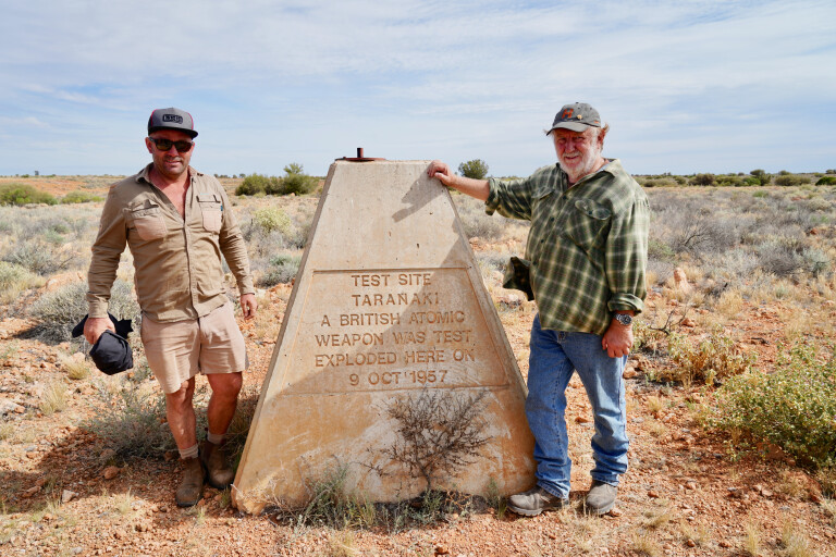
While the test sites have been cleaned up and the whole area declared ‘safe’ for visitors, our guide was only too willing to show us some glass that had been formed when an A-bomb had melted the natural silicon in the surrounding sand. Once, whole sheets of this glass covered many acres here, but most have been cleaned up and buried in the mammoth pits that dot the area.
That evening our plans were thrown into disarray as we were told our planned route through the Aboriginal land to the Anne Beadell Highway and the highway itself, which we had already received permits for, was now closed to all travellers for ‘Men’s Business’.
Next morning with a new plan in place, we were escorted out of the area and south to the railway line, where we turned west for the rough and slow crossing of the Nullarbor Plain.
Forrest metropolis
We stopped briefly at Cook, still one of the most important sidings on the line, now used mainly as a rest spot for crews on the trains as well as maintenance people working the line.
Later that same day we crossed the WA-SA border and next day pulled into Forrest, which seemed like a metropolis after the deserted sidings we had been past. Still run as an important refuelling spot for light planes and helicopters flying across the continent, the strip here can take large passenger aircraft as well, if and when required. We all grabbed a coffee, ate the small cafe out of bacon and eggs and then refuelled the vehicles.
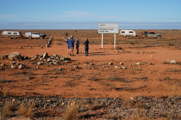
Travelling the next day brought us to the site of the WW2 prisoner-of-war camp and you’d have to say it would have been a lonely, desolate spot for the mainly Italian prisoners who were brought here. You can find out more about the place and the prisoners here.
After three long, torturous days, the limestone-studded track began to improve as we approached the railway siding of Haig. Once again there was hardly anything to mark the place on the map, but we were just happy to be able to cruise at 60 to 70km/h.
Stopping at Rawlinna briefly we didn’t see a soul, although there was some sign of life with a couple of work vehicles pulled up near one of the buildings. We found the junction to the Connie Sue Highway on the northern side of the railway line and headed north across the flat, stark and treeless Nullarbor Plain for 45km or so before seeing the shapes of trees etched against the flat horizon.
The highway – a graded track at best – continued in a beeline north, typical of the many roads that Len Beadell and his Gunbarrell Road Construction crew surveyed and built during the 1950s and 60s. You can find out more about this amazing Australian icon here.
Great Victoria Desert
Next day, we entered the Great Victoria Desert and then the Neales Junction Nature Reserve. We stopped earlier that day at the junction itself, where the Connie Sue crosses the Anne Beadell Highway, another one of Len’s famous roads, but again a long way short of most people’s idea of a ‘highway’. There’s a very pleasant camp located just to the west of the crossroads where a tank supplies water, while a couple of magical marble gums, endemic to the Great Victoria Desert, cast some lovely shade.
From the crossroads we continued north along the Connie Sue, the track became more eroded and hemmed in by spinifex, the country showing ever increasing signs of recent rain. Still, it didn’t slow us down too much and after 170km for the day we pulled up for camp, just off the track and close to Hanns Tabletop Hill. Frank Hann, a somewhat famous WA explorer, had noted the butte as a landmark on his 1903 expedition, and it was named in Frank’s honour by geologist H.Talbot in 1916.
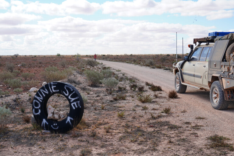
Like the previous day, we travelled across sandy country dotted with stony rises and gravel plains that were well covered in spinifex, scrub and occasionally dotted with the taller and bigger marble gums.
At about midday we stopped at the overlook into the Mackenzie Gorge, which is just to the west of the track, the vantage point giving good views over the surrounding country and the rugged escarpments that make up the gorge.
That afternoon, after turning on to a bitumised Great Central Road and crossing a flowing Elder Creek, a result of recent rains, we pulled in to Warburton Roadhouse. With tyres to repair and replace, and a suspension on one of the trailers needing some work, we took over the small caravan park behind the roadhouse.
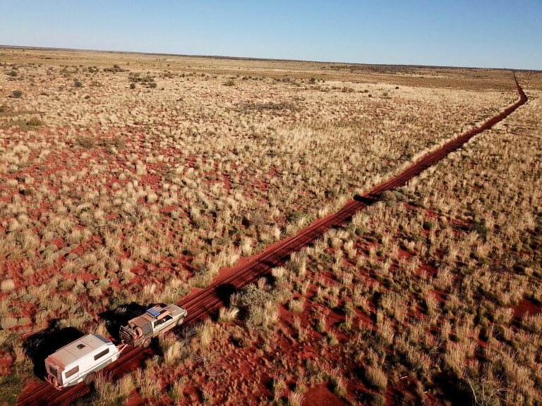
It was a late departure as we headed off west along the Great Central Road before taking the Heather Highway north-west and then north to meet with the Gunbarrel Highway, arguably Len Beadell’s most famous road. Along this famous route you’ll find blazed trees, plaques and rocky hills named by him and for him. Just west of Len’s Thryptomine Hill and in the centre of a sandy flat, we found a working bore with a hand pump and a good spot to camp for the night.
Camp Beadell with its bore casing (you will need a pump and a long hose to get water) is also a good spot to camp, which we passed early the next day before arriving at Mt Beadell, where there is a monument to Len and the work of his men.
Where the Gunbarrel turns directly west, near the red bluff of Mt Everard, there are a few tracks and a camping spot, while the Gunbarrel continues rocky and rough before once again entering sand ridge country and coming to Everard Junction. Here our little group of travellers, after signing the visitors’ book and taking photos of the Len Beadell plaque located here on top of a 44-gallon drum, turned north along another of Len’s roads, the Gary Highway.
Gibson Desert
We had left the Great Victoria Desert and were now in the Gibson Desert, the country around the road junction being protected in the 18,900km² Gibson Desert Nature Reserve. The reserve is now known as the Pila Reserve, under a 2020 agreement with the Gibson Desert Aboriginal People and the WA Government, with management shared between the traditional owners and WA Conservation department.
The country was steadily getting greener as we headed west and north from Warburton, a result of some good falls of rain over the preceding three months. I was hoping such verdancy was also an indicator that Lake Cohen, almost beside the Gary Highway, would have water in it.
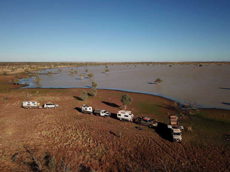
Some 38 years previously, Viv and I had been fortunate enough to visit this lake for the first time and it had water in it then and was an oasis for the area’s wildlife. Subsequent visits since had seen it as dry as a chip and, while still a good spot to camp, you’d have to say it had lost its major attraction.
We were in luck as a large expanse of water greeted our eyes and there was no need to ask if anyone wanted to camp there. We pulled up alongside the lake, one of our group venturing a little too close to get a grassy camp and sunk in the soft mud. A winch was needed to pull him out, but it was such a great camp we opted to stay a second night, enjoying the play of light on the water between sunrise and sunset.
Sadly, the birdlife wasn’t as good as we expected; probably because there was so much water dotted across the desert country that there was no need for the birds to congregate at any one spot. Still, a few flocks of avocets waded through the shallows while some small mobs of grey teal and black duck dibbled and dabbled their way across the normally glassy surface of the lake.
Inland sea change
Back on the road again, we headed north and then turned on to the Talawana Track at Windy Corner. Just 10km later we came upon our sea of water and after flying the drones to see the size of the challenge, reluctantly turned back and headed to the Gunbarrel Highway, having already received word that the Gary Highway north of Windy Corner was also flooded in numerous places.
Back on the Gunbarrel we pushed westwards, camping the night beyond Geraldton Bore (another source of water and small campsite) on a wide, soft, spinifex-covered plain.
With the route west improving all the time we stopped to admire the watery expanse of Mangkilli Claypan, once again the water being a rare sight in this vast expanse of desert country. Later we pulled in to Carnegie Station nearly 200km farther on, having covered that distance in just a few hours.
The property was getting ready for its annual muster and people were working on vehicles and mobile yards in preparation for the next few weeks of hard work. We fuelled up and set up camp in the nearby camping area before having a few drinks around the fire and yarning to a couple of the workers.
Next day, we rolled in to Wiluna, or more correctly the Gunbarrel Laager, the only place you can camp in or around the outback township. The town has been cleaned up, although the historic Club Hotel is closed but has been renovated and is used for Shire offices.
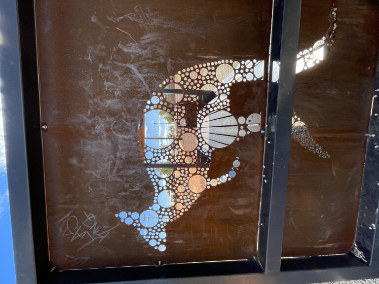
One place worth visiting, whether you have travelled the Gunbarrel or the famous Canning Stock Route, is the Canning-Gunbarrel Discovery Centre, which is also home to the Tjukurba Art Gallery where local artists display their latest creations.
Wiluna also marked the end of this phase of the trip, the route now wandering through more settled areas of WA as most of us pushed on to the north-west coast, north of Port Hedland. It had been a great adventure through ever-changing desert country, enlivened with the recent rain.
Top 5 places to see
01: FOWLERS BAY
From Ceduna, follow the sandy tracks and rugged coastline to Fowlers Bay on the Eyre Peninsula. Fowlers Bay is a prime winter southern right whale-watching spot and is also renowned for its extensive sand dunes, beaches, wildlife and fantastic fishing.
02: MARALINGA
Take a guided tour of the Maralinga’s A-bomb sites of the 1950s and 60s, plus the massive 3000m runway that is still maintained for emergencies. Be warned, the tour is not cheap and needs to be booked in advance, but well-worth the effort and cost.
03: THE CONNIE SUE HIGHWAY
The Connie Sue Highway is one of Australia’s outback tracks constructed by Len Beadell in the early ’60s and named after his daughter. The dirt-track Connie Sue traverses the Great Victoria Desert from Warburton to Rawlinna.
04: LAKE COHEN
Recent rain has seen the ephemeral Lake Cohen, on the Gary Highway in the Gibson Desert, return to its verdant best. It attracts migratory birds and is a great spot to camp.
05: DISCOVERY & ART CENTRE, WILUNA
Wiluna is the gateway to the Gunbarrel Highway and Canning Stock Route. While there, check out the Canning-Gunbarrel Discovery Centre and the Tjukurba Art Gallery.

COMMENTS