Explore NT
Gallery53
The Finke River is the world’s oldest riverbed that only flows for a few days in good years. It winds its way through the Red Centre, eventually disappearing into the sands of the Simpson Desert.
Along its route are some of the best remote campsites you’ll ever experience including the famous Boggy Hole, as well as many other great spots.
This adventure begins on Ernest Giles Road, an unsealed road from the Stuart Highway to Kings Canyon Road.
53
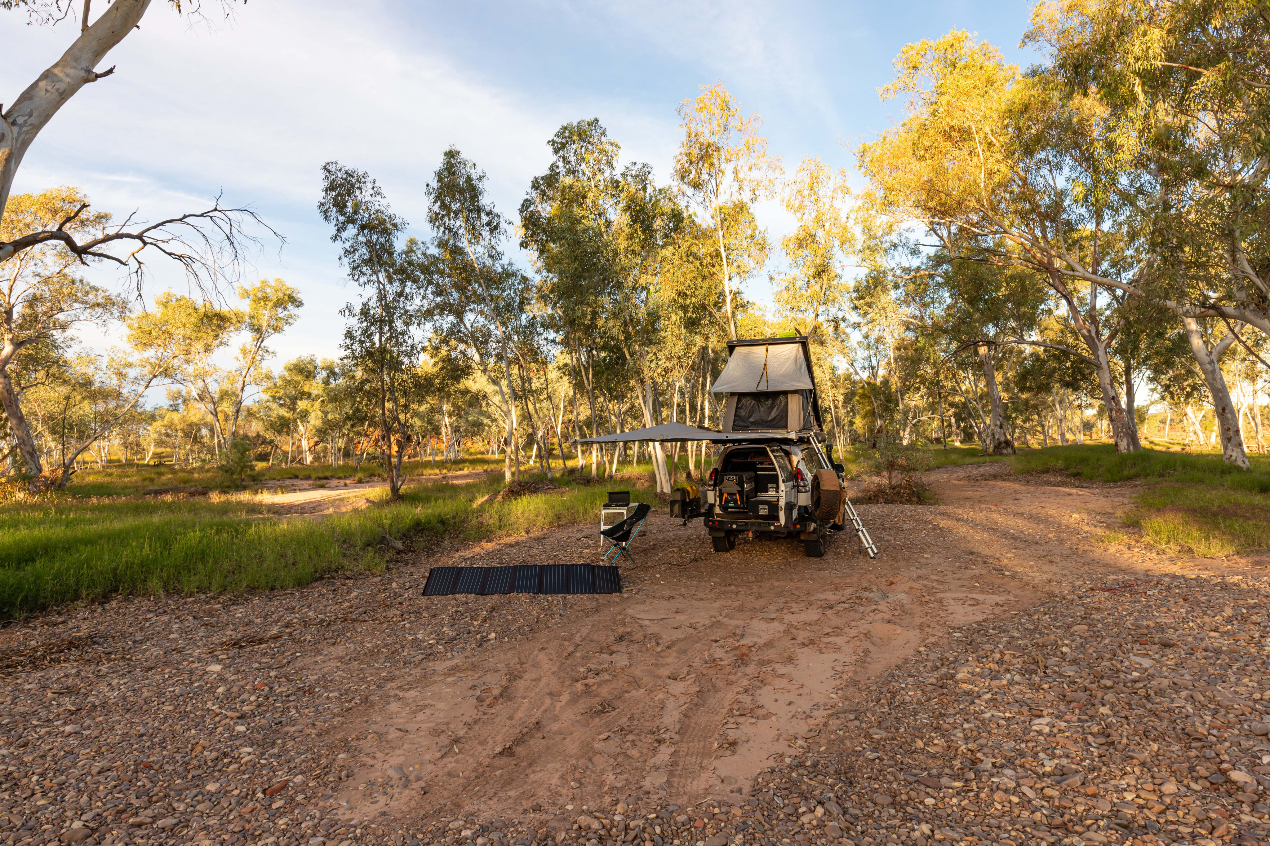
Once off the Stuart Highway, I aired down my tyres to gravel-road pressures of around 26psi in the front and 28psi in the rear. This provided a more comfortable ride over rough patches, floodways and corrugations.
I was supposed to tackle this track a few years ago with some mates. However, we took a wrong turn and had to cross the dry Palmer River. I was towing my camper trailer at the time and it took us four hours to extract it and my Prado, as well as another vehicle, out of the deep sand.
We retreated with tails between our legs. Had we read the map properly and worked out that the start of the track was a few kilometres to the east, we would’ve enjoyed the drive.
53
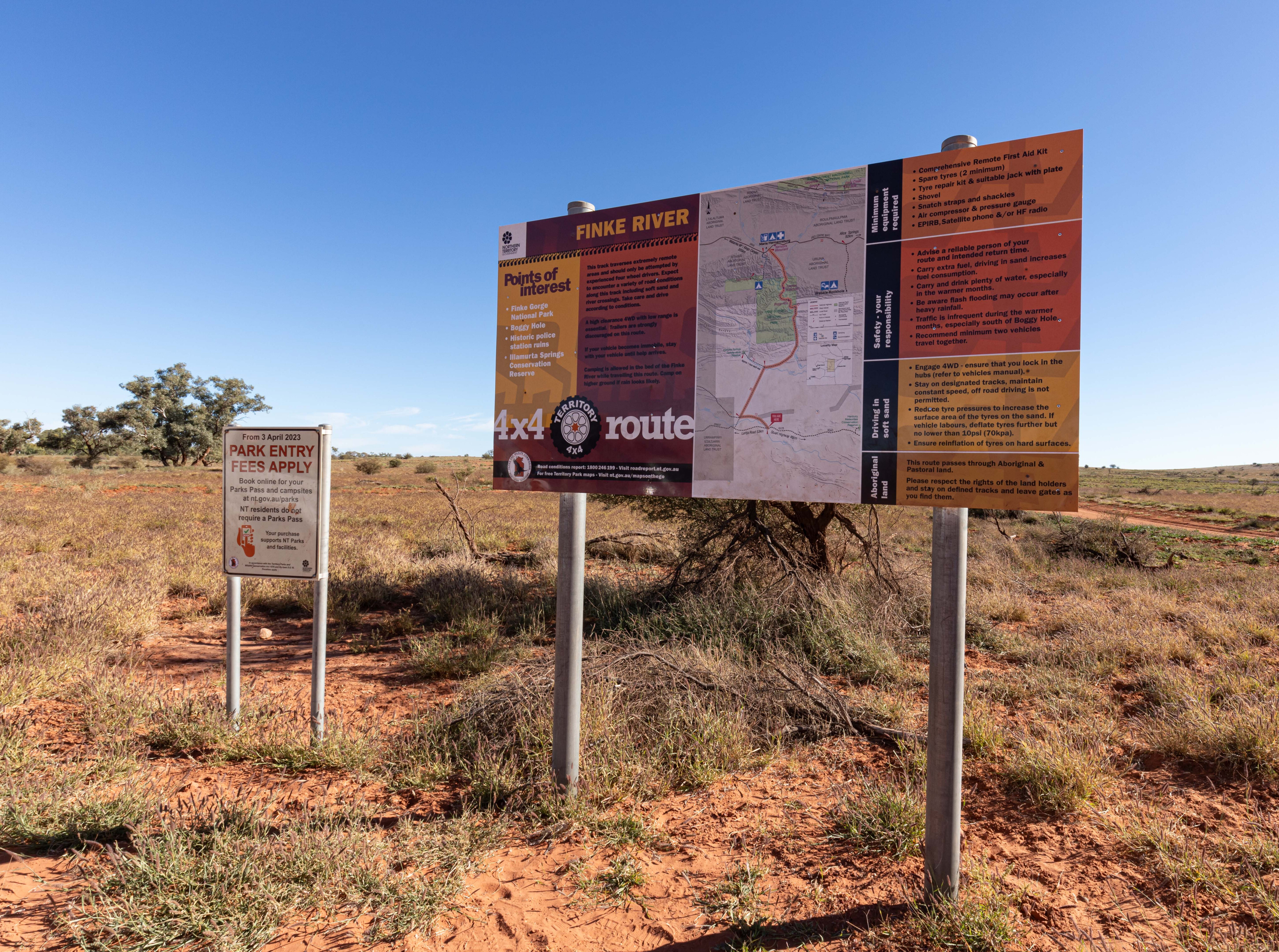
The right way
For the right route, turn onto the Tempe Downs Road from the Territory 4x4 Route information board until the track heads north. Once through the gate, the sandy track traverses dune country with plenty of desert oaks making for a picture-perfect scene; it is a beautiful drive.
Keep to the left when traversing the dunes, and UHF channel 10 is probably the best channel to be on, although when travelling solo, it’s better to scan and listen for chatter. If you find that your 4x4 is labouring a bit on the soft sand dunes, let a little more air out of your tyres to make the going easier.
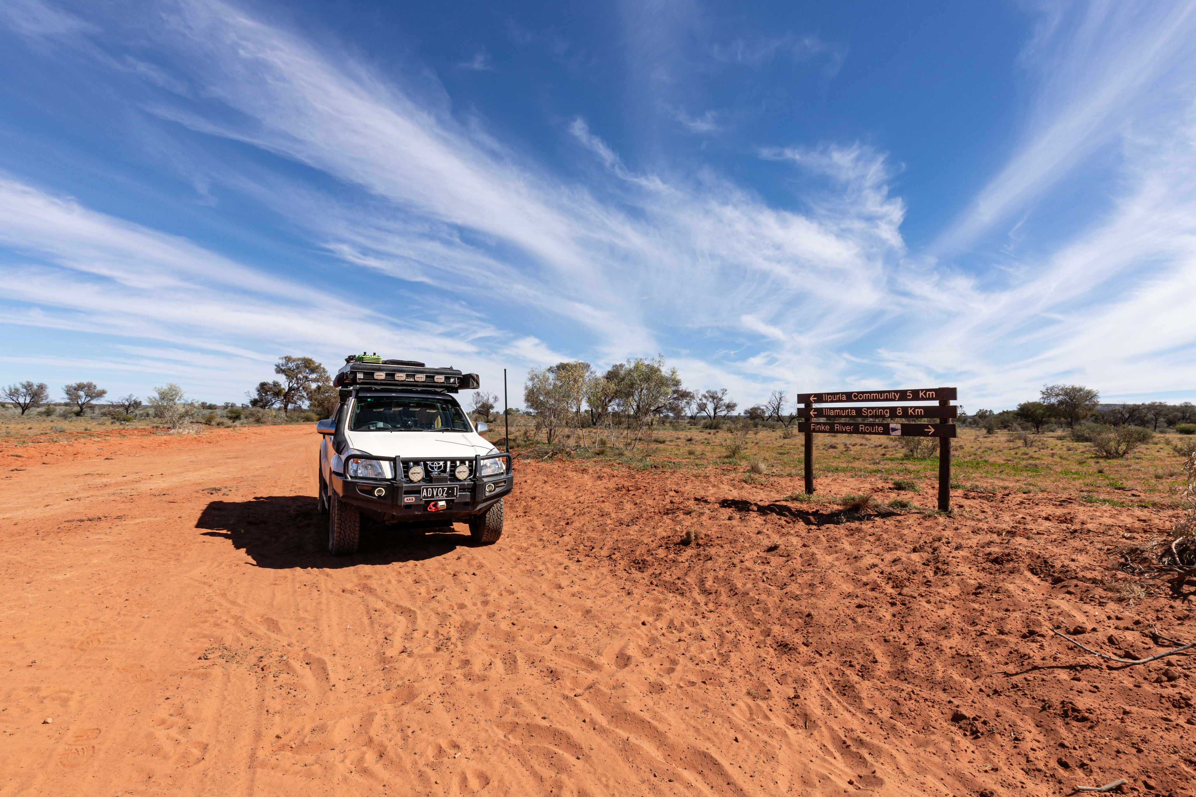
Passing through a second gate, leaving it as found, the track soon crosses the ford at McMinn Creek. Once over the creek, you’ll reach a fork in the road, and from here follow the signs to Illamurta Springs. You will come to another intersection; keep left as the track to the right leads to Ilpurla Community.
53
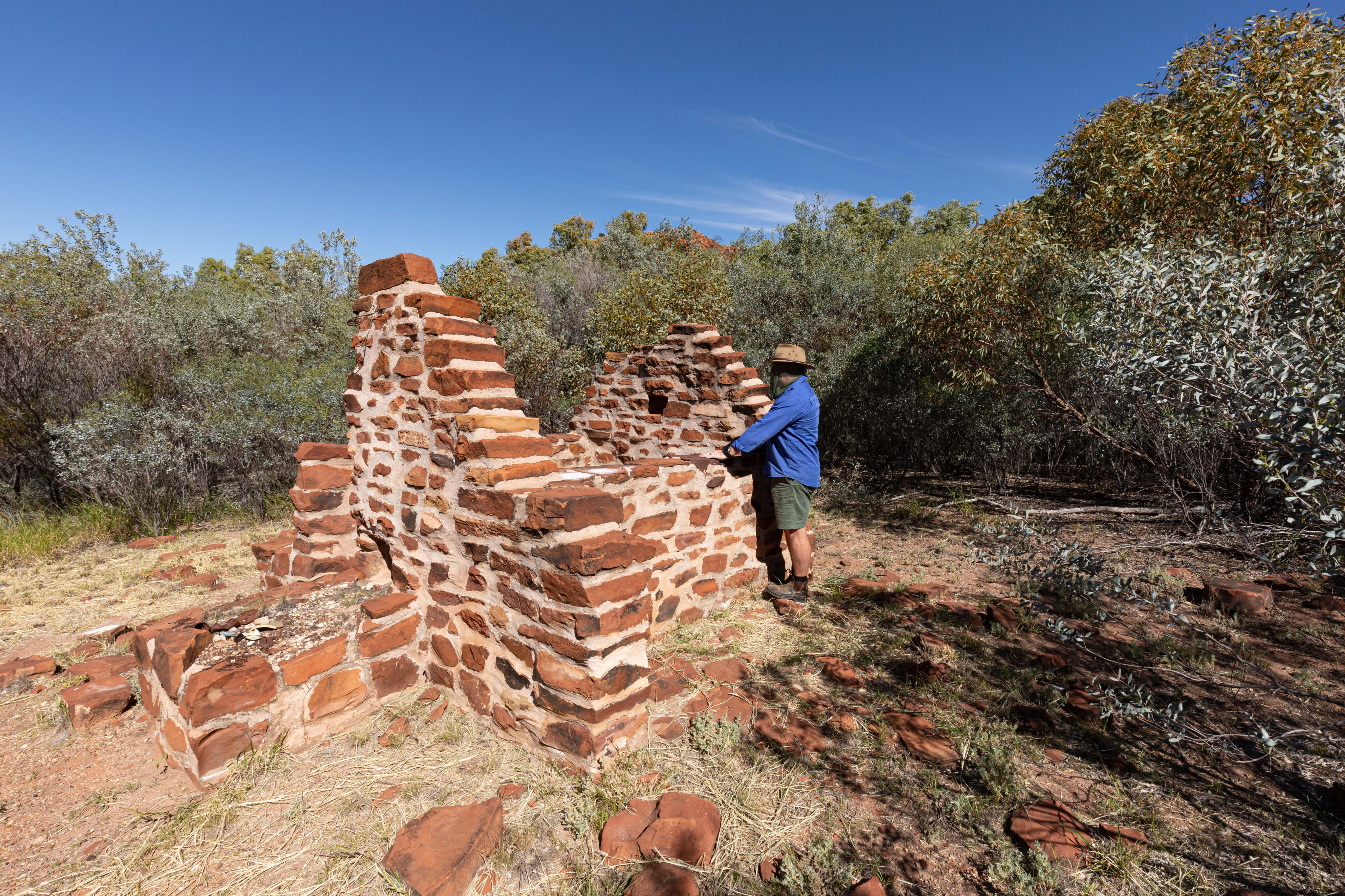
It is a 1km return walk out to the police ruins at Illamurta Springs, which is quite fascinating. It certainly would’ve been harsh living out here, especially in summer.
The springs provided an important refuge for Aboriginal people until a police outpost was established here in 1893 at the request of settlers taking up leases along the Finke and Palmer rivers. Assisted by Aboriginal trackers, the police pursued and arrested many cattle spearers and took them to Alice Springs to stand trial.
The walk takes you past abandoned stockyards before entering a dense thicket of umbrella bush. You’ll pass a small well before emerging into a clearing which is the site of the old police outpost. A fly net is a must-have, as the little buggers are sociable and plentiful. I was greeted by some good-looking horses when retracing my steps back to the main track, and they’d joined a handful of cows at a water trough.

53
Down by the river
Once on the Finke River Route, the track to Running Waters is easy-going.
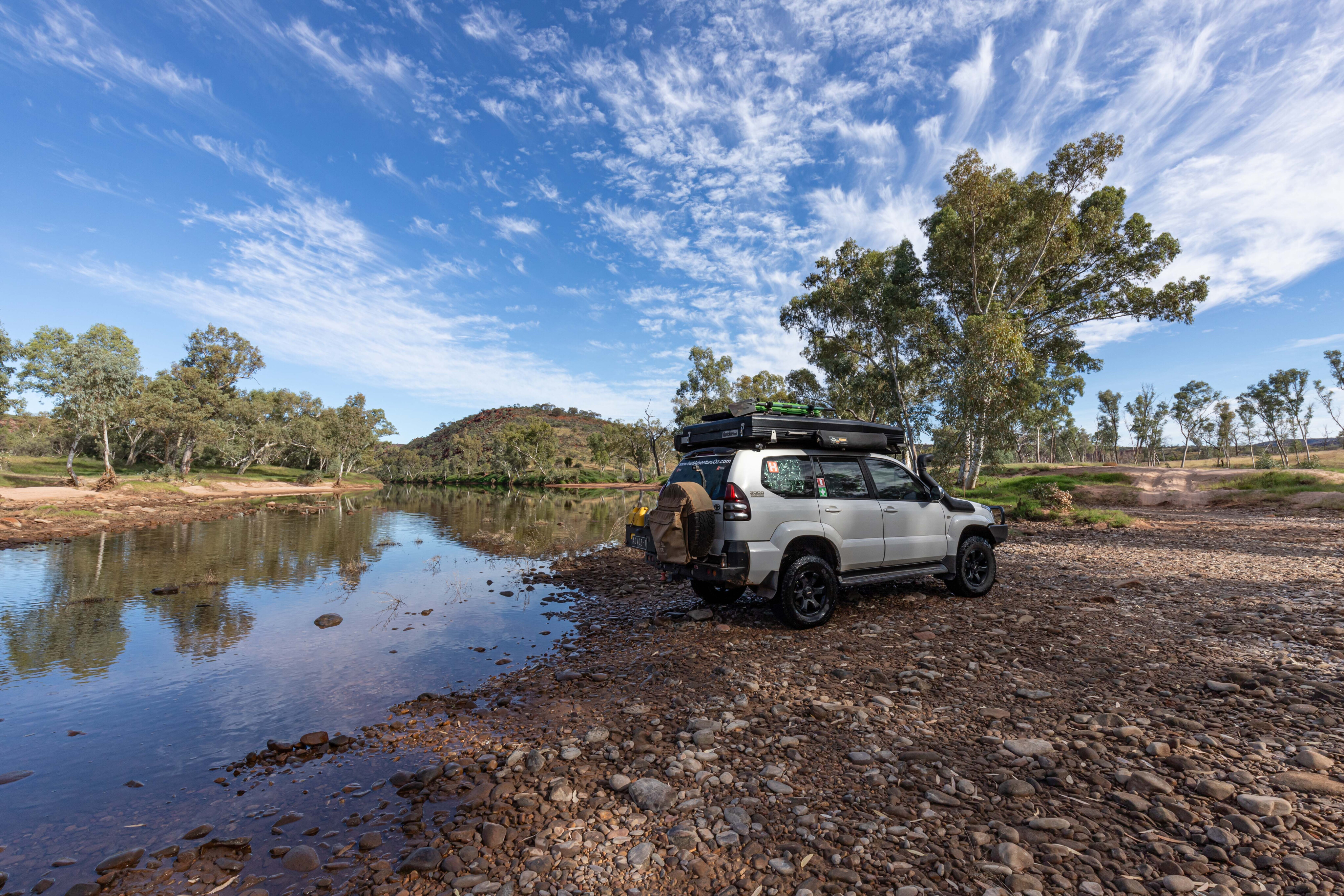
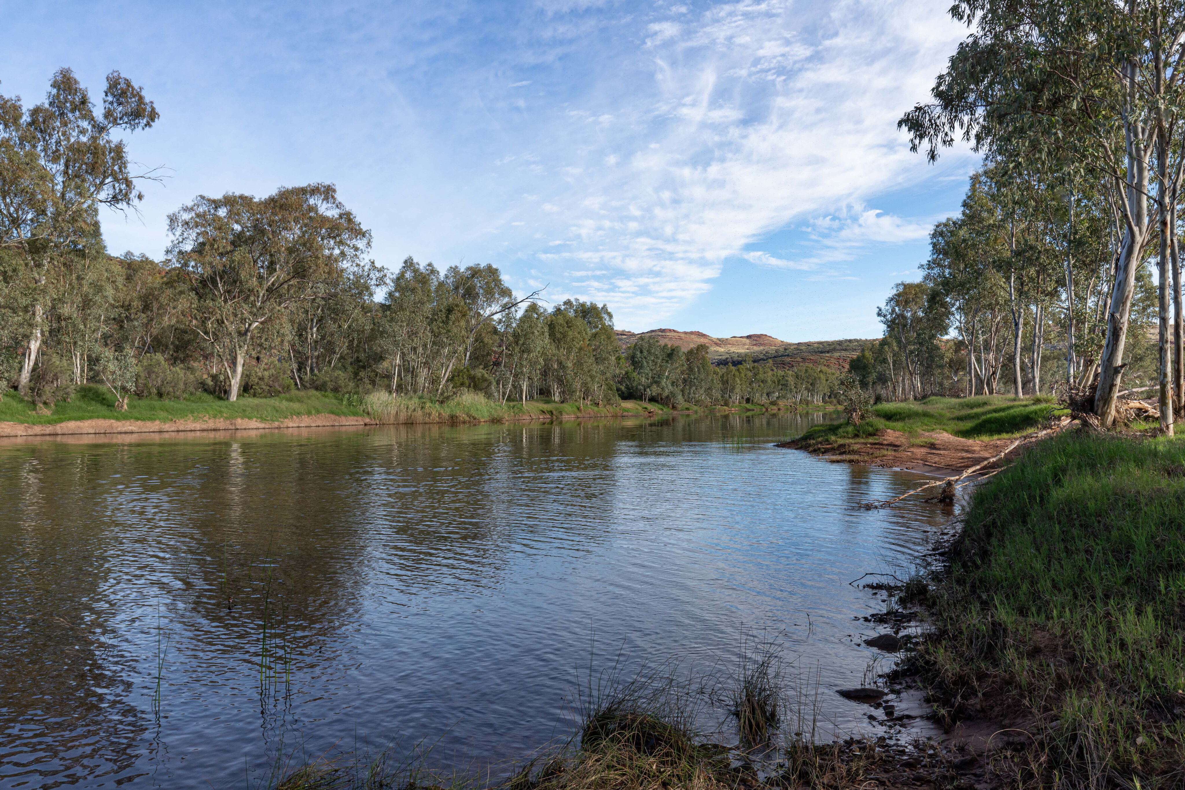
There are a couple of stretches of deep sand, but pick your line and keep the momentum up and you’'ll be fine. Running Waters is a designated campsite, but I wanted a campsite overlooked by cliffs, and as it was only lunchtime I continued on until I found a good site on the Finke River.
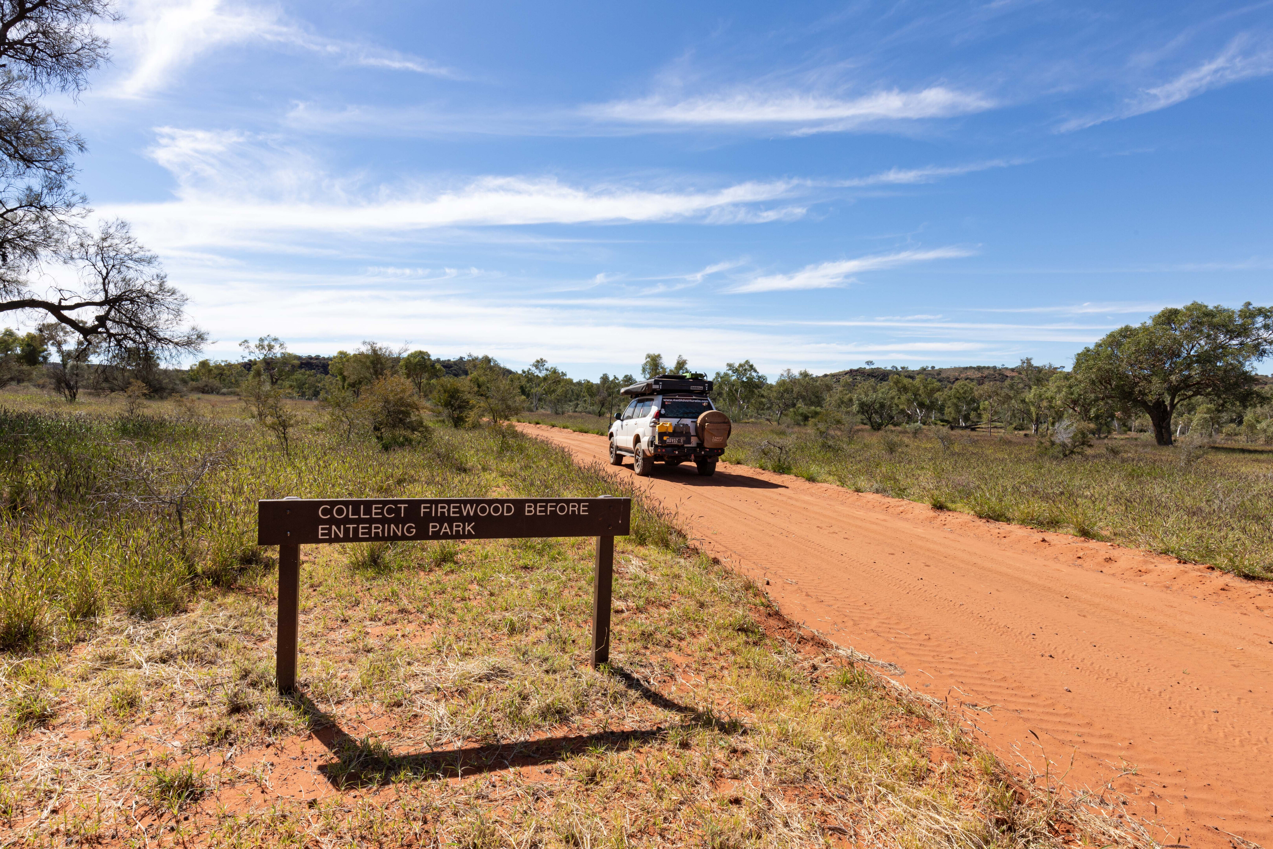
You’ll pass a sign that tells you to collect firewood before you enter the national park, but you will have to walk for a bit because the landscape has been stripped bare between the sign and the first Finke River crossing.
I found a fantastic campsite just past the first rocky crossing of the Finke River. On the opposite side of the waterhole, a colourful cliff face looked over the campsite. There was plenty of firewood too, so I found a level spot on the river stones and set up camp.

53
The whisper of a breeze blowing through the trees was soothing, and the chirping of crickets and occasional bird song meant I soon forgot about the buzzing of the flies. My afternoon was spent chilling after a few days of long drives, and it was nice to sit back and relax.
A couple of dingoes visited just as the sun began neared the horizon and lit up the cliff face. They weren’t worried by my presence so I assumed they’d seen humans before and held no fear; I kept a close eye on them while cooking dinner and kept all the lights on in case they came closer.
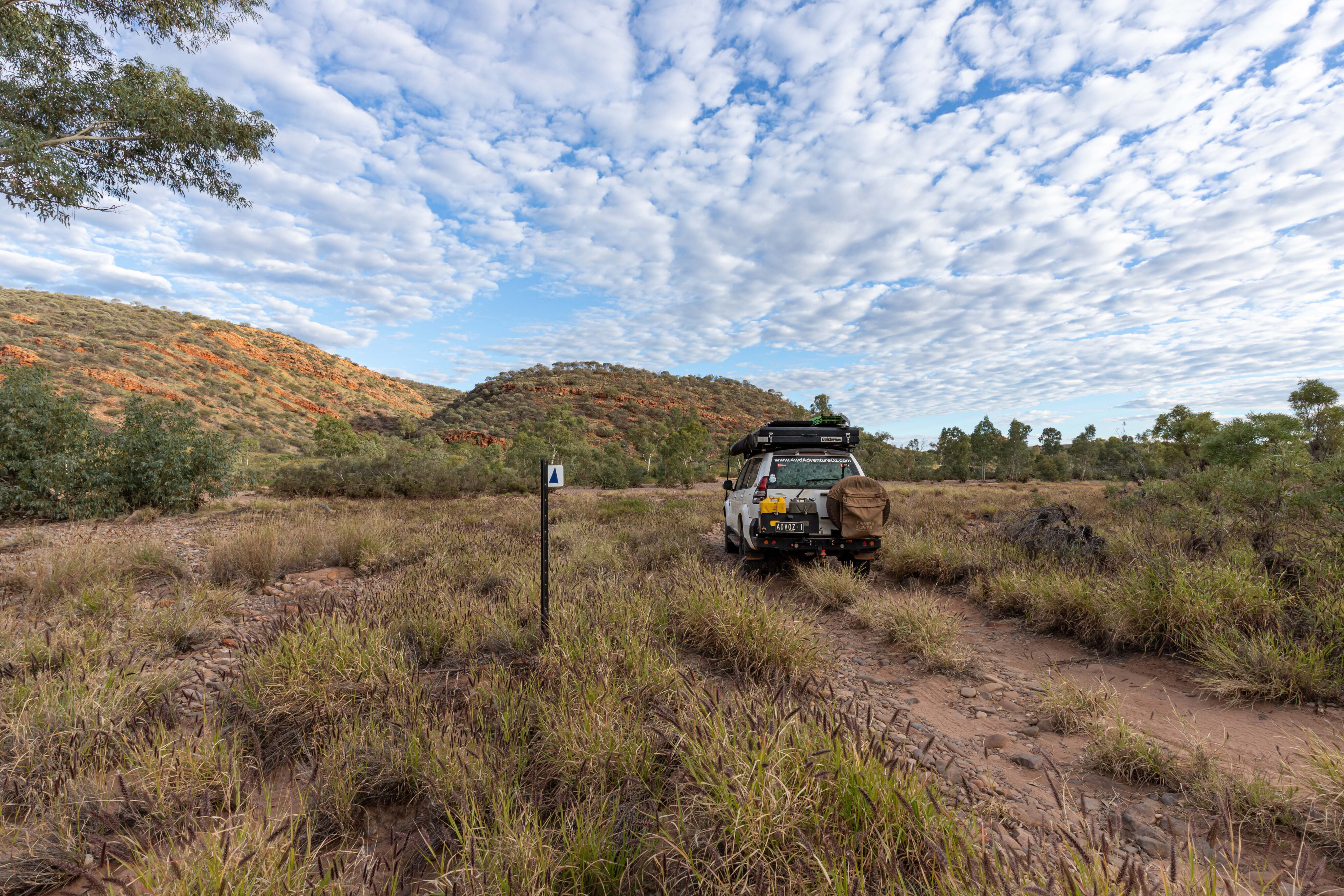
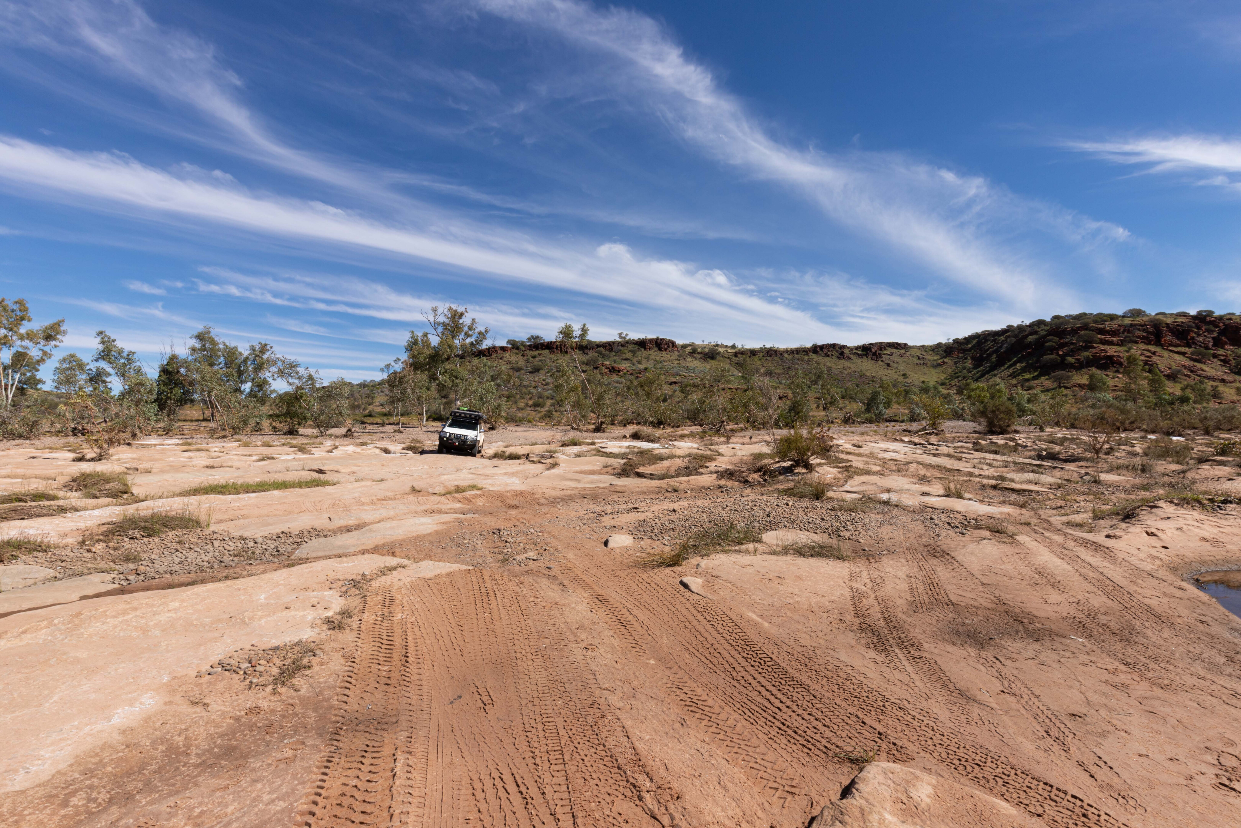
Leaving camp, the track heads away from the riverbed and returns to red desert sand. It was mildly corrugated as it wound its way alongside a range and headed towards the national park.
I enjoy driving early in the morning, looking at all the animal tracks in the sand, but it’s a concern when you spot feral cat footprints everywhere as I did on this drive. The spinifex was seeding after the rains, and it was nice to watch the sunlight bouncing off the seed heads. The flora here is a mix of acacia desert, mulga and gidgee, with the occasional desert oak.
53
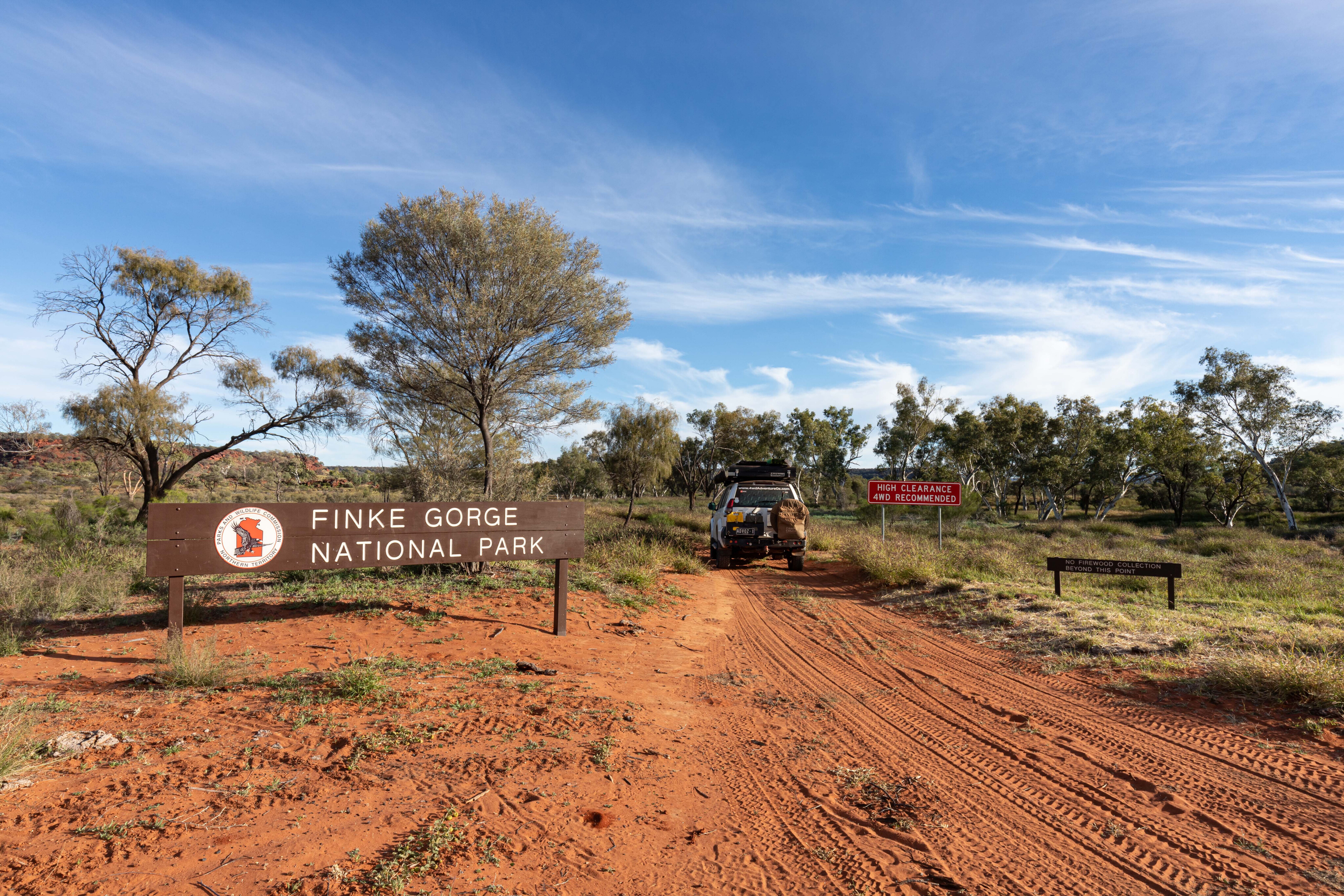
Entering the park
Reaching the Finke Gorge National Park gate, I spotted several warning signs that read ‘No firewood collection past here’, ‘Experienced drivers only’, ‘High-clearance vehicles only’ and ‘Must carry recovery gear and enough food and water’. The track briefly follows a fence line before returning to the river and heading across the high bank. It was great seeing so much water here; a good amount of rain had fed this massive waterhole.
Take care driving with the grass so high because it’s difficult to see washouts and holes in the wheel tracks. There is a steep dip along this section, highlighted by Northern Territory warning signs, which is one reason why towing on this track is not recommended; you’re likely to get stuck and need to winch out, as the angle of the drawbar on the back of a 4x4 would be severe.
You need to book campsites online before arriving in Finke Gorge National Park, and you’ll need a Northern Territory Parks Pass, which is a separate fee for access to this and all the national parks within the Northern Territory.
53
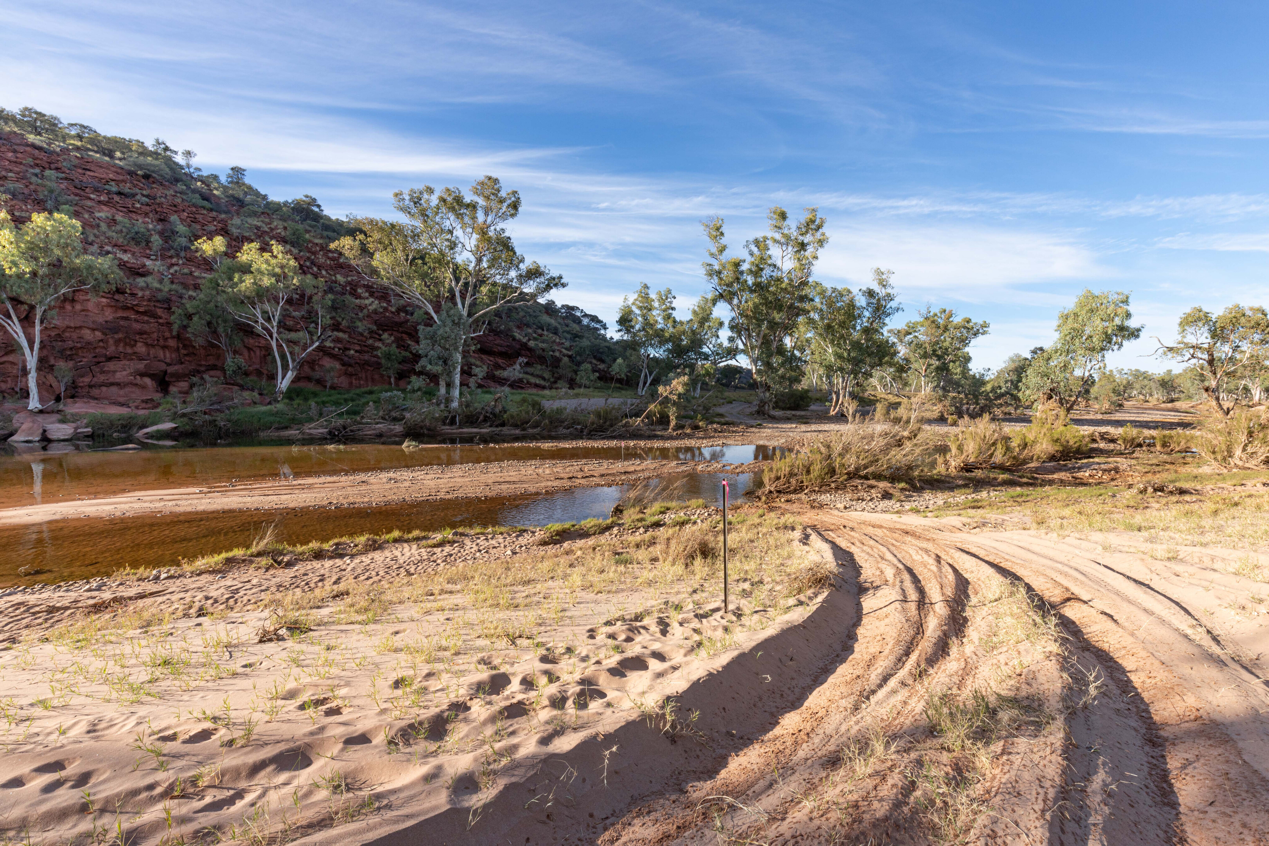
The next crossing of the Finke River was fun. Star pickets with pink ribbons show the correct route, and the water levels were low when I went through, but the sand was deep. The next crossing was wide and stony with a stable base, and if you look up the river, a beautiful rock face dominates.
This spectacular track heads cross country before meeting up with the river again. A short crossing had a stony base, so it didn’t cause any issues. Close by is another good bush camping option near to the water with a rock face overlooking the campsite.
From here the track closely follows the Finke River, with a jagged range on the left that’s a bit like the China Walls near Halls Creek. There are spectacular spots along here for camping close to the track, and the track isn’t as busy south of Boggy Hole.
53
You need to pick your line carefully at the next crossing with some larger rocks on the southern side, but it’s not too difficult to negotiate. If at any stage you think you’re on the wrong track, just keep an eye out for the pink ribbons or blue triangles on the trees and star pickets.
As the track heads to the right-hand bank it becomes sandy, but more like desert sand than river sand, so it’s easy-going. There is a camping sign that leads to Sunny Waterhole, which I consider to be the best bush camping site on the Finke River.
The sand is deep and soft, but if you head upstream, it’s stonier and more accessible. It was only 10am when I reached this fantastic camp and I had the place to myself. There were a lack of flies on this morning after a chilly night, and the air was still nippy with a cool breeze. I didn’t miss them, but they returned with a vengeance once the air warmed up.
53
Top spots
As I sat and reflected on this journey with an ice-cold beverage in hand, I realised that it was the campsites that made this such a fantastic adventure.
With colourful rugged cliff faces overlooking calm waterholes, and white ghost gums contrasting against the coloured rock, plus the white sandy beaches and multi-coloured river stones, this is why I’m drawn to Central Australia.
The following day, having departed this epic campsite, I continued towards Boggy Hole. The track became stony in sections with a few rocks and plenty of washouts. Care is needed, especially if it’s wet, as the clay would be slippery. The track leads you across a low range and back down to the riverbed. The next crossing is stony, followed by an extensive stretch of deep sand traversing the river’s western side.
Not far from Boggy Hole are some police station ruins on the eastern side of the river. There was a walking track, but the water was so deep there was no chance I could reach the ruins. Thankfully, I had the drone and sent it across to check them out.

53
The Boggy Hole camping area is stunning but not as good as where I’d camped the previous night. This camp is often used with the number of fire pits dispersed around the small area. Access to the water is down a steep, unstable bank, and the water here is deep, so it wouldn’t be wise to fall in; it would have been icy cold.
The birdlife was prolific here with ducks, a cormorant and other birds such as budgerigars, wagtails, whistling kites and sparrows enjoying the water and adding their voices to the sound of fish splashing as they fed on the bugs. There were many reeds along the bank, so access to the water was limited. I sat and watched the little green budgies fly in swarms through the trees and grasses, the noise from their wings like bicycles on a velodrome.
Another campsite with nobody else but me and my thoughts. I love my job, travelling to places like this and sharing it through 4X4 Australia. We truly are spoiled by the beauty of the McDonnell Ranges and the Red Centre.
53
Journey's end
The sunset that night was a colourful one, and with it the flies disappeared and I could cook dinner. I enjoyed an early night before my sleep was interrupted by the eerie howling of dingoes.
This went on until after 7am. It was as though the matriarch had called the pack home, and it was an incredible few hours. I spotted one dash through camp in the predawn light and another on the other side of the river, howling as it ran. Once the dingoes had settled, it was peaceful again, until one bloody crow told me where to go. It was time to get up and hit the trail.
From here the track again follows the river closely, and the next crossing was the deepest one so far. Thankfully, star pickets showed where to drive, so it was second gear low, with just enough speed to create a nice bow wave.
53
The exit had some deep, soft sand and then I had to make a sharp turn to follow the track. There were a few more short crossings before a long stretch of deep, soft sand. The northern section of the track is fascinating, and I loved driving it.
There were still a few river crossings and stretches of deep sand, but it wasn’t a demanding drive early in the morning. Having said that, it would be a real challenge in the heat of the day.
Eventually I arrived at the junction of the Finke River and Ellery Creek. Once I crossed Ellery Creek, the track reverted to a two-wheel desert track with grass in the middle, relatively smooth compared to the bumpy ride endured on the first couple of days, although there were some slow goings through washouts and as I traversed a section of Ellery Creek before reaching the national park gate.
53
I ran into a couple of park rangers just after I had exited the park – this was the first vehicle I saw since I left the Stuart Highway – and I had a good chat with them. They had a boat on the back of their LandCruiser as they were checking for invasive weeds along the waterholes.
The sand is deep just before reaching Mpakaputa, and then the track becomes a corrugated dirt road. Follow the Northern Territory 4x4 track sign – you’re not permitted to stop in the community. The track ends when you reach Hermannsburg.
The Finke River Route is an incredible drive and you should put it on your Red Centre bucket list. Take your time and enjoy spending a few nights camped beside the waterholes that dot this ancient riverbed.
Travel planner
Where
The Finke River Route covers 120km from Ernest Giles Road to Larapinta Drive near Hermannsburg.
Best time of year:
Cooler months from April to October.
Permits:
Camping Fees must be booked and paid online at www.parkbookings.nt.gov.au/Web/
A Northern Territory Parks Pass allows access to this and most other national parks within the Northern Territory. Get one at www.nt.gov.au/parks/parks-pass
What to see and do:
Unrivalled bush camping, prolific birdlife, dingoes, superb scenery and plenty of sand driving. Flash flooding is possible in the Finke River and river red gums drop branches without warning.
What to take:
You must be self-sufficient and carry all the necessary water, food and fuel, a first aid kit, PLB, a tool kit, a spare tyre, vehicle parts, a shade awning, a camera, sunscreen, insect repellent, and suitable clothing and footwear. A satellite phone or Starlink is recommended as there is no mobile coverage. It is suitable for high-clearance four-wheel-drive vehicles only, and trailers are not recommended.
Other info:
Finke Gorge National Park: www.nt.gov.au/parks/find-a-park/finke-gorge-national-park
Hema Atlas & Guide Great Desert Tracks
NT Roads: www.roadreport.nt.gov.au/home
Weather: www.bom.gov.au/
COMMENTS