Explore WA
Gallery113
Some of the best 4x4 destinations are located in Australia’s biggest state. Here are five fantastic WA experiences for the adventurous four-wheel driver 👇
JUMP AHEAD
1. Pemberton
Words by: Kev Smith
Rich in history and natural beauty, Pemberton is a gateway to the spectacular coastline in D’entrecasteaux NP.
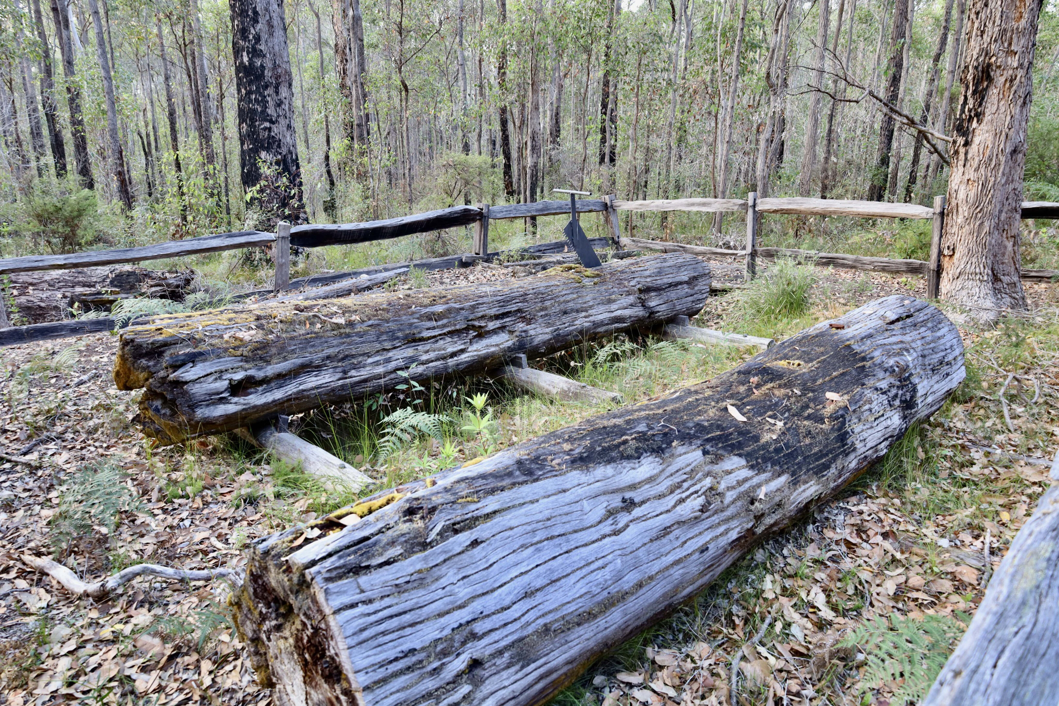
Pemberton is a quiet town known for its local boutique wines and beers, handmade pies and cakes, and shops with a country feel. The old restored railway station at the back of the town is a highlight, featuring a steam engine, turntable, diesel engines, a low-loader crane, and a disused tram that once ran tourists along the line.
Although the trains and tram no longer run, the area remains a fascinating place to visit and explore.
The rail line was built in 1926 through the forest to Northcliffe during the timber industry boom, transporting goods to new farmlands and moving timber. It operated at heavy losses for 50 years, sustained only by the timber industry.
113
By 1961, things started to decline due to bridge fires, and buildings were sold and relocated. The last train ran in 1986.
Today, many bridges, sheds and the station are heritage-listed or recognised as highly significant. A tourist tramway operated here until February 2023.
A popular route in Pemberton is the Karri Forest Explorer scenic drive, looping around the town’s attractions. National Parks surround the area, offering timber-related points of interest. One significant feature is the fire lookout trees, an idea conceived in the 1930s by local forester Don Stewart.
Tall karri trees were used to spot fires, with large steel pegs forming ladders to small cabins high up in the trees. Today, two of these trees can still be climbed: the 53m Gloucester Tree with 153 pegs and the 65m Dave Evans Bicentennial Tree with 182 pegs. A third tree, the Diamond Tree, has been declared unsafe to climb due to decay but there is a replica hut nearby.
113
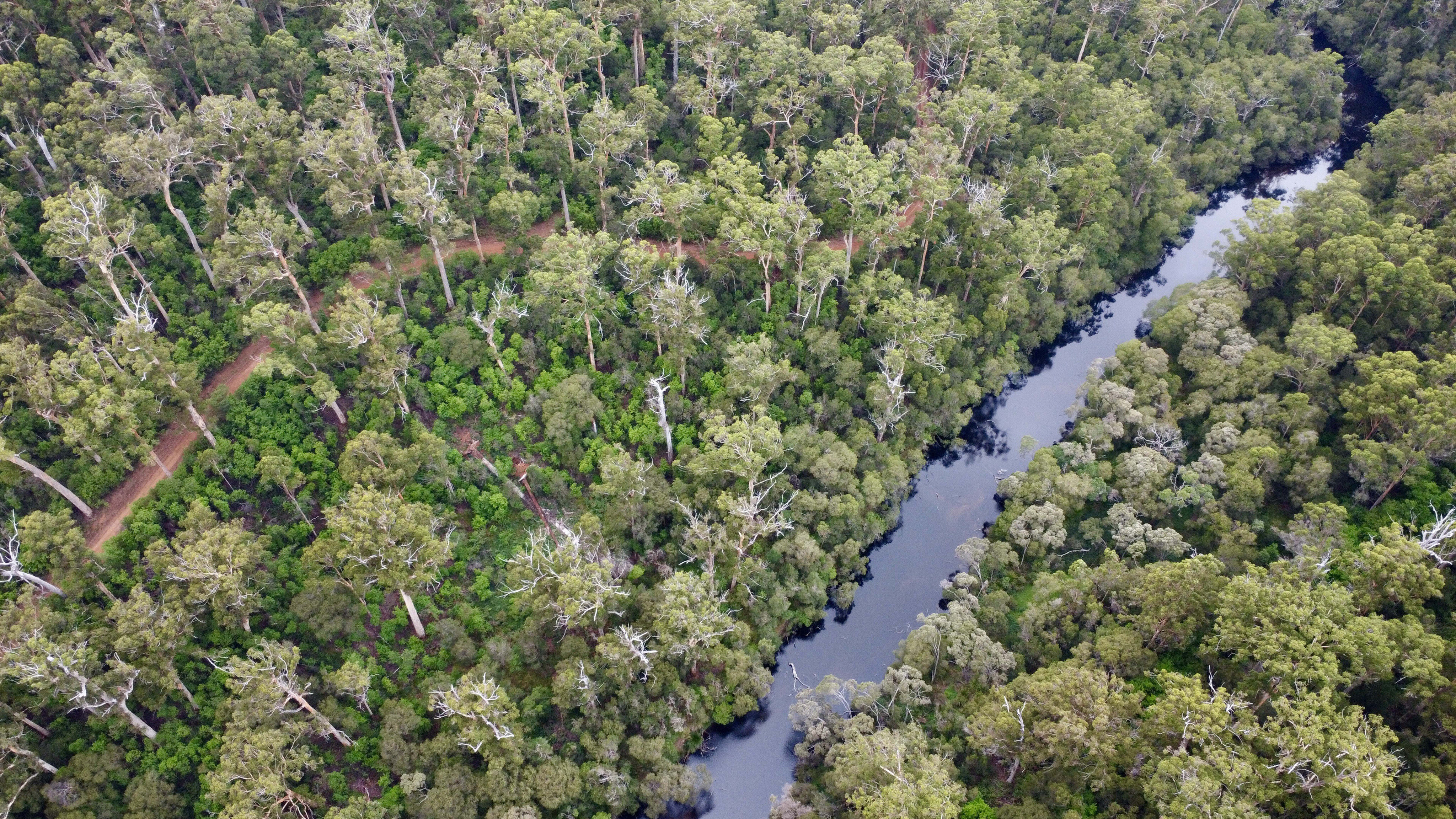
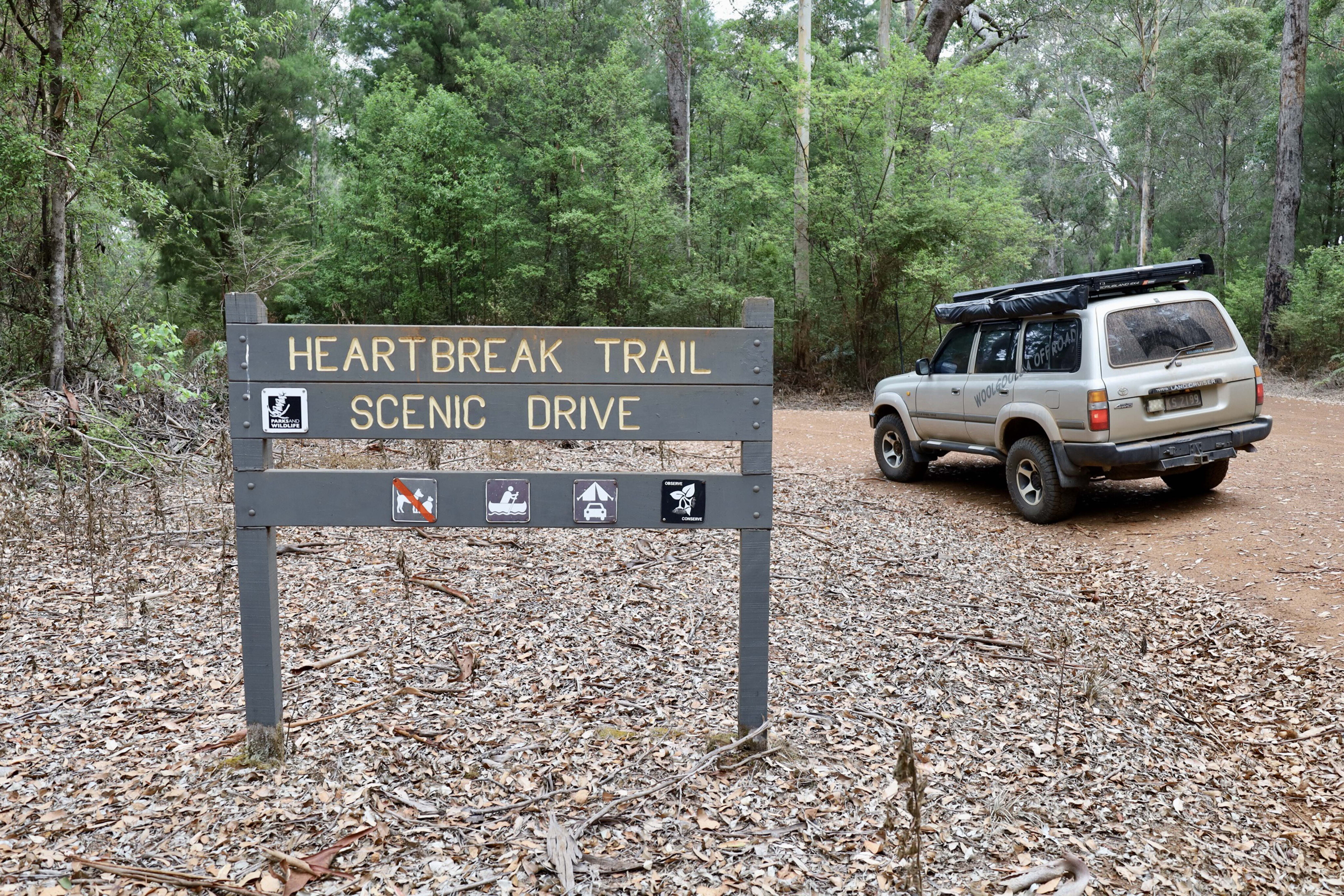
The 4x4 trails and camping options here are appealing. Heartbreak Trail in Warren National Park is a 12km one-way track descending into the Warren River Valley.
It’s not very steep, but is quite challenging in the wet. The valley has two campsites, Drafty’s and Warren, offering river access for canoeing. Nearby is Brockman Sawpit, dug by convicts around 1865 and rediscovered in 1972 with jarrah logs and tools still intact.
Water-related attractions around Pemberton include Beedelup Falls, which is most impressive in winter, and Cascades, known for transforming into a raging torrent after heavy rains. Big Brook Dam, constructed in the 1920s as the town’s water supply, is now used for swimming and fishing.
113
Kayakers often paddle down the Warren River, getting picked up downstream towards the ocean.
Exploring further afield, D’entrecasteaux National Park, 40km south of Pemberton, offers a maze of sandy 4x4 tracks. The park, named by a French Admiral in 1792, features 130km of coastline, lakes, rock formations, and various activities like fishing and camping.
While it may not be a hardcore off-road destination, the park is stunningly beautiful and perfect for relaxing and exploring over several days.
Pemberton is a place where time seems to stand still, offering a mix of historical charm, natural beauty, and outdoor adventure.
113
2. Karunjie Track
Words by: Kev Smith
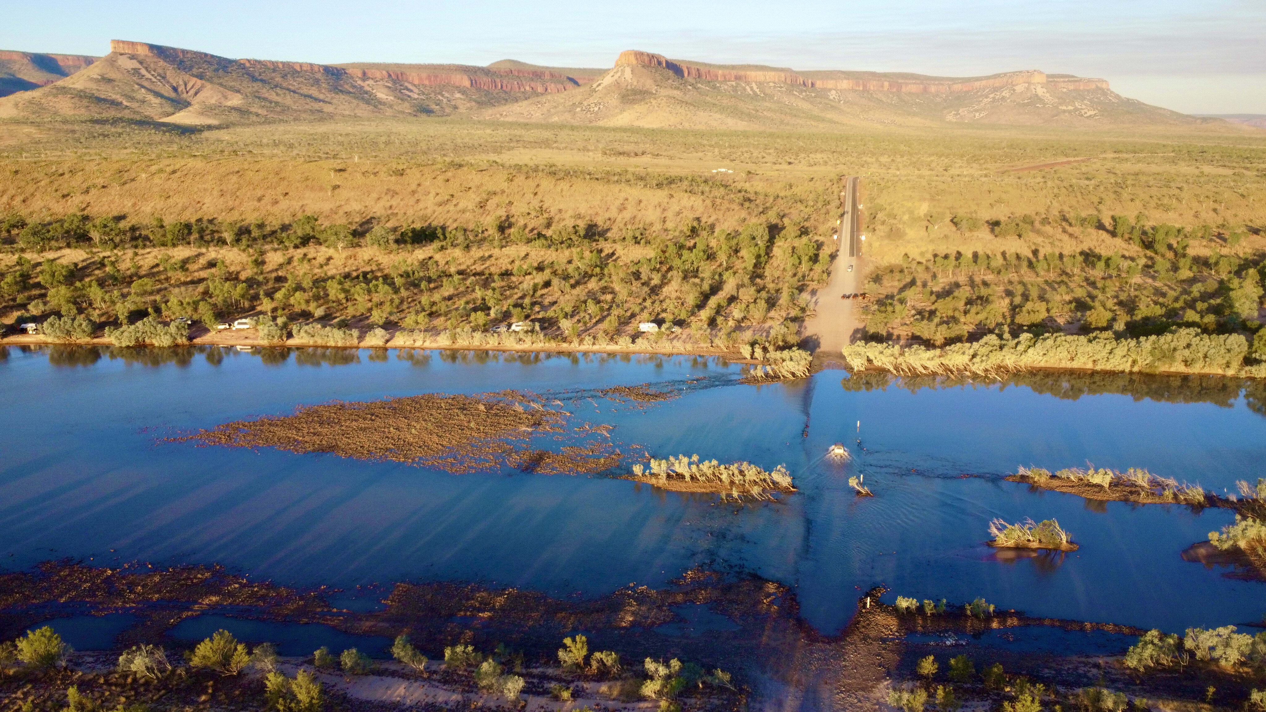
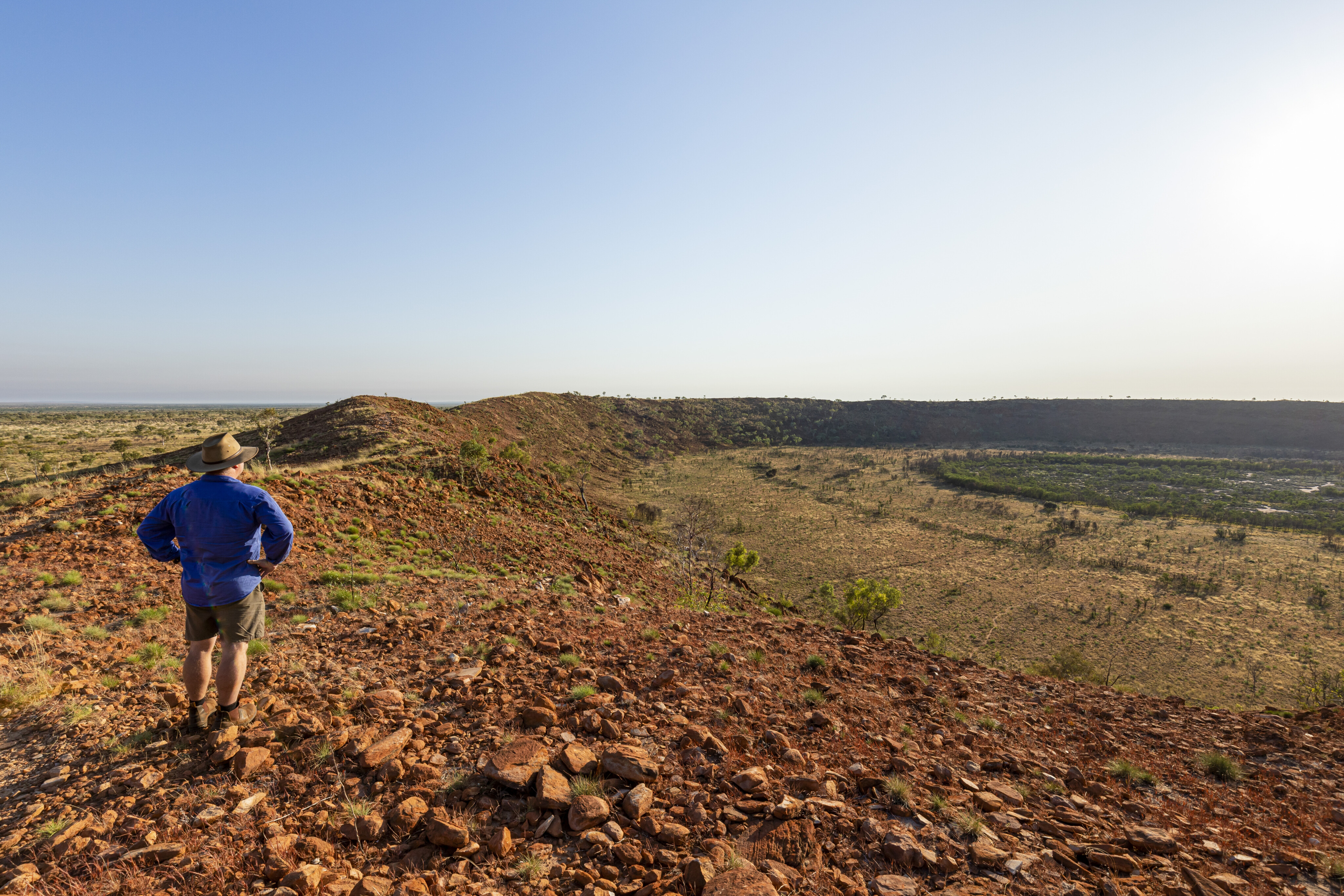
Karunjie Track runs between the Cockburn Range and Pentecost River in the East Kimberley.
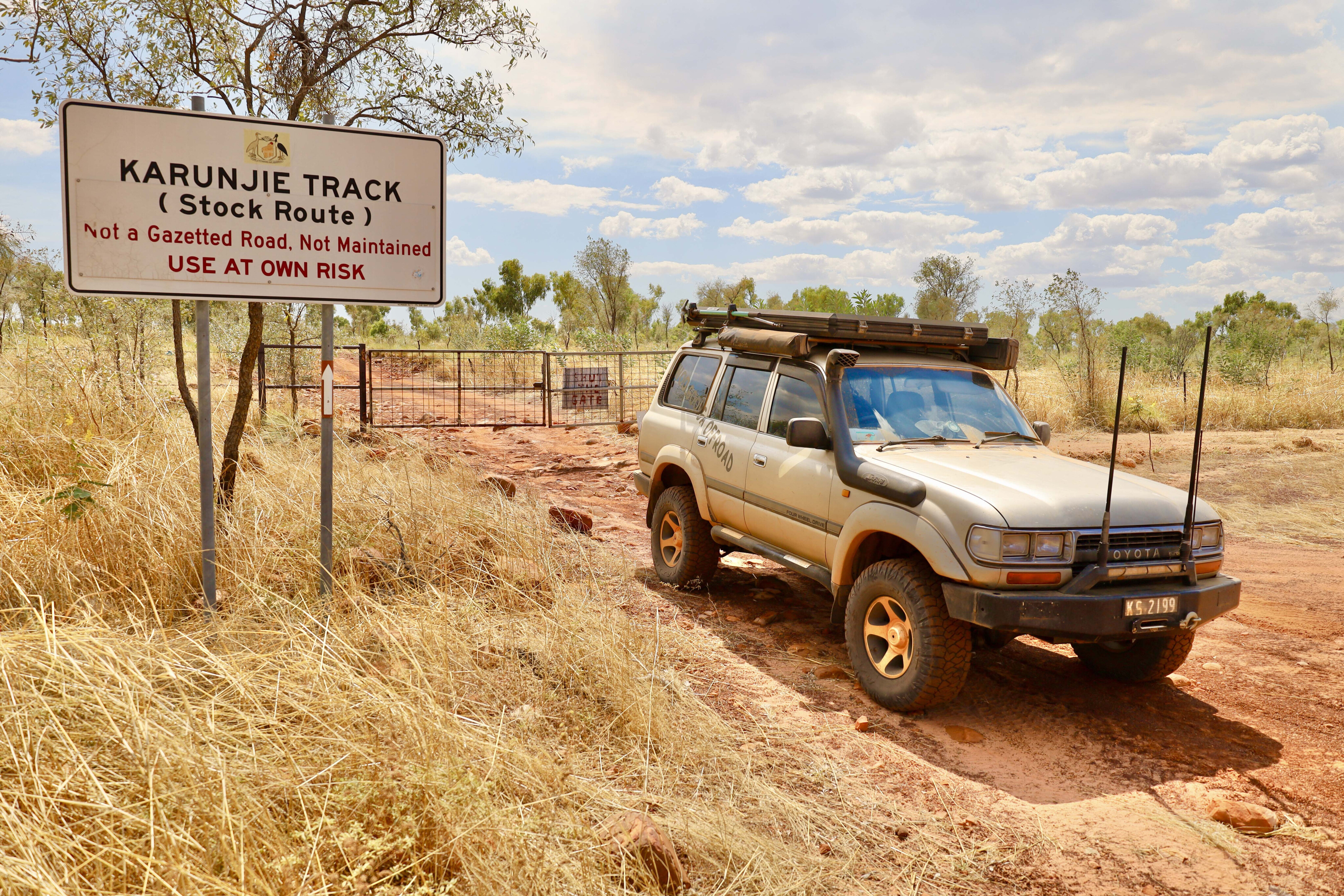
Over a century ago, the Karunjie Track in the far north of Western Australia was used by drovers to move cattle across the Kimberley, from the south up to Wyndham for export. Our journey starts at the end of the Gibb River Road, at the Home Valley Station in Balanggarra Country.
There are two camping areas on offer, a great bar and grill, as well as tours with traditional owners showing off their stunning waterfalls and rock art, with the majestic Cockburn Ranges as a backdrop.
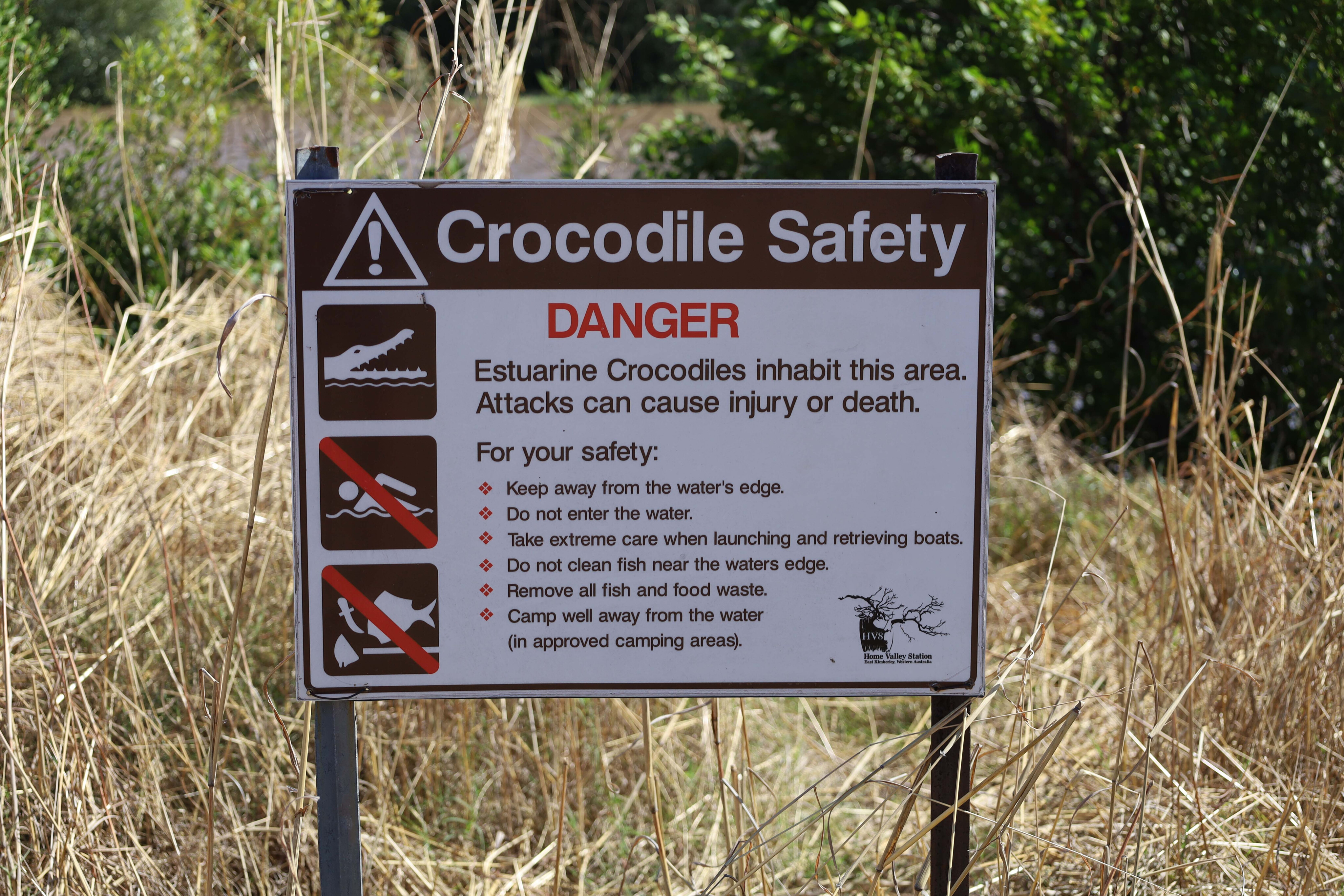
The Pentecost River crossing – a 10km drive from Home Valley – is several hundred metres wide and has a hard rocky base.
113
If the water isn’t too deep, most 4x4s easily get across in the dry season. On the eastern side of the river is where the blacktop starts (or stops, depending on your direction) on the Gibb River Road, all the way to the east coast.
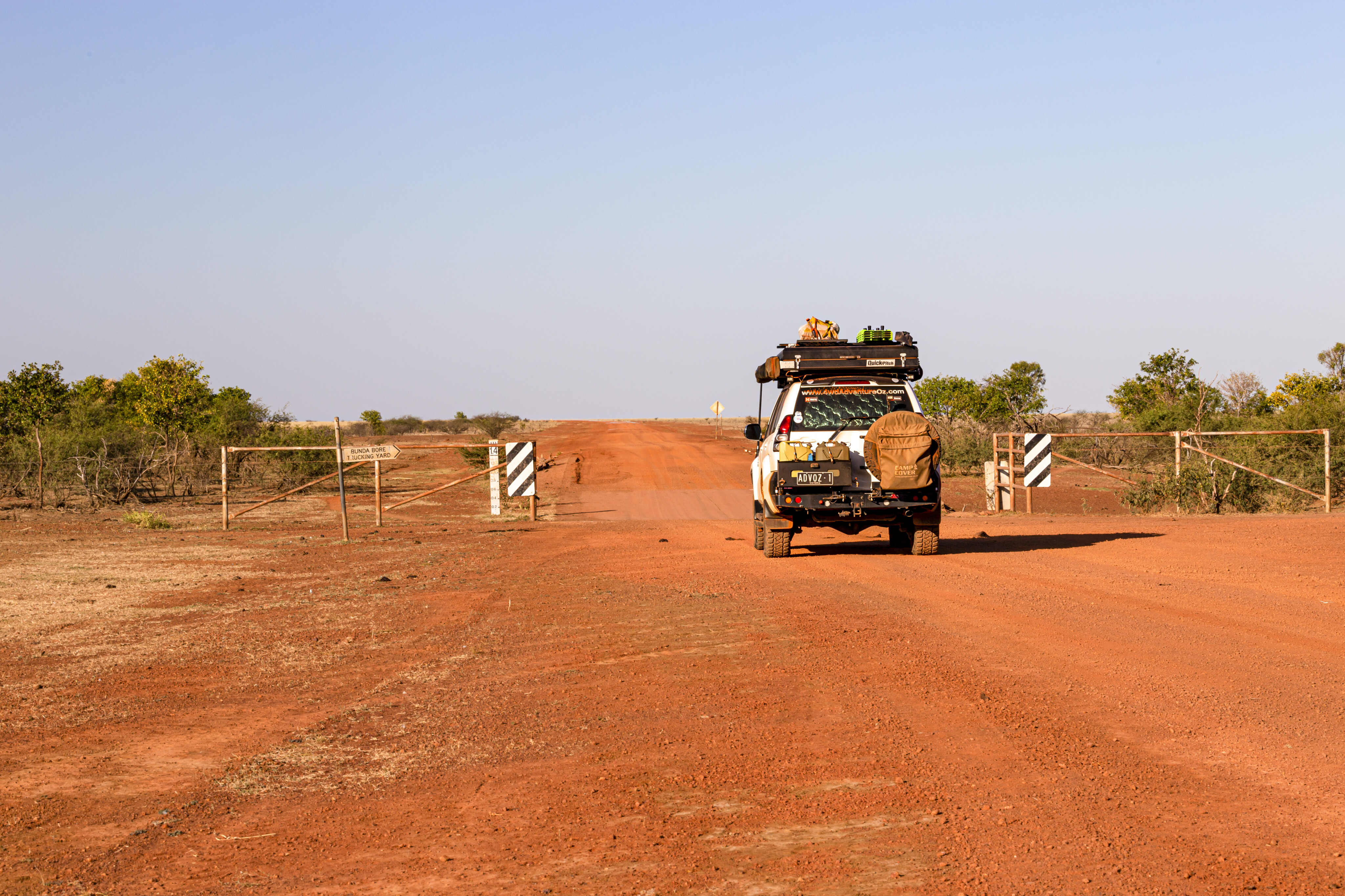
Cross the mighty Pentecost River and turn left to follow the river along the 80km-long Karunjie Track. At the start of the track is a popular free camping spot where travellers pull up either before or after tackling the Gibb River Road.
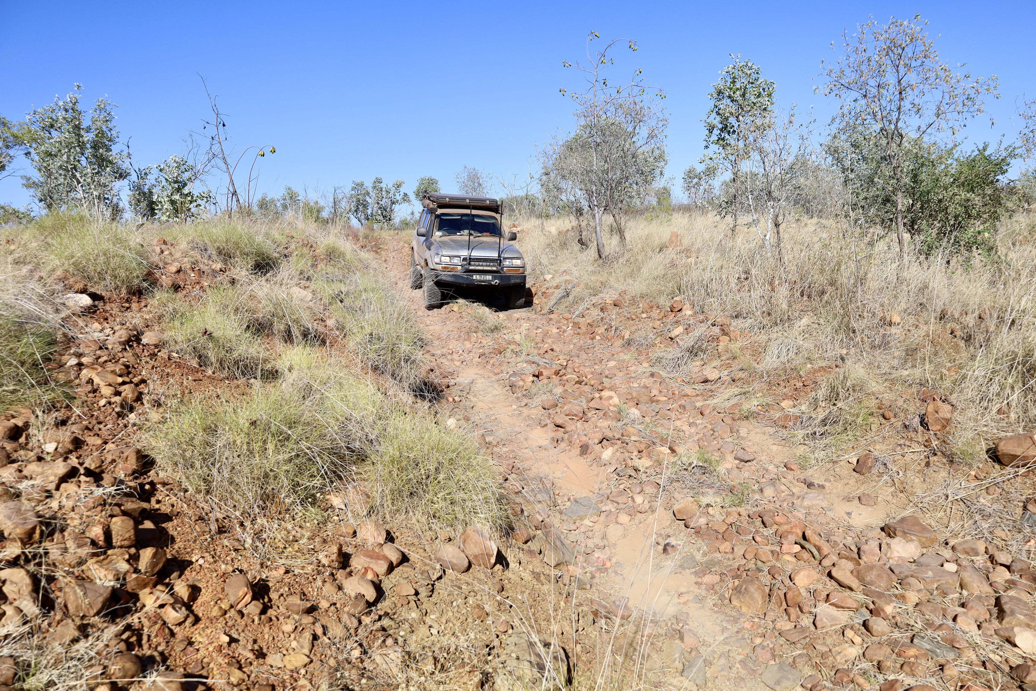
Once a stock route, today Karunjie Track is a remote 4x4 track that is only traversable in the dry season, and it is not maintained for its entire length. Departing the Pentecost River the track is slow-going for the first 20km, with deep ruts and plenty of washed-out sections.
113
The first gate leads to private property, owned by El Questro Station. Once down on to the floodplains, the track smooths out and you can pick up the pace, but the massive floodplains become an impassable quagmire in the wet season.
The flats soon give way to some higher rocky country and the boundary gate signifies the end of the Karunjie Track. Officially, no camping is allowed between the two gates, only near the Pentecost River, as El Questro is still a working cattle station.
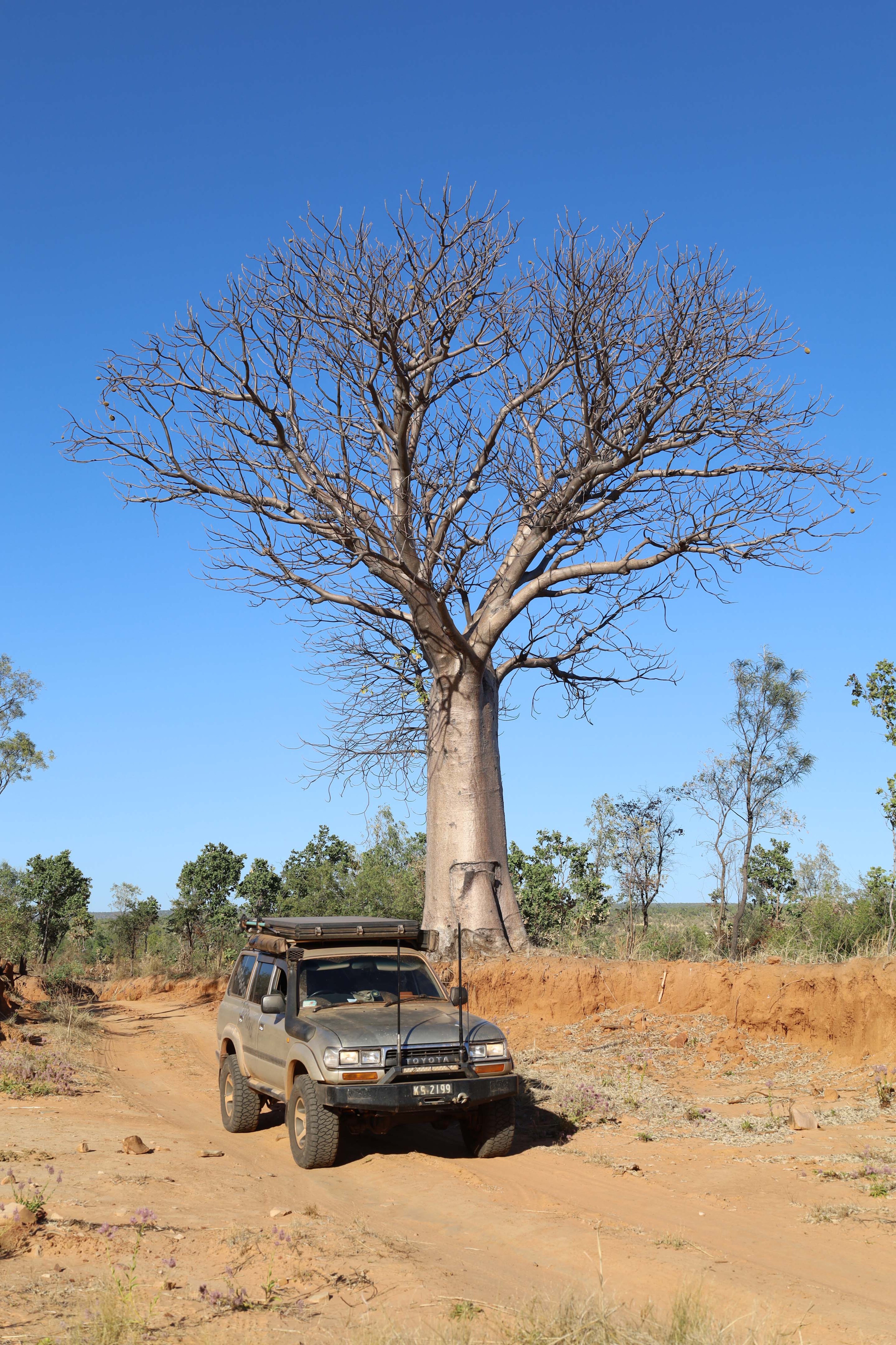
Once through the last gate you’re now on the King River Road where, if you turn left, will take you to Diggers Rest campgrounds, or straight on towards Wyndham. Not far along this road, an historical marker signifies the infamous Boab Prison Tree, also known as Hillgrove lockup.
113
In 1890 this boab was hollowed out and used as a holding cell for Aboriginal prisoners on their way to Wyndham for trial.
Crossing the King River, Moochalabra Dam is just 10 minutes down the road. The rock art on the ceilings and walls include depictions of animals, handprints and other shapes. This site is important to the Balanggara people, where there are also depictions of Wandjina spirit ancestors, all painted with natural ochres found in the cliffs.
Following the King River Road for another 30km will lead to the Wyndham to Kununurra road. At the beautiful old town of Wyndham, the Pentecost River ends its journey into the Cambridge Gulf, and the best viewing point is up at the Five Rivers Lookout about 15 minutes drive out of town.
113
From here, there are five rivers that drain into the gulf: the Pentecost, Durack, King, Forrest and the Ord rivers.
Below the lookout is Wyndham Port, where drovers used to move their cattle after traversing the Karunjie Track. Established in 1885, the port was a hub with slaughterhouses, a freight centre and the nearby original town of Wyndham. While the new town is situated away from the port, the waterways are still used for the export of fuel, freight and live cattle, and occasionally cruise ships visit here.
While the Karunjie Track may only be 80km long, it’s a fascinating part of East Kimberley that is well worth exploring.
113
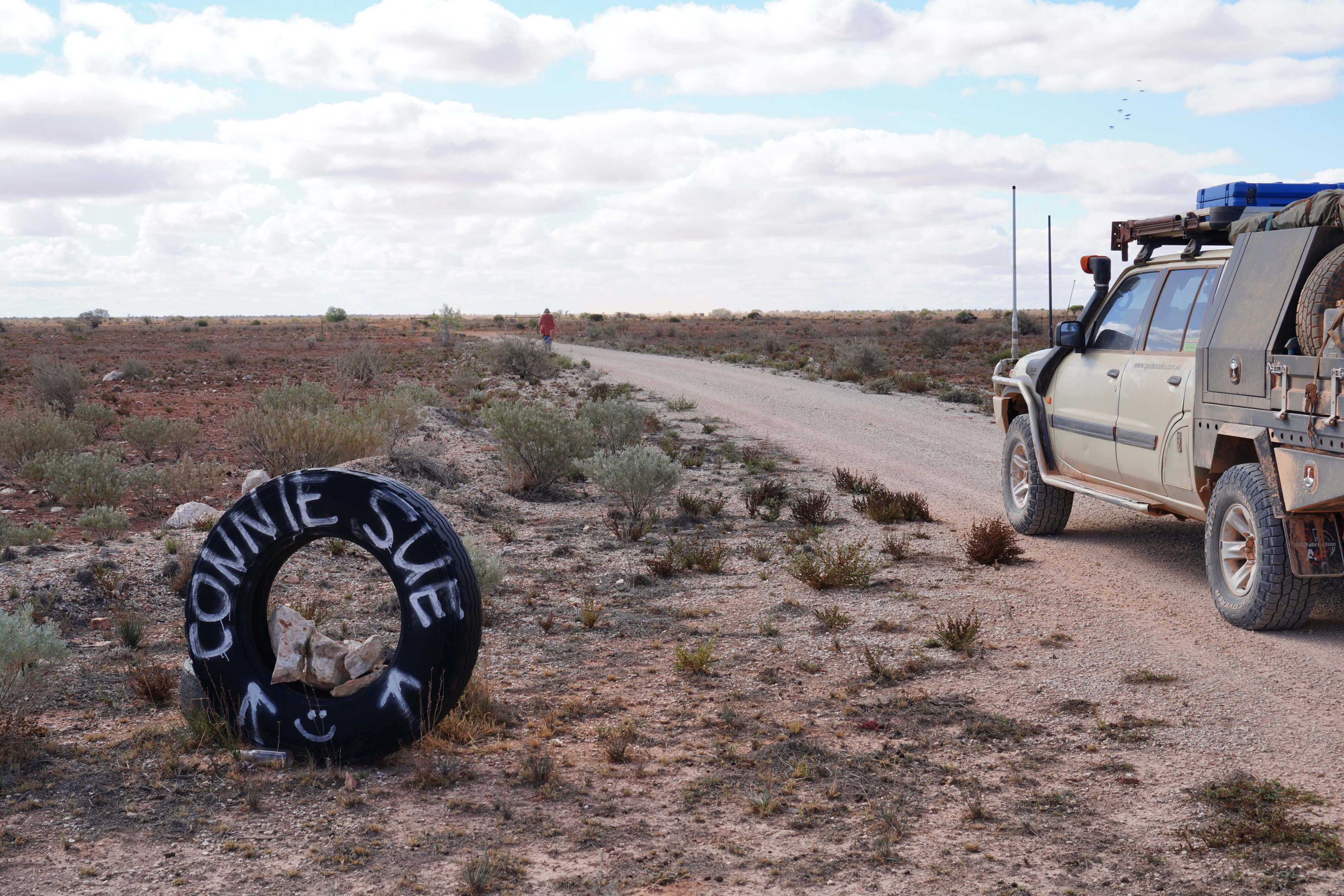
3. Connie Sue Highway
Words by: Ron Moon
The Connie Sue Highway is a brilliant drive for those after a remote outback experience.
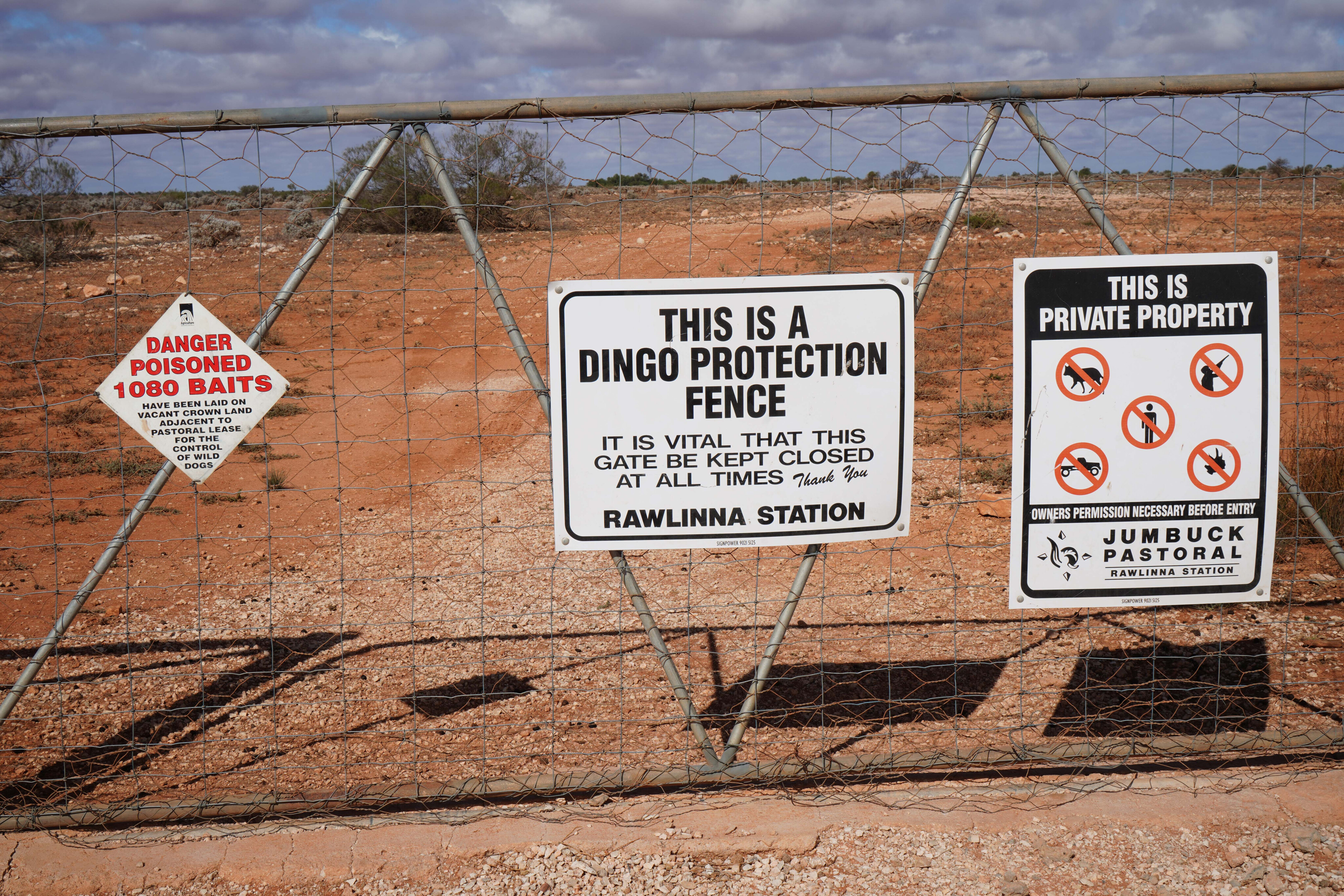
Rawlinna Station, the largest sheep property in Australia, covers over 10,000km² and operates between 60,000 and 80,000 sheep. Established in 1962, it predates the Connie Sue Highway by only a short time.
Reaching Rawlinna is an adventure. The easiest route is from Kalgoorlie, a 380km drive on a graded road parallel to the railway. Alternative routes include a rough track from the east or a limestone-studded path from Cocklebiddy. All routes intersect the 370km-long dingo-proof fence surrounding the sheep property.
You can join the Connie Sue Highway (CSH) on Rawlinna’s eastern side. The road, established by Len Beadell and his Gunbarrel Road Construction Party in 1962, was part of the A-bomb and ICBM test routes. It offers one of Australia’s great 4x4 desert adventures.
113
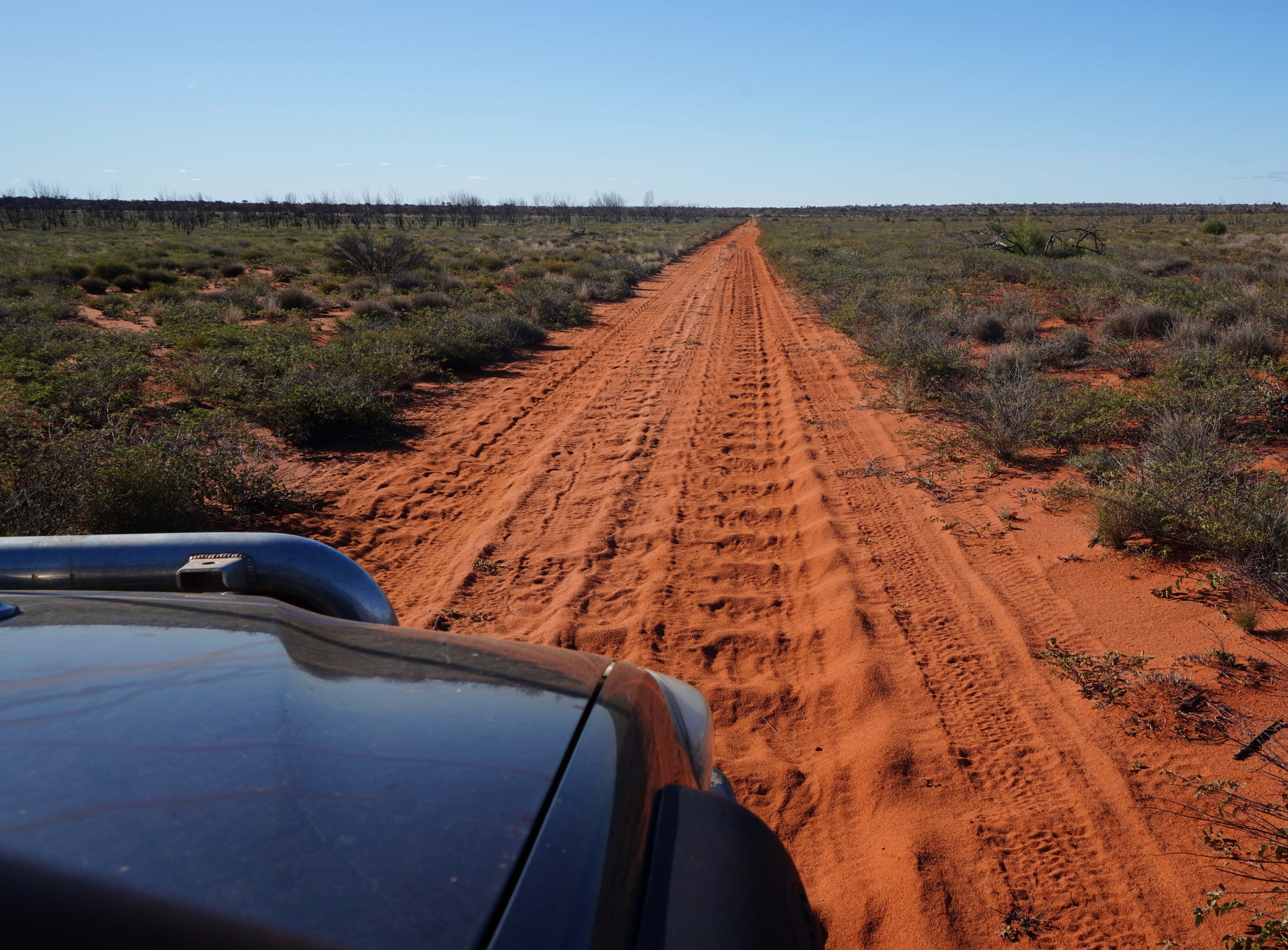
Initially, the CSH crosses near-treeless limestone plains on the edge of the Nullarbor Plain.
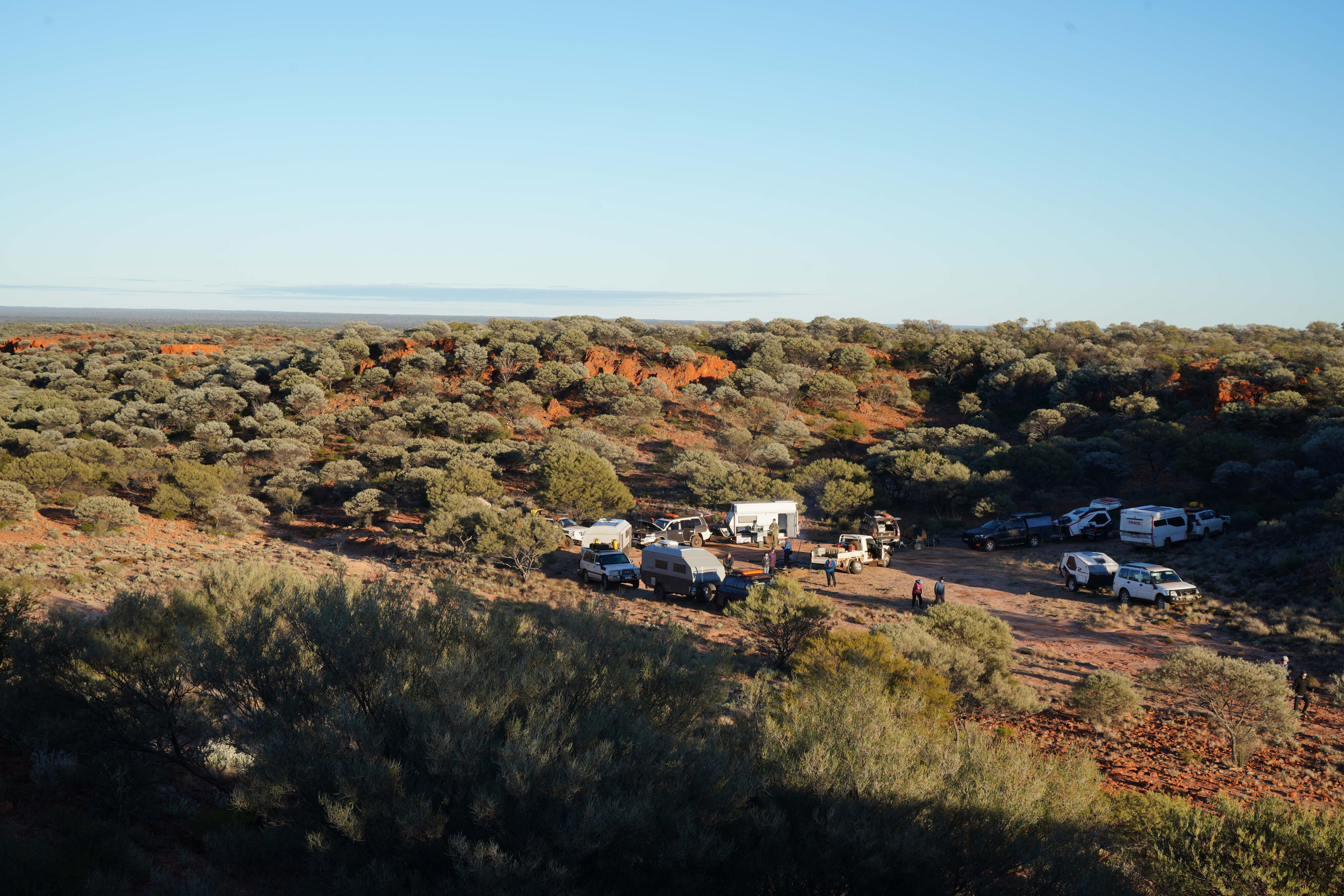
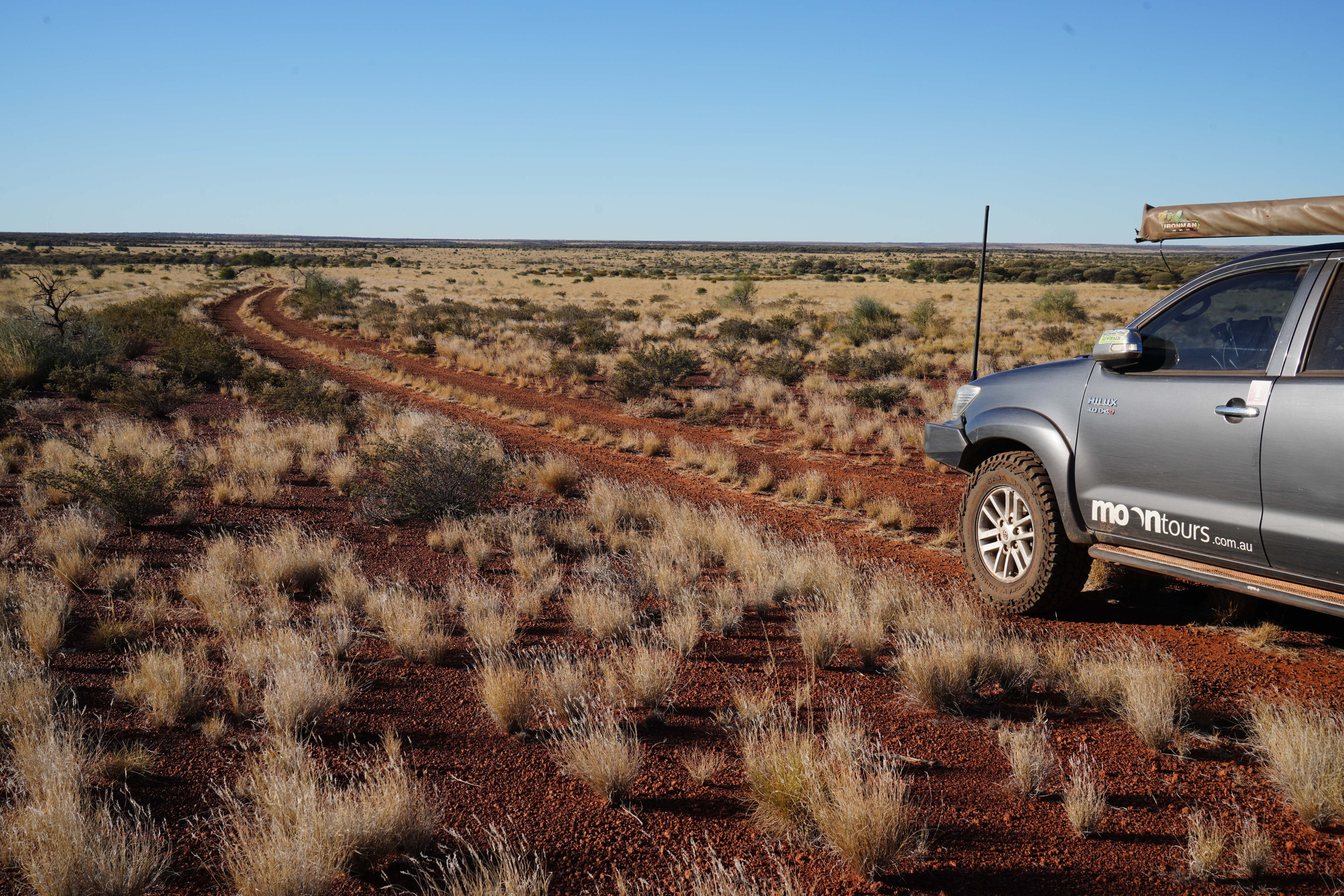
The terrain gradually becomes more varied, transitioning from bluebush plains to mulga and mallee scrub, with a thick covering of spinifex. On our most recent visit we camped 90km north of Rawlinna after an easy run.
The next morning, the track remained straight and reasonably smooth. About 15km from our camp, an Aboriginal Business Road joined the CSH, improving the road condition significantly. A shelter and water tank nearby were popular with campers, but we pressed on. North of the business road, the CSH veers towards the Aboriginal community of Tjuntjuntjara, marked by another shelter and water tank.
113
The vegetation varies as you continue north, passing through bluebush plains, mulga scrub, and mallee scrub before encountering red dunes that signal you are truly in desert country.
The CSH is a well-formed double track, smooth except for occasional corrugations and rocky outcrops.
Crossing into the Great Victoria Desert, Australia’s largest desert, you will encounter diverse flora and fauna. The desert features open woodland, marble gums, black oak trees, and various animals including camels and dingoes.
Historical explorers like Ernest Giles and Frank Hann traversed this area in the 19th and early 20th centuries, facing harsh conditions and discovering vital water sources.
113
The camp at Neale Junction, where the Anne Beadell Highway intersects the CSH, has a shelter, water tank, and fireplaces, making it a good spot for rest.
After a night camped here, we navigated through dunes and undulating sand plains, dealing with washouts and corrugations. We turned off the main track into thick vegetation, eventually reaching Point Lillian, where Frank Hann first arrived in 1903. We explored the area, including a cave with ancient Aboriginal rock art.
Continuing north, we passed landmarks named by Hann, such as Point Sandercock and Ryans Bluff, and checked out Cooper Hills Bore, where we managed to get the solar-powered pump working for a flow of fresh water.
113
Further north, we passed Hanns Tabletop Hill and noted tracks to Sydney Yeo Chasm and Waterfall Gorge, both now restricted by traditional owners. We camped at Mackenzie Gorge, enjoying the sunset.
The next day, track conditions varied from easy to corrugated. We veered right at a junction, and the route became smoother, with introduced buffel grass replacing spinifex. We soon reached the Great Central Road and drove the final stretch to Warburton.
After a few repairs and a much-needed shower at the roadhouse, our journey along the Connie Sue Highway came to an end. It had been a memorable trip through the Australian outback.
113
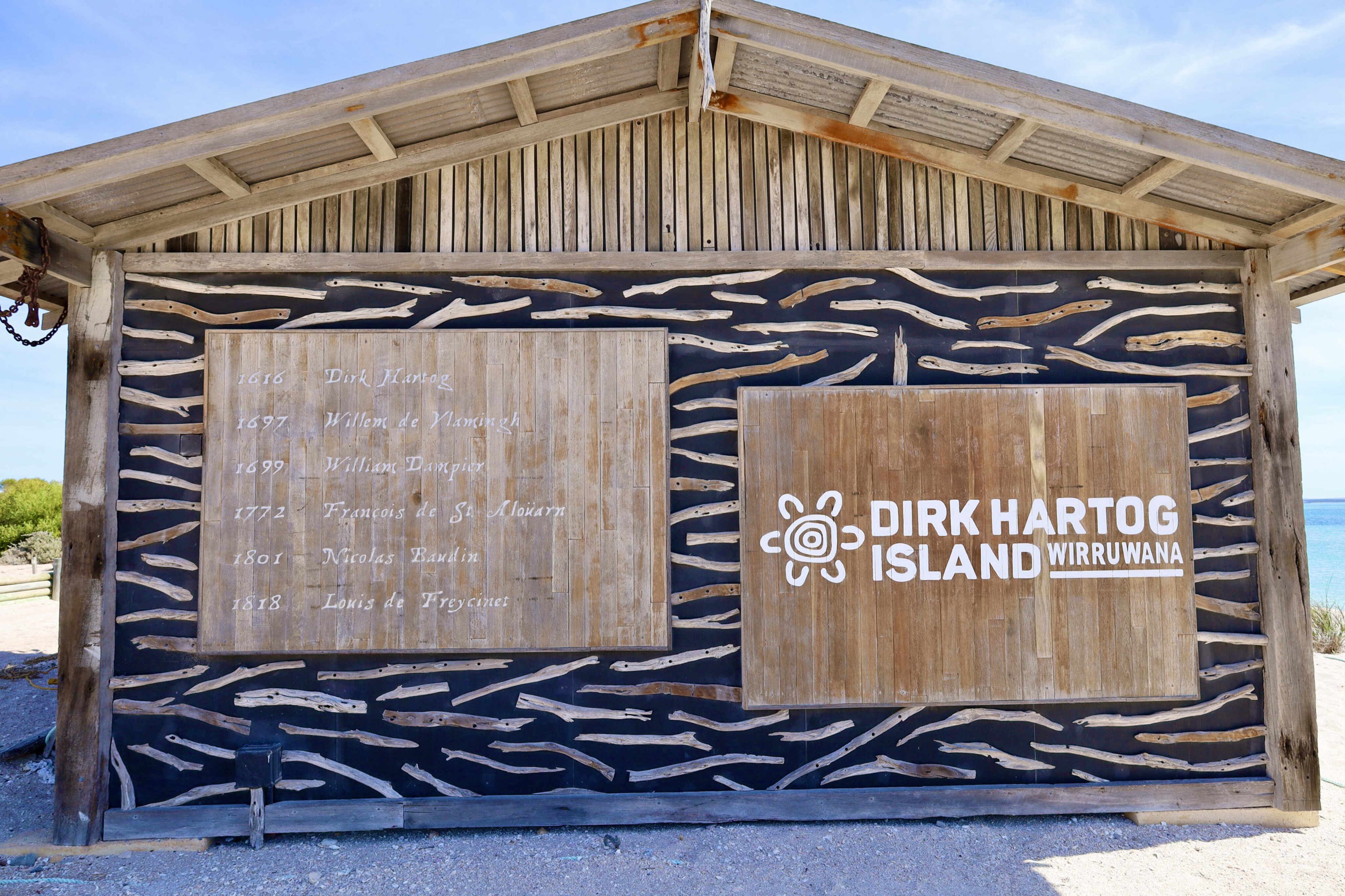
4. Dirk Hartog Island
Words by: Kev Smith
The pristine Dirk Hartog Island feels like the edge of the world.
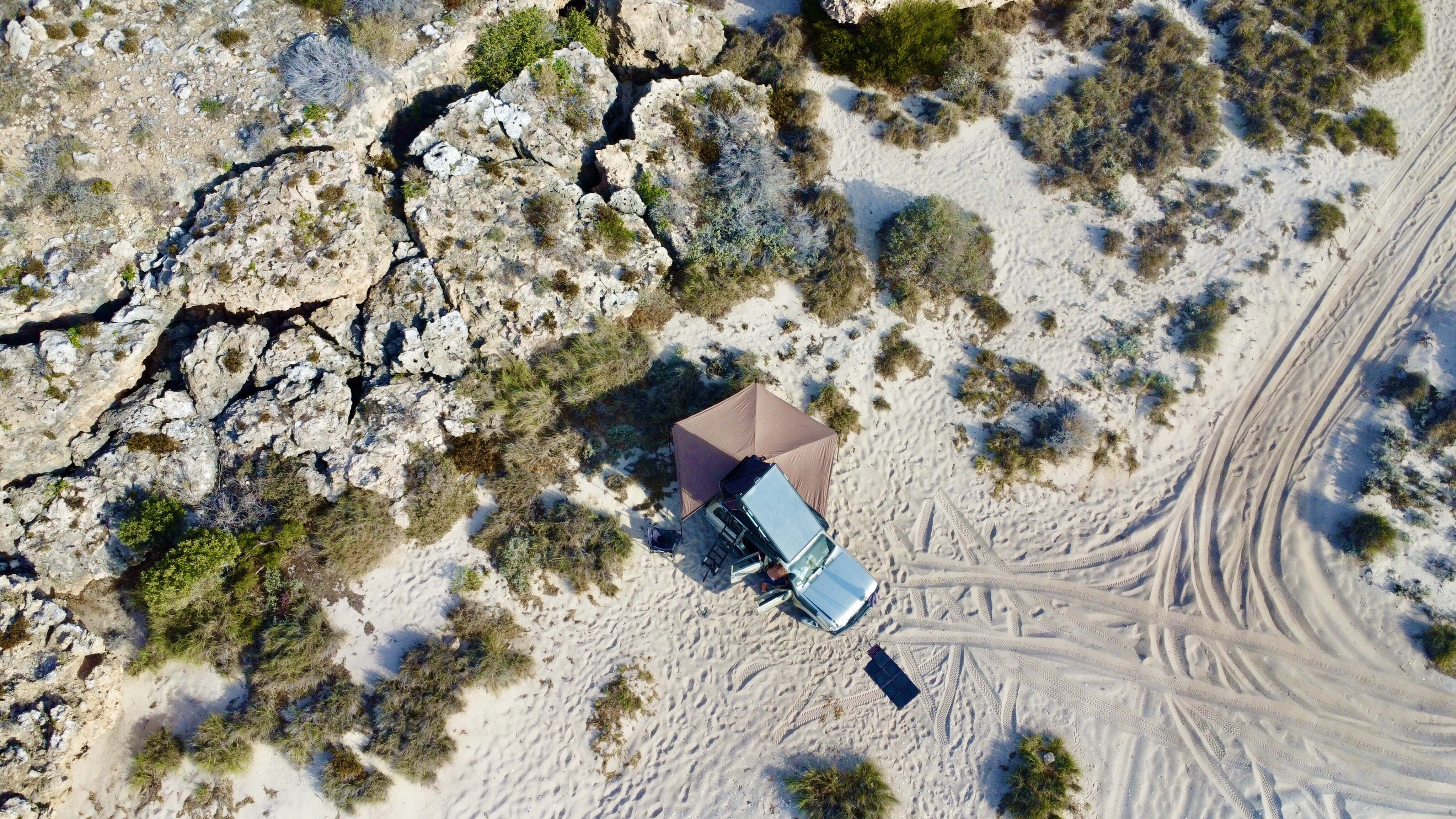
Dirk Hartog Island is off WA’s west coast adjacent to Steep Point, the most westerly point of mainland Australia. Now classed as a national park, Dirk Hartog is being returned to its natural habitat thanks to the eradication of all feral pests.
It’s a logistical effort to get to the island where only 20 vehicles are allowed at any one time, so once there it’s peaceful, isolated and remote. The Island is part of the UNESCO Shark Bay World Heritage Area.
The nearest fuel stop is over 200km from the barge departure point, and the same distance from the drop-off point.
113
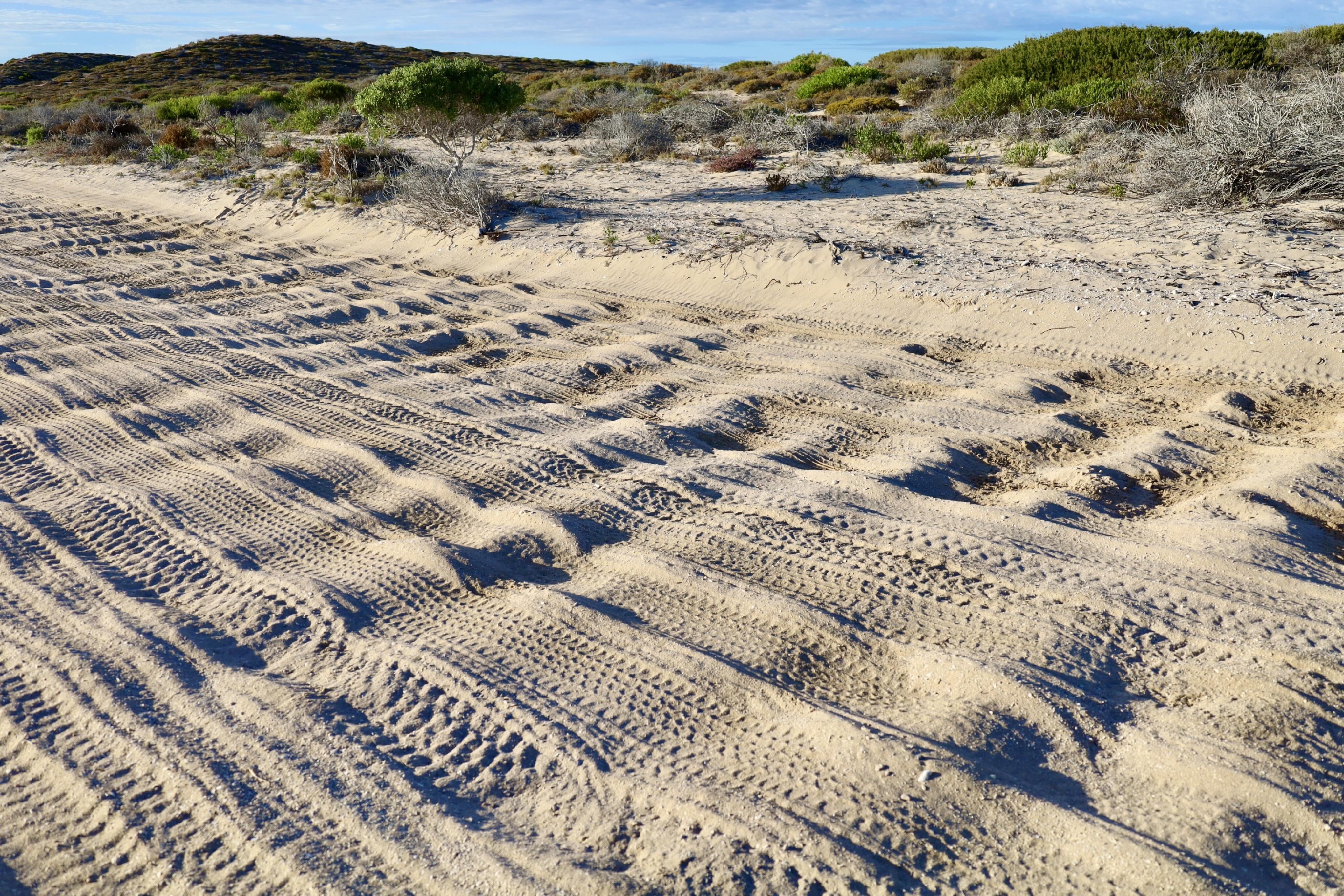
Considering the 100km of island tracks to cover, you need to be prepared for nearly 500km of four-wheel driving with low tyre pressures. A fuel drop can be arranged on the island but it comes at a premium.
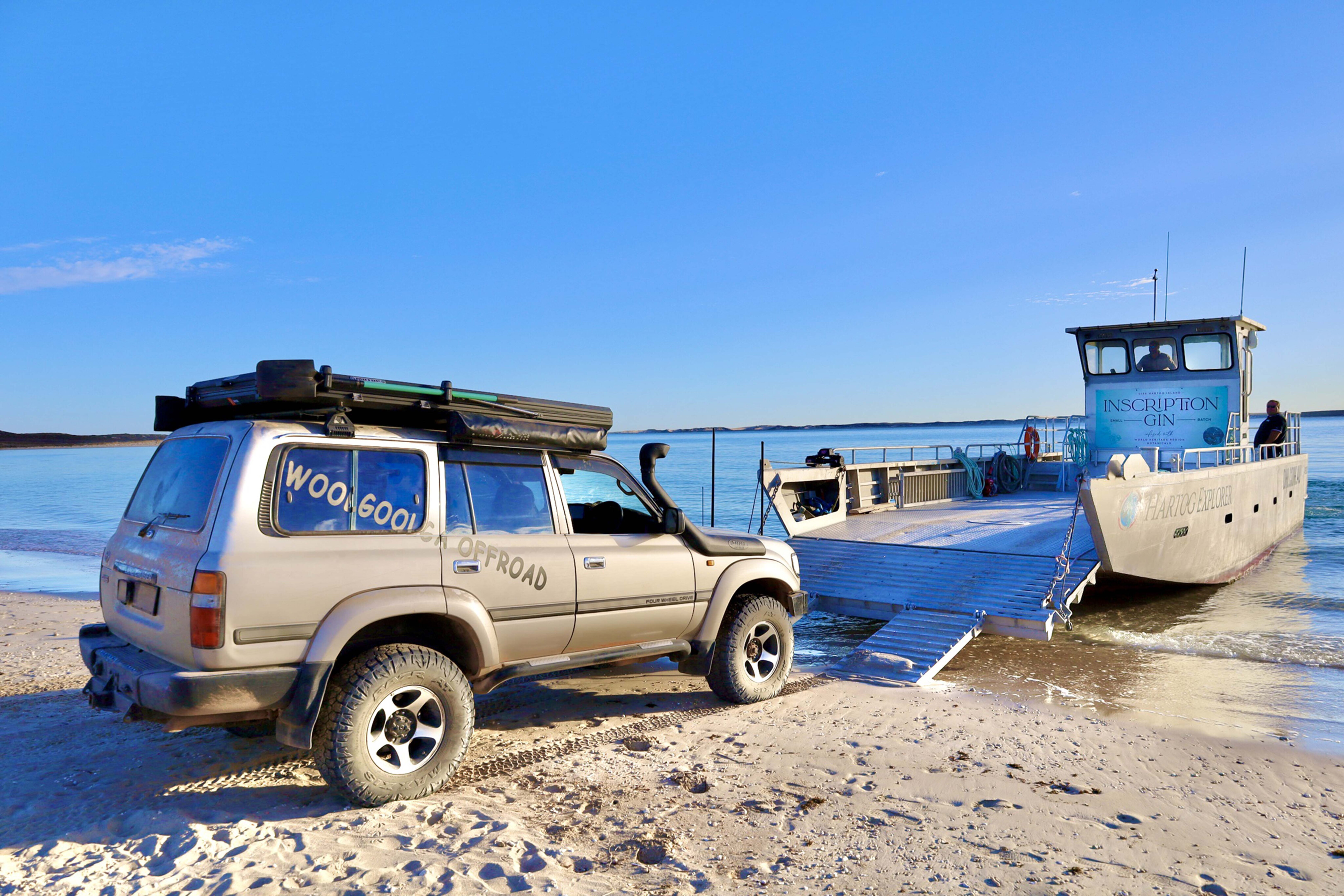
When we visited, with both fuel tanks full and a top-up shop at Denham on the Cape Peron peninsula, we headed to Steep Point, the barge pick-up point. The drive to Useless Loop Road was 100km, initially on sealed roads, but soon required lowering tyre pressures for the sandy, rough tracks.
Parks WA advises lowering tyres to 28psi and switching to low range for the sand-dune and corrugated sections. The road to Steep Point was among the roughest we’ve encountered in 30 years. With daylight fading, we reached Steep Point, ready for the morning departure to Dirk Hartog Island National Park.
113
The barge operates with a 30-minute turnaround, transporting one vehicle at a time, including camper trailers of a specified length. Vehicles must lower tyres to 20psi to avoid getting bogged when unloading.
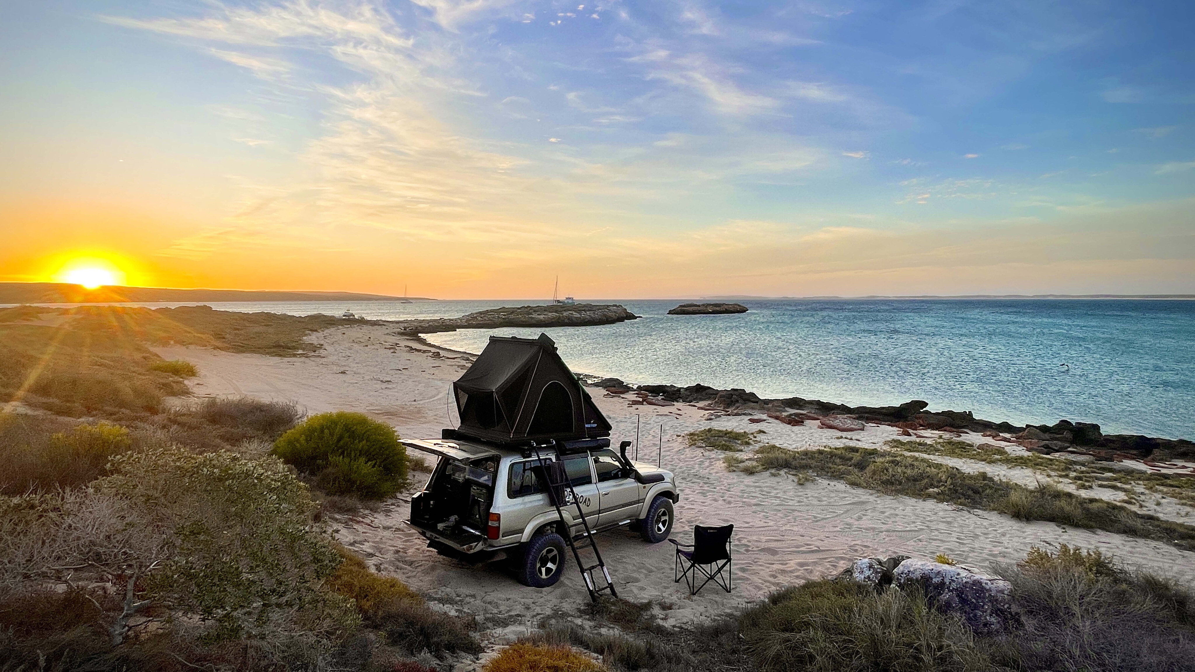
The island is roughly 70km long and 20km wide, with only about a dozen tracks. There are eight campsites, seven remote and one near the Eco Lodge, which offers a bar, coffee, souvenirs and luxurious stone cottages. For our five-night stay, we chose various remote camps to experience the island’s isolation and beauty.
Each camp has a water view: calm and sandy on the east, and rough and rocky on the west. The island, shaped during the Pleistocene epoch, features shifting dunes and calcified remains of vegetation and shells, especially visible on the west coast.
113
We explored from Notch Point, enjoying sunrises and bird activity, to William Dampier’s landing site in 1699, and the eroding west coast at Quoin Head, where we spotted sharks below the cliffs.
At Inscription Point, we visited the site where Dutch skipper Dirk Hartog first landed in 1616, leaving an inscribed pewter dish. Hartog sought a faster trade route and ventured farther east than any of his time. Over 200 years, explorers like Willem de Vlamingh and Louis de Freycinet visited, with the latter’s vessel wrecked but the dish saved and brought to Paris.
The 123-year-old lighthouse at Inscription Point is now solar-powered, with interpretive boards explaining its history. Construction began in 1908 to aid navigation, and nearby Turtle Bay was linked to the lighthouse by a tramway.
113
Dampier’s Landing is a key nesting area for loggerhead sea turtles, the largest in Australia.
The island’s ‘Return to 1616’ project aims to eradicate pests introduced since Hartog’s arrival, including goats, sheep, foxes and cats. Grazing has devastated native species’ habitats. A feral animal fence divides the island, aiding in the project’s success. Ten native species have been reintroduced across the island.
Make sure you spend time exploring the whole island; it can’t be done in one day with nearly 200km worth of tracks to explore. It is a beautiful but challenging place, recognised as a World Heritage site for its future preservation.
113
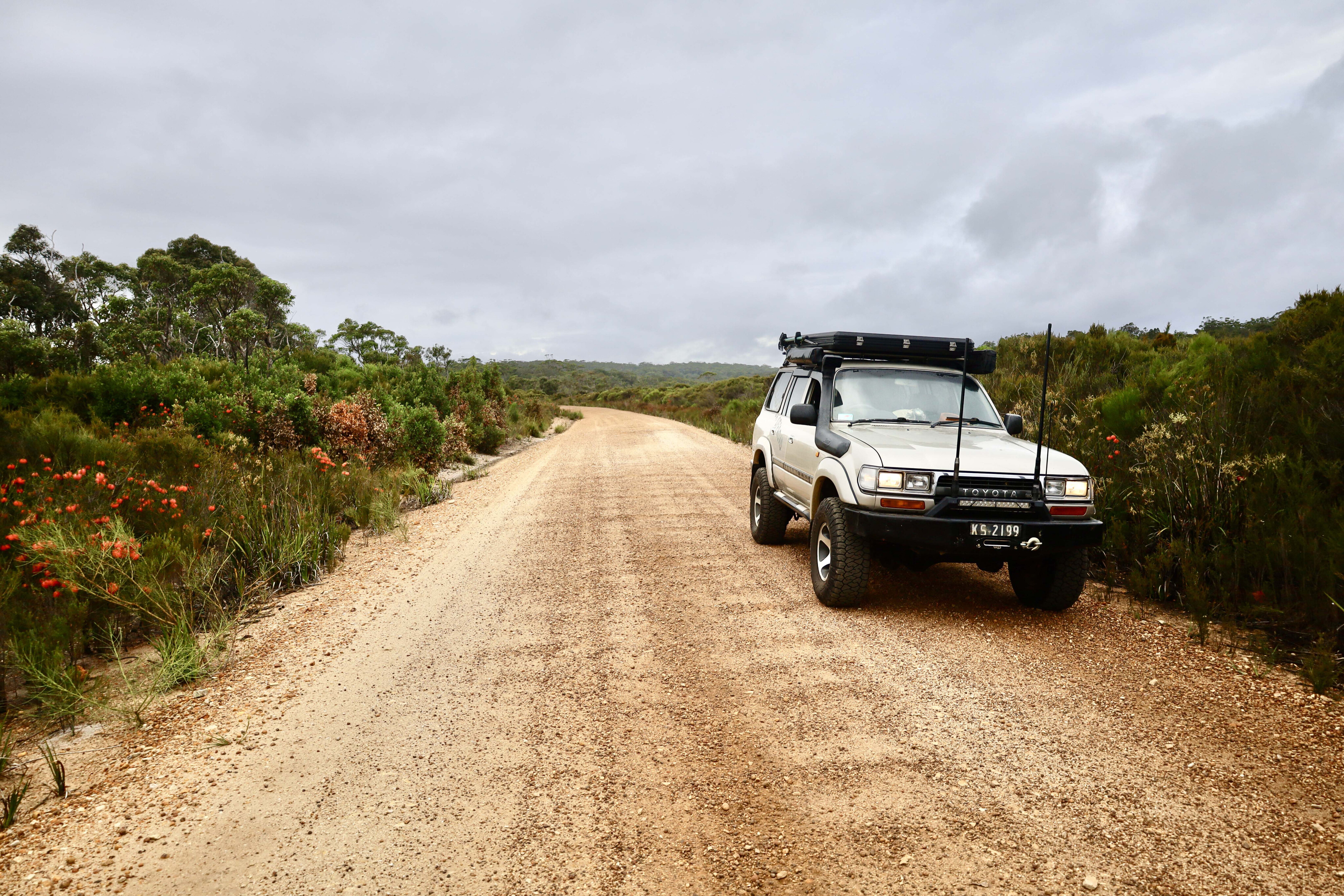
5. Buntine Highway
Words by: Glenn Marshall
Does the Buntine Highway live up to its poor reputation, or is it a next-level drive?
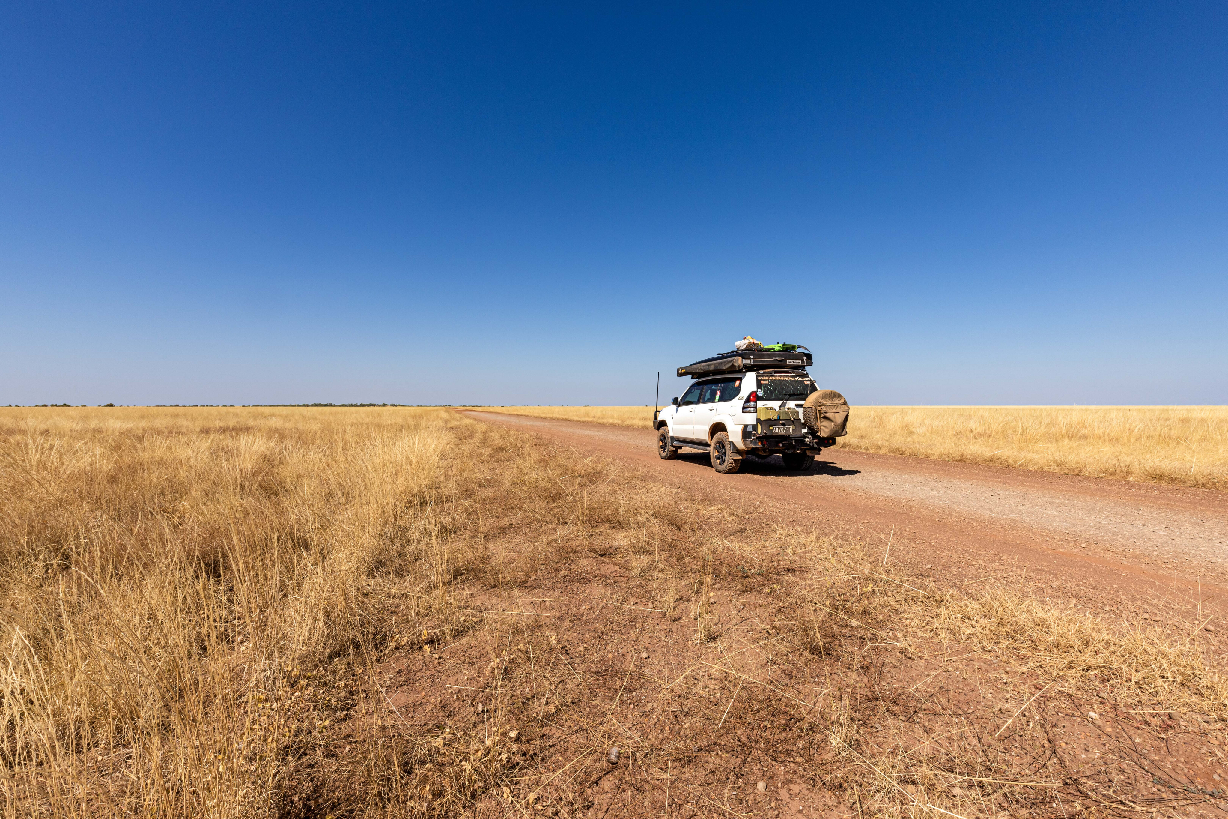
The Buntine Highway runs 600km from Duncan Road in WA to the Victoria Highway in the NT, and this journey begins at Halls Creek. Once a bustling gold-mining town, Halls Creek experienced a brief gold rush before the town relocated due to the highway’s construction.
Today, a discovery walk around the old town site and the preservation of the mud-brick post office highlight its heritage. Basic camping at The Lodge offers solar showers and rudimentary toilets, popular among fossickers still finding gold in the area.
Leaving Halls Creek, the journey through the Albert Edward Range involves slow progress due to tight bends, washouts, blind crests and corrugations.
113
Crossing the Black Elvire River brings the travellers closer to Palm Springs, a picturesque oasis with palms and reeds.
The turn-off to Sawpit Gorge reveals a rewarding campsite despite a rough access road, while the Black Elvire River, overlooked by a dramatic cliff face, is particularly beautiful at sunset. The main camping area, high on the bank with bins and drop toilets, contrasts with the more desirable spots on the riverbed. A relaxing swim followed by a fire would make for a pleasant stay.
Continuing towards the Buntine Highway, the road straightens and the valley flattens. The next 35km traverses the Ord River Regeneration Reserve, aimed at revegetating degraded sections and reducing silt flow into Lake Argyle.
Approaching the Buntine Highway, the landscape becomes bushier alongside the Nicholson River.
113
Marella Gorge, once a challenge to find, now has restricted public access due to new ownership. Recently maintained, the Buntine Highway offers a smooth drive to the WA-NT border.
With Kalkarindji still four hours away, finding a camping spot along the Buntine can prove challenging. Kalkarindji has a rudimentary caravan park. The town is historically significant; on 23 August, 1966, Gurindji, Mudburra, and Walpiri people walked off Wave Hill Station in protest, led by Vincent Lingiari.
This event led to the 1974 land rights legislation, allowing First Nations people to claim land titles, marking a significant step in Australian history.
113
The route then leads to Top Springs Hotel, where the storyboard highlights Noel Buntine’s vision for a reliable cattle transport system in the 1950s, evolving from a single Model B Mack truck to a fleet of 50.
From Top Springs, the Buntine Highway, often dual-lane, extends 165km north to the Victoria Highway. Termite mounds, golden grasses, and sapling gums line the road, with Telstra coverage around the Delamere Air Weapons Range.
The road is well-maintained, offering a better experience than anticipated and serving as a useful shortcut between Halls Creek and Katherine.
COMMENTS