IT’S BEEN said that simple ideas are often the best.
Well, when somebody recently came up with the notion of linking all of the coastal roads and tracks that hug the western seaboard of Ireland, who would have thought it’d end up being one of the most spectacular coastal drives in the world?
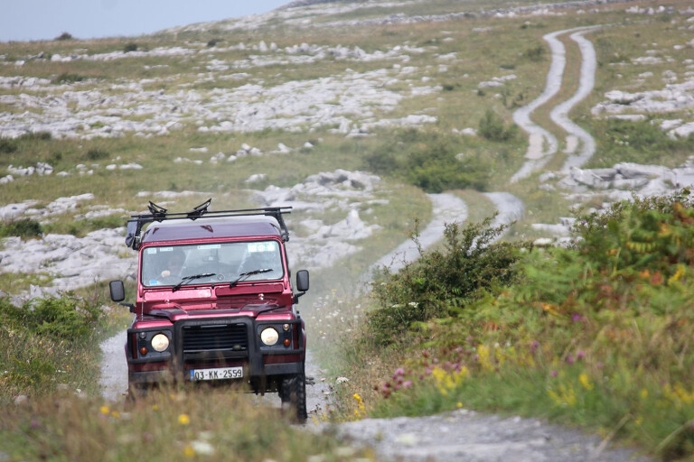
We simply had to see what all the fuss was about. So we loaded two Land Rover Defenders and, over two and a half weeks, planned to take in as many remote tracks as possible along this 2500km route.
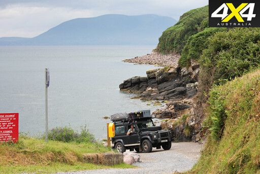 The adventure started in the picturesque town of Kinsale in County Cork, where we followed the coastline through the counties of Kerry, Clare, Galway, Mayo, Sligo and Leitrim, before ending on a high note as we tackled a maze of dirt tracks in the mountainous County Donegal. Alternatively, you can start in Donegal and work your way down the coast to Kinsale.
The first phase of this epic coastline drive took us along the County Cork coast, where areas of interest included Baltimore, Skibbereen, Schull, the scenic Mizen Head, Glengarriff, and the beautiful yet remote Beara Peninsula, before arriving at the busy town of Kenmare.
We decided to stay in a campsite in Killarney, one of Ireland’s most famous tourist towns. After a good rest following a few pints of the black stuff, it was off to explore the Ring of Kerry en route to the Dingle Peninsula.
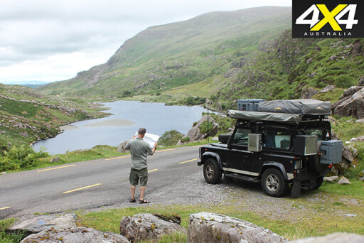 On the way to the Dingle Peninsula, we decided to set up camp early at Inch Beach. This provided the first opportunity for some beach driving, and we found the perfect spot to camp just a couple of kilometres near the end of the beach. As you drive down the beach you can’t help but notice the spectacular views of the MacGillycuddy’s Reeks mountain range – the highest in Ireland – and the Dingle Peninsula in the distance.
After agreeing on the perfect camping location, we set up a campfire and relaxed in the deckchairs to chow down on some hot bread cooked in the Dutch oven.
After dinner we sat back and watched the spectacular scenery change colour as the sun went down behind the distant mountains.
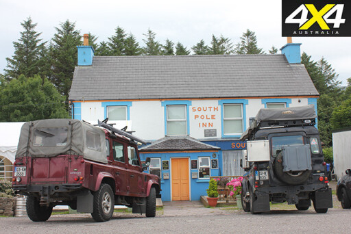 After some good, strong coffee the following morning, we packed up and took the short drive to the village of Annascaul. We were keen to visit a famous pub in the village once owned by one of Ireland’s most famous explorers, a man called Tom Crean. Crean passed away in 1938, but in his pub, the suitably named South Pole Inn, his presence is very much still alive.
Tom Crean was a gentle giant and is often described as an unsung hero who served with Ernest Shackleton on numerous polar expeditions. He took part in three
of history’s most gruelling Antarctic expeditions, whereby he received the Albert Medal for Bravery. He retired in his home village of Annascaul, where he bought the pub.
After a hearty breakfast in the South Pole Inn we continued towards Dingle to visit another famous Irish site: Saint Brendan’s Port, just outside of Dingle. Dingle is as close to America from Europe as you can get.
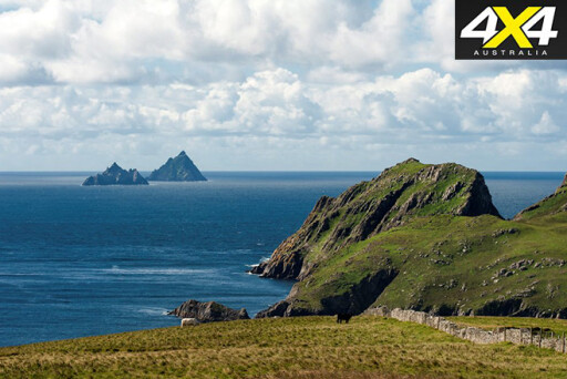 You can also take a boat trip to the Skellig Islands UNESCO World Heritage Site. These unusual pyramid-like islands, perched 13km from the mainland, were recently used to film scenes from the flick Star Wars: The Force Awakens. You will see the islands in the distance as you drive along the coastal Slea Head Route.
The County Clare section of the Wild Atlantic Way offers a very different and unique coastal experience. It’s packed with big-hitting attractions including the Cliffs of Moher, Burren National Park, stunning beaches packed with surfers, and an abundance of ancient sites that are of national significance.
As you continue along the narrow, meandering coastal road you will soon see the Cliffs of Moher appear over the horizon. We spent two days in this very unusual moonscape environment, which was just a short walk to the village of Doolin.
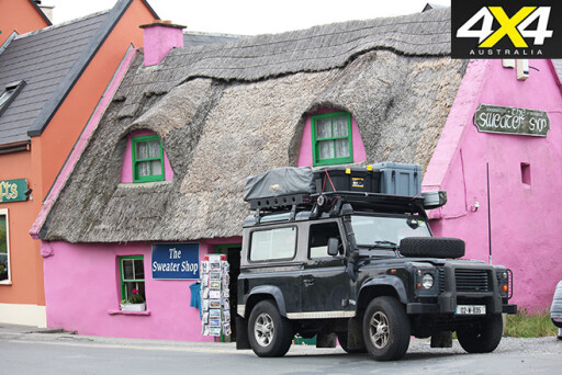 Doolin boasts a number of excellent fish restaurants. You can also experience village pub life, with one of the local pubs showcasing traditional Irish music. This musical experience will give you an insight into the culture that has echoed within this town for centuries.
The word ‘Burren’ comes from the Irish word ‘Boíreann’, meaning a rocky place. The Burren, covering an area of 160km2, is probably Ireland’s most unique national park.
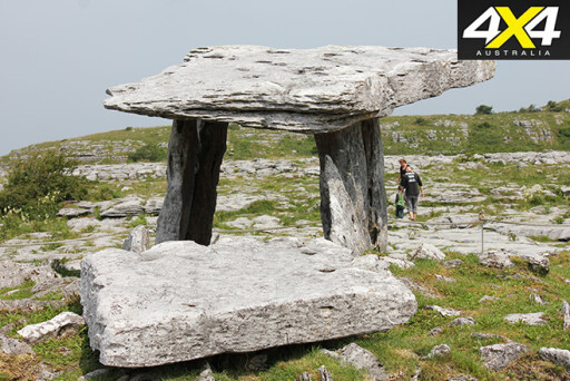
Humans have settled here since the Stone Age and Neolithic times, with evidence of their existence – tombs, dolmens and forts – scattered throughout the park. One of these well-preserved tombs is the Poulnabrone dolmen, which dates back before the pyramids of Egypt.
 After spending a couple of days in the Burren, it was time to point the Land Rovers towards Galway and the next section of the Wild Atlantic Way.
Arriving in Kinvara, near the Galway and Clare border, I knew we were close to the home and birthplace of Robert O’Hara Burke – the Irishman who led the ill-fated expedition across Australia in 1860.
Having had the opportunity to take my Land Rover along part of this route in the Australian outback, I was keen to see where he was born and visit the house he grew up in. We couldn’t get into the privately owned house, but we did get a chance to talk to the caretaker who told us there was a plaque on the wall of the mansion documenting Burke’s achievements in Australia.
 After enjoying another great campsite close to Burke’s home, we packed up early and decided to head towards Maam Cross. Here we picked up the coastal track at Killary, Ireland’s only fjord.
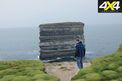
We were one week into the trip as we entered County Mayo, which has often been described as the heartbeat of Ireland’s Wild Atlantic Way, and our first port of call was to see Dun Briste, Ireland’s largest sea stack. This spectacular site is also the location of one of World War II’s stone aerial letter markers, which was placed along the Irish coast to identify the land below as neutral. It was inscribed ‘Eire’, for American bomber pilots crossing the Atlantic Ocean.
Achill Island, connected to the mainland by a small bridge, boasts great 4WD tracks, pristine unpolluted waters with five Blue Flag beaches, and great wild camping sites.
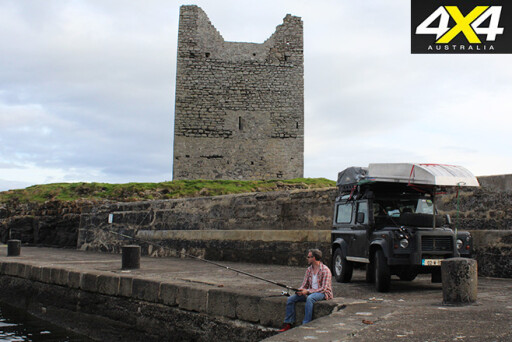 If you’re into sea angling – or any type of fishing for that matter – you will not be disappointed, with the island’s waters holding a number of sea angling records. The most notable record took place in 1932, when a porbeagle shark weighing 365lb was caught with a rod and line by a man called Dr O’Donnell Browne. You can still see the head of this specimen mounted and displayed on the wall at the Achill Head Hotel in Keel.
Another highly recommended track on the island is to the top of Minaun Heights. To get there, take the main road through Dooega and you’ll reach a left turn that leads to Minaun Heights. We drove to the top of the mountain in the Land Rovers, only to get badly stuck on the summit. It’s best to stay away from the boggy surface at the top – it’s a bit like black soil combined with quicksand. We ended up being stuck for five hours before we were eventually recovered by a local in a JCB.
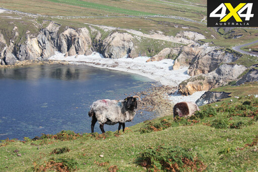 There are a couple of great campsites in Achill. You can camp at the base of Minaun Heights, or you can stay at the well-established Keel Sandybanks campsite located right on the beach just a couple of kilometres from Europe’s highest cliffs.
As we headed north towards County Donegal we contacted Shane Gallagher, who recently set up a website called Greenlane Donegal. This site provides plenty of information to help you plan your 4WD adventure in this remote part of the Wild Atlantic Way. Shane kindly agreed to spend a couple of days taking us to some of the county’s best 4WD tracks and hidden-away camping gems.
Donegal, located in the country’s north-west, is the last county you will hit along the Wild Atlantic Way, and it’s one of the largest in Ireland. Two thirds of the land consists of rough pasture, lake-filled valleys, windswept moorland and upland bog, making it the perfect playground for some 4x4 fun.
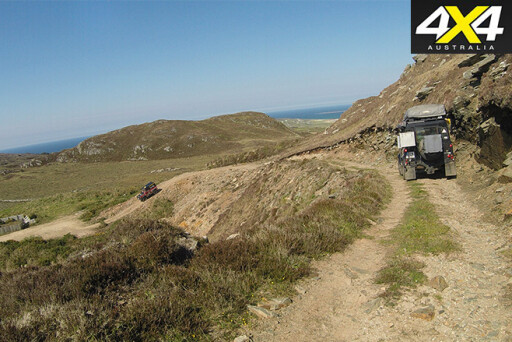 Our first Donegal challenge was tackling the Glenveagh National Park and the surrounding green lanes and mountain tracks. We then hit the tracks near Sheephaven Bay, before finally arriving at the Inishowen Peninsula, which is the most northerly point of mainland Ireland.
Our last camp was in Leena, a small, picturesque coastal fishing village. The fishing was apparently pretty good here, so we decided to camp on the pier and throw a line out. We had just set up camp when one of the local fishermen kindly offered us a whopper of a crab for tea. This was the perfect end to a great adventure along the Wild Atlantic Way.
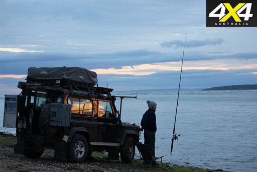 This trip more than lived up to the surrounding marketing hype. Around most corners of this coastal route you will be presented with magnificent views of the west coast’s rugged shoreline. With the endless coastal vistas, diverse attractions, great pubs and ancient sites, you can easily spend more time than originally planned in any one area.
Better still, if you explore the Wild Atlantic Way in a 4WD you will be guaranteed to experience the hidden gems that don’t always get into the tourism brochures.

COMMENTS