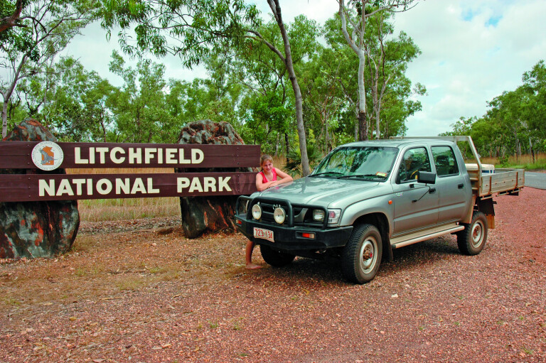
Ask a local in Darwin which is the best national park in the Top End and you will be informed it’s Litchfield. Which is surprising because the attention is always on Kakadu. But again, the locals will tell you that Litchfield is a simple park without the b/s …
Don’t get me wrong, Kakadu was my home for the entirety of the 1980s and I love the place. It’s not to be missed on a Top End holiday.
However Litchfield has perennial creeks that feed thundering waterfalls and cataracts that, unlike those in Kakadu, never dry. There is also safe swimming in the plunge pools and at the spring-fed Buley Rockhole.
This alone makes Litchfield a favourite day escape for Top Enders during the build-up season, when the soaring temperatures of the coming wet makes having a cooling dip in a crocodile-free swimming hole invaluable. But the 146,000-hectare park is more than a swimming park for a weekend dip; it’s one that has scenic flora and fauna values that are so much a part of the Top End landscape.
SWIMMING HOLES
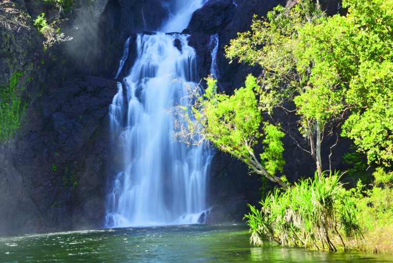
Swimming is popular at Tjaynera Falls (Sandy Creek), below Florence Falls and in Buley Rockhole. Wangi Falls is very popular, but it can be suspect, especially during and after the wet season when saltwater crocodiles make their way upstream into the plunge pool from the nearby Reynolds River. It’s your call ...
Powerful currents are also present when the falls are in flood. Some years ago, following a huge ‘knock-em-down’ storm, I was lucky enough to photograph the Wangi Falls in full flood. The falls were roaring and powerful waves, along with spray, were washing the pandanus that line the creek. A bikini-clad English lady turned up to go for a swim. I warned her that the current was too strong and that a crocodile may be in the pool as they often are after a flood. She thanked me and passed it on to several others in her tour group.
After enjoying a coffee at the kiosk my wife and I headed back to the car park and were ambushed by a park ranger and a tour driver at our LandCruiser. I was soundly abused for giving the girl some life-saving advice to the point where I told both to shut their mouths or face the consequences, especially when the tour driver told us to go back to Queensland …
Later, I picked up the Northern Territory News at the newsagency and noted the headline: “12-foot crocodile captured in the Wangi Falls plunge pool.” I dropped it on the counter of the park office along with my business card – and told them to Google my credentials. In hindsight, the park people of the Top End have been amazing and very helpful to me over the years, but I suppose there is always a tosser in the pack.
The lesson is never swim in one of the rivers and creeks below the escarpment plateau during and after flooding – and take note of the local bushmen. You will live longer in the tropics …
GETTING THERE
Litchfield is only two hours’ drive from Darwin and, with a mostly sealed ring-road from Batchelor to the Cox Peninsula Road, getting there is simple, whether for a day excursion or an extended camping trip by lodging at one of the park’s campgrounds or those run by private enterprises at both entrances. Meals, cabins and motel accommodation are available on the Litchfield Park Road, east from Batchelor, before the park’s eastern entrance.
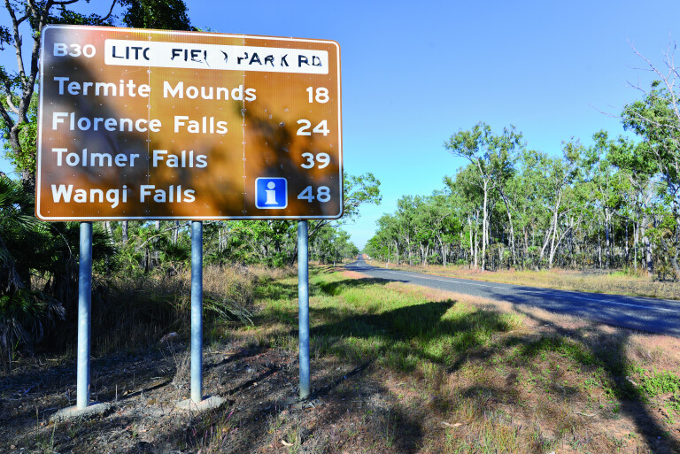
Roads are open all year, as is most of the park, but during the wet season the Reynolds and Finniss River often flood the road crossings. Again, common sense rules when the environment is warring with itself. Best stay home when flooding is on the books. The Finniss River, while bridged, is crossed at both the eastern and northern park entrances.
4WD TRACKS
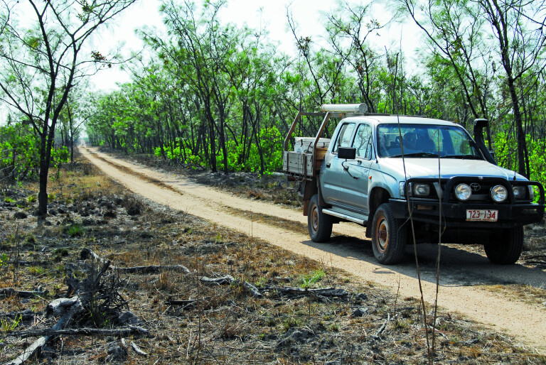
There are several 4WD-only tracks in the park and they are closed during the big wet. These challenging 4WD-only tracks terminate on the Daly River road to the south. The first track leads to the Lost City, Tjaynera Falls and the Blyth Homestead ruins. There is a natural crossing on the Reynolds River on the western track, but be careful there when wading as crocodiles live here. It’s a popular 4WD excursion route to the Daly River.
The main park ring-road route is fully sealed and provides access to several waterfalls and swim pools. Florence Falls, Buley Rock Hole, Tolmer Falls and, lastly, Wangi Falls are all located close to the road. There are short walks from the car parks to the falls.
Another nice 4WD track is not far past the Finniss River bridge on the Litchfield Park Road. It cuts across monsoon woodlands, over steep hills and terminates on the north bank of the Florence Creek Falls. This 20km track and others to the Daly River are popular with 4WD explorers wanting to get away from the maddening weekend crowds.
WALKS
There are several walks in the park, the most used being the easy boardwalks that terminate at the waterfalls. If planning an extended walk across the plateau or the surrounding monsoon woodlands, you must apply for a permit which is available from the Territory and Wildlife Parks office in Batchelor.
They will want to know your planned route and other details. Carry a Personal Location Beacon (PLR) or sat phone when trekking across the Tabletop Plateau and the monsoon woodlands of the low country.
Hiking and walking are very popular due to the scenic terrain and wilderness experience. While there is no marked trail system, rangers will assist with suggestions and more. Existing walks from the car parks do not pose any problems, being no longer than a brief stroll with two hours being the longest. It all depends how much time one spends looking at things along the route.
The Rainforest Track at Florence Falls is 2km. It commences at the plunge pool and follows Florence Creek upstream, where lush and verdant gallery rainforest is encountered before it swings back to the pool. Another extends from the campground. Some fitness is required.
The Buley Rockhole to Florence Falls track is 1.5km and an easy walk for the fit and young at heart.
The Tolmer Falls Track is 1.6km long. It has recently been upgraded and skirts the top of the gorge above the falls, while grand views fold to far western horizons from the new lookout across the woodlands. No access is allowed in the deep rainforest gorge below the falls or the caves that are home to bats.
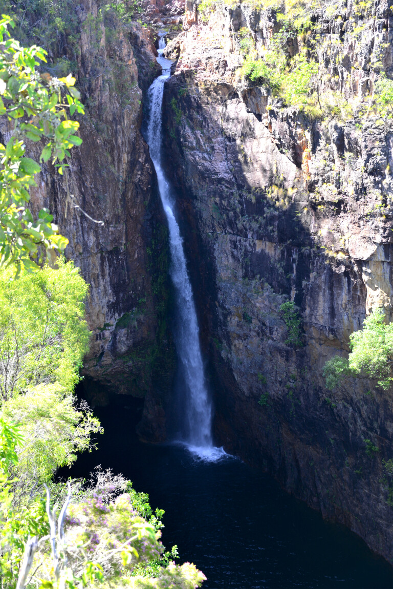
It’s arguably the most spectacular ’fall in the park. While a thundering 80m cataract in the wet, it drops down to a serene and plume-like waterfall at the end of the dry. The continual mist has created a true rainforest below the falls.
The Lookout Walk Track at Wangi Falls is 1.5km and is only suitable for the fit, as it has steep ascents and descends to the top of the 50m high sandstone escarpment. The falls are the most popular with visitors who come here to swim and relax in the big plunge pool that is on the bottom of the twin cascades.
Snorkelling is also popular, but nature can be deceptive, and people have drowned in the strong currents under the falls – and, of course, there is the odd crocodile …
CAMPING
There is organised camping only in the park, with showers and toilets available. No bush camping is allowed, nor are pets. The most popular is the Florence Falls campground. It’s downstream from the falls where a short, steep walk takes you to the plunge pool below the cascading torrent.
Buley Rockpool is nearby. The campground is deemed unsuitable for caravans due to a steep ascent and limited space, but it’s okay for camper trailers.
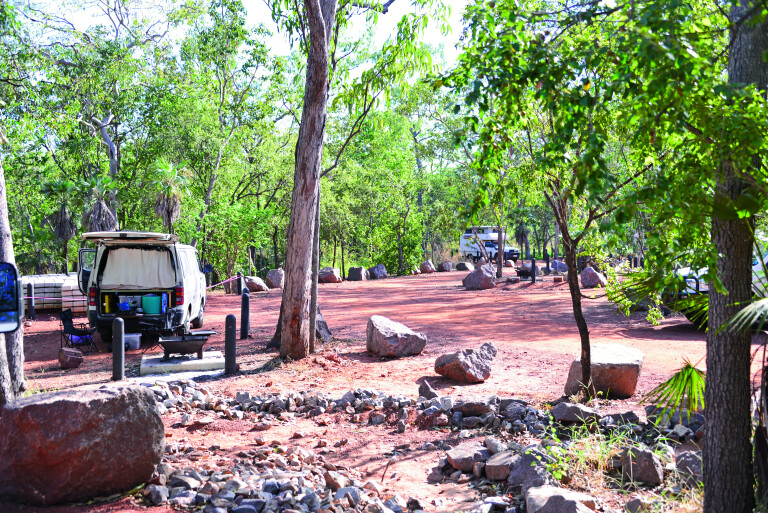
The next campground is at Wangi Falls, with a private campground just outside the park up the road a little. Caravans are suitable for Wangi campground. It has a kiosk with meals, showers and toilets. No powered sites are available. Camping fees apply and must be deposited in the honesty box provided. Rangers check for permits.
There is a bush campground at Tjaynera Falls – 4WD-only track. The park campgrounds are managed by ‘Campground Services’, who will demand unpaid fees if you don’t have a ticket.
ROAD ACCESS
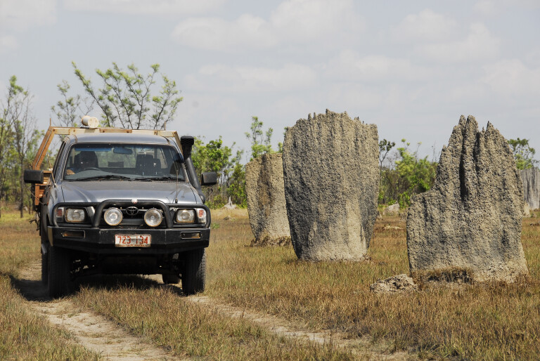
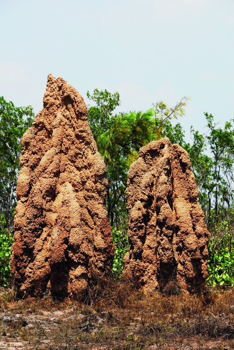
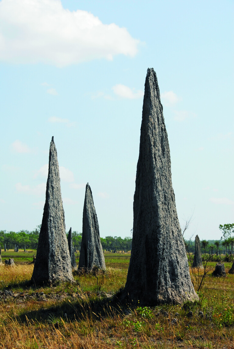
If coming from Batchelor, don’t miss the imposing termite mounds. Both the magnetic and the 4m-high Nasutitermes triodiae termite mounds are represented on the black soil plain. Magnetic mounds, constructed by Amitermes meridionalis termites, take full advantage of the sun and warmth, akin to having air-conditioning in the home. These mounds are orientated 10 degrees east to true north.

On the way out to the Cox Peninsula Road, keep an eye out for extensive huge magnetic termite cities, soon after crossing the Finniss River bridge.
Another attraction is the Tabletop Swamp, where a shallow depression has created ideal conditions for the swamp. It is generally clad with reeds and fringed by paperbark trees. Swamps like this and the natural ‘sponge’ effect of the sandstone tableland are responsible for the slow release of water that feeds the spring-fed creeks and enables the waterfalls to flow permanently, even during the most severe dry season.
The swamp attracts a lot of wildlife, so take the easy walk about it and be surprised by its avian inhabitants in variety and numbers.
About 4km past the Florence Falls marker is the Lost City turn-off. It’s 4WD-only country and tracks for 18km through monsoon forest. The track extends beyond the sandstone pillars of the Lost City to the Reynold River Track near the abandoned Blyth Homestead ruins.
The Lost City has tall, weathered free-standing sandstone pillars that reach to the top of the gum trees. Nature has created works of art here and taking a gander and a walk about the ‘city’ is a must.
Farther on is the Blyth Homestead, a living testimony to how tough and hard things were for the pioneers that dared to challenge the bush and the often-hostile natives. The homestead was built in 1929 and has endured.
You have a choice here of turning north to Wangi Falls or south to the Daly River road, via Tjaynera Falls, which is well-worth the drive. Plan to camp in the bush along the creek.
Once past Wangi Falls, several attractions on the last leg to the Cox Peninsula Road are located outside the park. There is a kiosk and campground near the boundary, and beyond it is the private rainforest reserve of the Petherick family. Years ago, I met the now deceased founder of the reserve. Old man Petherick made a living from shooting crocodiles and said he once shot a 15-footer in the Wangi Falls plunge pool … now you know why I don’t swim in it.
Bamboo Creek Mine turn-off tracks for about 2km before the old mine site is reached. Copper, tantalite and tin were discovered in the Litchfield region in the 1870s. Mining was active at Mount Tolmer and Bamboo Creek, but mining activity ceased in the 1950s.
Farther on is the Finniss River, turn right after crossing the bridge and be amazed by the beautiful waterhole that appears. Camp here, launch the tinnie and catch a barramundi for tea.
The next attractions are the huge cities of magnetic termite mounds. They are located on private land, but no one stops people from viewing the mounds.
HISTORY AND GEOLOGY
Litchfield was named after Frederick Henry Litchfield, who was the first white man to visit the region in 1865. An able bushman and explorer, Litchfield died in 1873 from gangrene caused by a festering spear wound.
During the dry season, traditional cultural burning regimes are practised by park management. Bush tracks may be closed, but generally burns are low key due to the lack of reduced fuel loads that is created by annual burning.
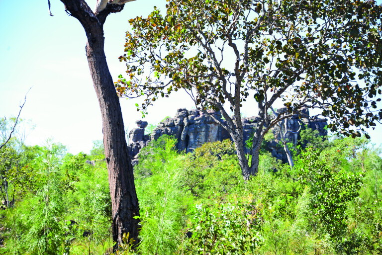
It’s odd that for all its size Litchfield is dominated by only two geological formations. The sandstone predominant of the Tabletop Range, a plateau that rises to 50m. It is home to the spring-fed creeks that feed the waterfalls. Elsewhere in the low country, shaded by the plateau, are typical Top End monsoon woodlands.
An average of 1450mm of rain falls in the park between November and May. Most of it falls during a two-month period when the monsoon peaks.
The tableland lacks a drainage system and its shallow depression – like the Tabletop Swamp and others – along with the natural ability of sandstone sponge effect and a finely balanced aquifer under them, makes the park a wonderful waterfall world.

FAUNA AND FLORA
Fifteen frog species, 58 reptile species, 44 mammal species and 174 species of birds makes the park an interesting spot for wildlife and bird watchers. Bats are found in many of the caves that are under the lee of the escarpments. There is a cave at Tolmer Falls that houses almost 30,000 orange horseshoe bats, considerable because its estimated that only 34,000 occur world-wide.
Aboriginal rock art is present in some caves and rock shelters, though no Aborigines live in the park. Contact the Park ranger for details on rock art.
The bats eat insects, which reminds me of the hungry hordes of park mosquitoes. Take Bushman Insect Repellent gel, wear loose-fitting and lightweight clothing, sturdy bush boots, and a wide-brimmed hat when walking in the park, and enjoy all that Litchfield has on offer. You may just agree with the Darwinian that it’s the best park in the Top End …
TOP 5 PLACES TO VISIT
1. Wangi Falls, Florence Falls, Buley Rockhole
2. Magnetic termite mounds
3. Lost City
4. Tolmer Falls
5. Blyth Homestead

COMMENTS