People have ‘discovered’ that their backyards often have the best attractions − camping, four-wheel driving, swimming, birdwatching and more. So it is not surprising that weekend escapes, mostly due to COVID-19 restrictions, are all the rage now, with national parks, forest reserves, waterways, impoundments and beaches more popular than ever before.
On such a place is the Wet Tropics World Heritage Area (WTWHA) which ranges north of Townville’s Paluma Range to the Black Mountain Range south of Cooktown − an unbroken 450km long corridor that contains rainforest, woodlands, mangroves, streams and wetlands.
It contains the highest mountain range in Queensland and the largest tract of tropical rainforest in Australia, which supports the highest biodiversity of life in Australia. The area has more than 3000 species of plants, including 700 endemic plants, 700 species of vertebrate animals, and 88 species that occur nowhere else on the planet. Think about it for a moment and find yourself in a wonderland of unbridled wilderness like nowhere else.
The Wet Tropics has the oldest continual rainforests in the world, its Gondwana heritage well-proven in the evolution of plants and animals. It also housed Aboriginal people who lived in the forests for thousands of years. The tribal groups comprise 120 clans and eight language groups that include 20,000 people who have cultural connections to the region. Many are directly involved in the management of the WTWHA.
Interspersed in the Wet Tropics are several national parks and reserves that are managed by the Queensland National Parks & Wildlife Service. The best known is the Daintree Rainforest and its parks − lowland parks that are easily accessible from the coastal route between Mossman and Cooktown.
However, there are several upland parks that remain largely unnoticed by visitors, even though their attractions are without par.
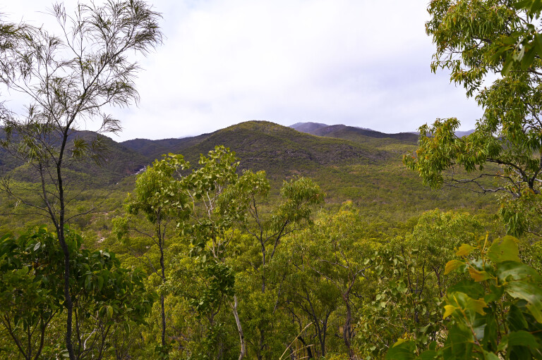
At some 1200m Mount Lewis National Park has the highest vehicle track in Queensland and many outstanding natural attractions, especially for bird watchers. As elsewhere in the WTWHA, these tracks were pushed across the ranges and in to the rainforest by timber cutters who once logged the forests, with red cedar being the most valuable harvested timber. Logging came to an end when the WTWHA was declared in 1988 to ensure full protection of one of our most valuable natural assets − one that matches the Great Barrier Reef.
However, many travellers en route to the Cape York Peninsula ignore the magical wilderness of the WTWHA, apart from a brief encounter across the Daintree River on the Bloomfield and CREB Tracks. But there is much more, and if you want to unwind and relax with nature or just lay back with a coldie in a bubbling stream while breathing pure mountain air, please follow me on epic adventures in to the magical world of the upland Wet Tropics.
Dinden National Park
Located 50km by road west from Cairns, between Kuranda and Mareeba, and straddling the 1300m-high Lamb Range, Dinden NP (east) has amazing streams and cascading waterfalls, while its flora is outstanding in terms of biodiversity.
It was gazetted as a national park in 2005 when it was upgraded from its forest reserve status and includes both Davies Creek NP and Dinden West Forest Reserve (Emerald Creek Falls). It is an attractive escape for city people escaping the heat and humidity of Cairns during the ‘build up’ of the wet season.
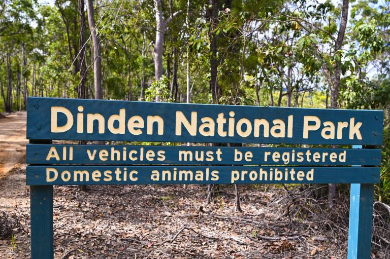
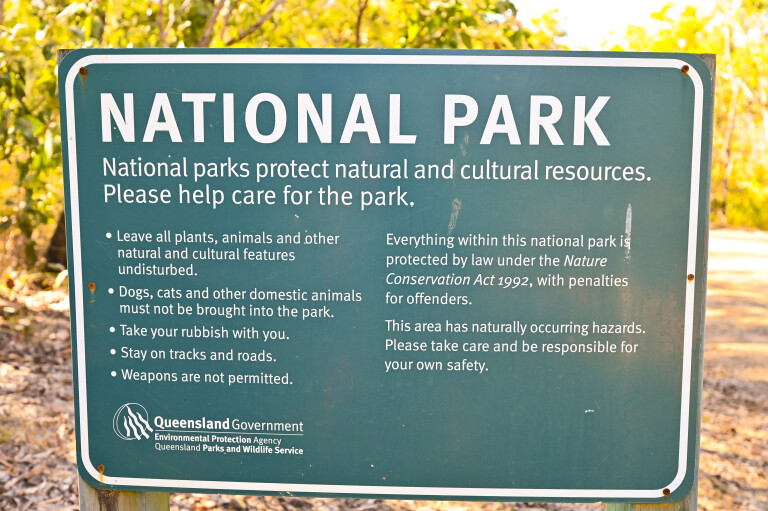
The entrance to the park is 15km southwest from Kuranda on the Kennedy Highway by taking the unsealed Clohesy Road. The first section traverses through foothills timbered by open grassy woodlands before another track turns off to a couple of resorts, one that caters for naturalists if you are in to that sort of thing. It has caravan sites, but don’t pull a ’van in to the national park beyond the junction as the road farther on is a 4WD-only track that, while unchilling for most 4WD vehicles, is unkind to ’vans due to its narrow confines and lack of passing, parking and turning space on the steep mountain slopes. No camping is allowed in the Dinden National Park.
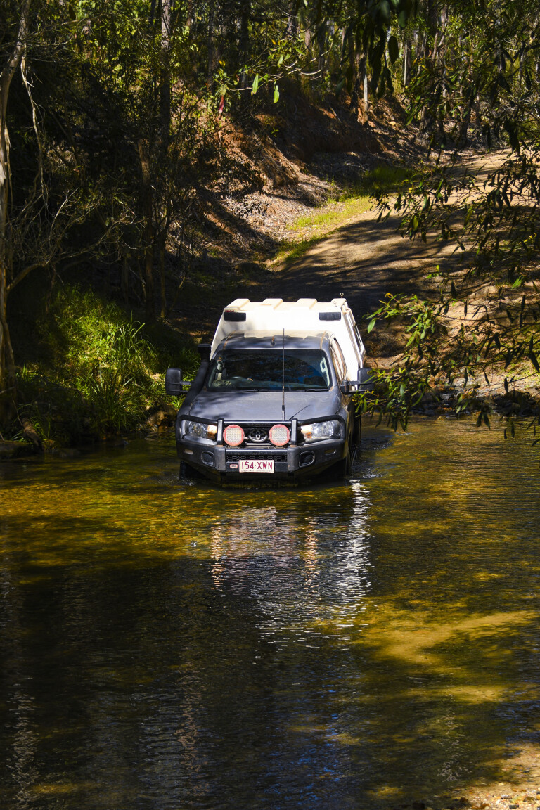
There are several stony streams on the track that are easy to cross in the dry season, but they turn in to raging unbridled torrents in the wet season when up to five metres of rain or more falls on the Lamb Range in a three- to four-month period. All tracks are closed in the park during the wet.
One of the attractions in the park is a massive fig tree on the Clohesy River boardwalk. Fig trees are also known as strangler or banyan trees. While they appear parasitic, they are not, because they begin life in the upper canopy of a host tree when a seed deposited there by a bird sprouts and sends its roots spiralling down the trunk in to the soil. Once done, more roots grow and in time, the host tree is strangled to death and rots away leaving the hollow-trunked banyan on its own legs, so to speak. It just keeps on growing with trailing roots ever expanding. Some are more than 1000 years old and no doubt the massive Clohesy River banyan is that or more.
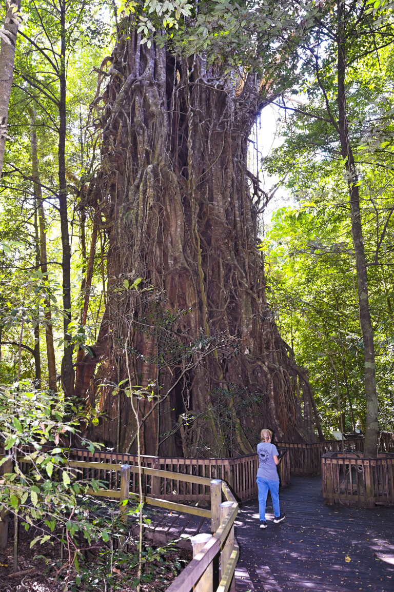
The boardwalk circuit takes you past a large scrub fowl nesting mound and huge trees that rule this fascinating rainforest – an encapsulated time vault, the home of epiphytes like ferns and orchids, climbing plants and lianas.
Fancy a swim? Do so from one of the day-use areas in safety in this upland region as crocs are absent, though beware of ticks in the dry and leeches in the wet. Another danger you must be aware of is the most poisonous plant in the world, the stinging tree. Contact a leaf and it’s akin to having petrol lit on your skin. The pain is instant and may last for up to six weeks with spasms occurring for up to two years. Having been stung a few times, the best remedy I can offer is to use spray bandage to prevent air from contacting the hollow slivers of poisonous silicon that the plant injects in to the skin. Other ‘cures’ like waxing may help, but I’ve found it far from doing so, even though it’s recommended by medics – your call.
The track continues to Lake Morris, the main water impoundment for Cairns, but it’s closed a short distance past the boardwalk where it meets the divide of the streams that feed the dam to protect it from soil run-off. The Bridle Creek Road, which connects it to the Davies Creek NP, enters a few kilometres past the fig tree boardwalk, but it’s also closed to vehicles.
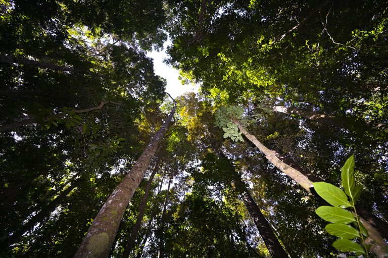
Several gravelly creek crossings on the track are not to be missed. If you love birds and their sounds, the open canopy of most streams is magical due to the many different species that hang about water and their strident calls, especially during the fruiting season from August on. Keep an eye open for colourful butterflies, reptiles and more.
On a recent escape, our way was barred by several large trees that had fallen over the track during a storm, just before the Bridle Creek track junction. Despite someone cutting away the bottom branches to allow vehicles to pass under the massive trunks, my Hilux’s canopy was about 30cm too high, so we turned back on to the Kennedy Highway and in to the Davies Creek NP some distance west towards my hometown of Mareeba.
Davies Creek National Park
This is a popular park for local people looking for a weekend and school holiday – camping, swimming, hiking and mountain biking escapes. During the week, it’s largely devoid of people and a great day-trip destination.
The Park is highlighted by massive granite outcrops on the summit of the Lamb Range, open monsoon woodlands on the foothills, and, most of all, the perennial crystal streams that flow from bountiful springs high in the rainforest and its pure mountain air.
For the fit, there are several trails that cater for both mountain-bike riders and hikers. The bike tracks are on the lower foothills and provide riders with a choice of steep trails that range from ‘easy’ to ‘hard’, in sections that are more than 10km in length. They traverse tracks that have rocks, jumps, creek crossings, dips and cliffs that connect with the Davies Creek and Clohesy River NP tracks, via the Bare Hill Conservation Park.

Hikers can walk the mountain-bike tracks or take the circular full-day hike of the upper Ridge Trail to the imposing 1289m high Kahlpahlim Rock on the summit of the Lamb Range. The shorter 899m-high Turtle Rock circuit trail is also popular with walkers. You need to be seriously fit as the highest point reached is at 1200m, where imposing panoramas of the mountains and the Atherton Tablelands are revealed.
The first section entry of the park is sealed to where the open eucalypt forest of the foothills are entered. It also marks the start of Bridle Creek Track, which turns off and junctions with the Clohesy River Track, but again, a locked gate bars further progress a few kilometres farther on.
There is a lovely rainforest-fringed creek at the gate that is popular for swimming and day picnics, while a short walking trail terminates under the lee of a high escarpment that shelters Indigenous rock art; a legacy of the Djabugay Clan, who shared a common boundary with the Bulwai people who resided in the foothills and the open forest below, most of which is now farmland. It’s estimated that the paintings may be as old as the Egyptian pyramids.

Unlike Dinden NP, Davies Creek has several camping sites that must be booked online. The road is suitable for campers and off-road ’vans. Compared to Dinden NP, there are few creek crossings as the road closely follows Davies Creek, which consists of fast-flowing rapids with short, shallow pools and several roaring waterfalls that offer a restful lullaby to those who are lucky enough to score a campsite nearby. Plenty of picnic and day-use areas are available.
After passing the monsoon forest-clad hills, you enter a narrow strip of eucalypt forest that is highlighted by stately 30m tall gums and little undergrowth. This type of forest separates the rainforest proper from the drier monsoon woodlands of the lower western slopes along much of the western WTWHA. It is known officially as wet sclerophyll forest and is in recovery from past logging activities.
Birdlife, especially colourful vociferous fruit-eating doves, are prolific in the rainforest, while flocks of chestnut manikins and seed-eating doves abound in the foothills. There are others, too numerous to mention, but the park is well patronised by serious birdwatchers as it offers some outstanding sightings.
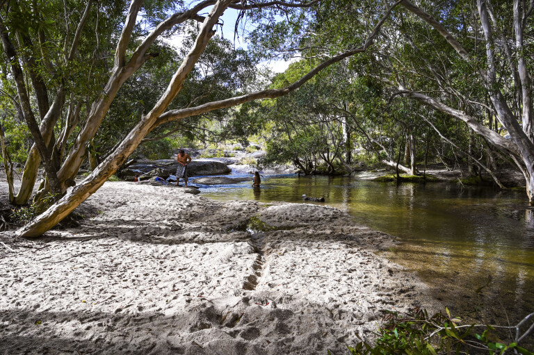
The highlight of Davies Creek NP is the creek itself. Just after the wet, when the park is reopened, the sound of roaring rapids and cascading waterfalls dominates over all. There is no escape from the roaring cascading of water on its suicide journey down the mountains on to the lowlands of the upper Atherton Tablelands and in to the Barron River where the water’s final plunge is at the Barron River Falls at Kuranda, something not to be missed if you are fortunate enough to be here in the wet.
There are two camp areas in the park. The Lower Davies Creek Camping Area has facilities that include wheelchair access, toilets and benches. Wood fires are discouraged − bring your gas cooker. The Upper Camping Area, which is in the rainforest proper, caters more for wilderness escapes. But all camps are situated on the creek or close by for swimming. Apart from minnows, there are no fish in the mountain creeks, so leave the rod and yabby pots at home.
Campers enjoy the company of possums, lemurs, tree kangaroos, frogs and the occasional reptile – scrub pythons that are longer than the average 4WD – at night …
The creek is fringed by torrent-pummelled eucalypt and bottlebrush trees with trailing roots that cling with precarious footholds on rocks. Be aware that during the build-up season, sudden storms on the mountains turn streams in to raging torrents that have no respect for man or beast – and certainly not for a 4WD should you risk fording one. Stay home when the tempest rages. Log falls create upstream ‘dams’ that burst with disastrous effect. The released water roars down without warning, taking anything in its path down the mountains.
Emerald Creek Falls (Dinden West Forest Reserve)
Take the Tinaroo Creek Road, just before entering the Mareeba east entrance traffic control zone and turn towards the beckoning Lamb Range. The road is well signposted. While an unofficial sign says that no caravans are allowed past this point, a 4WD towing one should have no problems on the steep foothills. An option is to book in at the comfortable Trinity Plains Tourist Park at 186 Tinaroo Road for the night as no camping is allowed in the Dinden West Forest Reserve, being day-use only.
The maintained road terminates at a large parking area that has an amenities block. It is situated along beautiful Emerald Creek, where shallow pools, divided by short sections of rapids, have safe swimming, especially for children. From the parking area a walking trail continues up the mountains to the Emerald Creek Falls. It’s for the fit only as there are stiff, steep slopes.
Of note is bordering Emerald Escape Camping, a private enterprise that has 14 secluded camping sites. Activities include swimming in a large dam and local creeks, walking trails, bird watching and more. Pets are welcome. It’s a nice option if you wish to stay a little longer in this awesome wilderness.
Climate and weather
The best time to sit back and relax in the upland parks is in the dry season when balmy weather conditions and cool, often cold frosty nights prevail. May to November is favoured by locals, most of whom are wise to stay out of the mountains once storms light up the skies over the Lamb Range and when trees are blown down blocking treacherous tracks.
Rains can also occur in the dry when the onset of the southeast trade winds pushes moisture from the Coral Sea on to the coastal ranges and beyond. It’s not the best time to be on these rainforest tracks as the clay soils are slippery and treacherous, while raging mountain creeks roar and sweep anything away that nature has no need for – including anyone dumb enough to cross one.
Five things to see and do
01: WET TROPICS WORLD HERITAGE AREA
In the forested ranges behind the FNQ tourist hotspot of Cairns are the easily accessible Davies Creek NP, Dinden NP and Dinden West Forest Reserve. These are part of the WTWHA protecting the remnant rainforests, woodlands, mangroves, streams and wetlands of the ancient Gondwana supercontinent.
02: DAVIES CREEK CAMPING
Davies Creek is the popular choice for locals to camp on weekends and school holidays offering swimming, hiking and mountain biking escapes. There are two sites available, but both are e-permit camping areas and all sites must be booked in advance.
03: CLOHESY RIVER BOARDWALK
Within Dinden NP is a wheelchair-accessible boardwalk (a 300m return walk) encircling the magnificent Clohesy River fig tree, said to be more than a 1000 years old.
04: EMERALD CREEK FALLS
There are two walks to Emerald Creek Falls. From the car park, the walk to the lookout is a 1.9km return trip, while the second 1.6km walk takes you to the bottom of falls.
05: OFF-ROADING
For 4x4ers, explore the Shoteel Creek and Clohesy River valleys on the Clohesy River Road. This 33km unsealed road has river crossings and the opportuning to visit many clear-flowing creeks, and the Clohesy fig tree.

COMMENTS