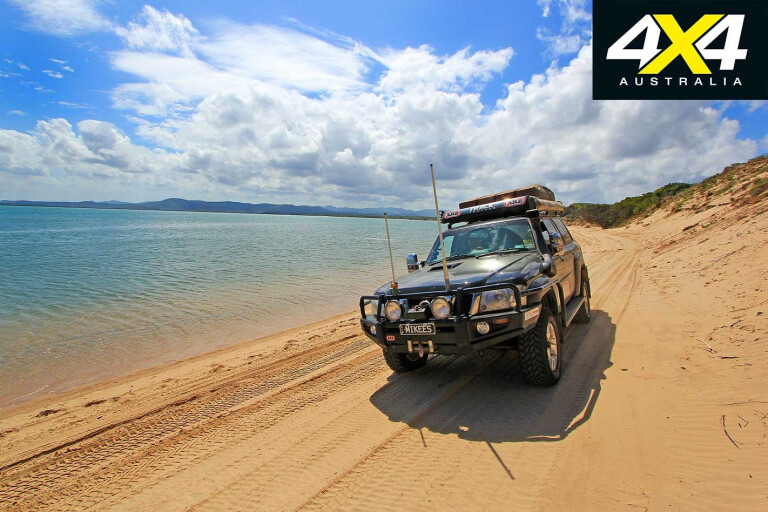
The east coast of Australia is blessed with magnificent 4X4 escapes but there are few better than Queensland’s Byfield National Park.
This article was originally published in 4x4 Australia’s November 2012 issue.
It’s the only 4X4 destination on the Capricorn Coast, yet it still manages to pack massive parabolic sand dunes, rainforests, freshwater lagoons, a sandy coastline and tall-pine plantations into a single family-holiday destination.
Byfield NP is just south of the huge Shoalwater Bay Military Training Area, a strictly off-limits wilderness area and one of the largest tracts of undeveloped land on the Queensland coast.
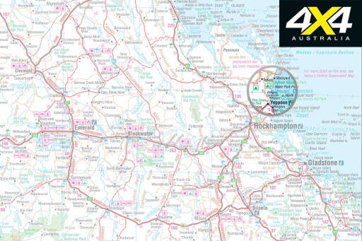
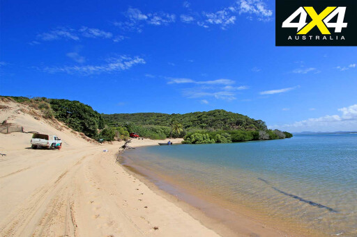 The southern boundary of the park is an easy 30-minute drive north of Yeppoon, or an hour north of Rockhampton. While the more demanding 4X4 tracks are in the park’s north, there are still plenty of interesting areas to explore in the surrounding state forest and further to the south.
From Yeppoon, take the Yeppoon–Byfield Road north along the coast to Farnborough. Ocean beach access is available from Bangalee, stretching north to Sandy Point at the mouth of Corio Bay, where there are views to the opposite peninsula and the northern end of the national park.
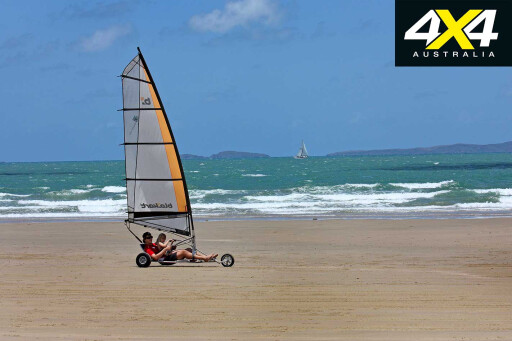
This is a popular, wide and flat stretch of beach that has plenty of visitors coming to fish, swim, bask in the sunshine or ‘blokart’ … yep, that’s like a billy cart with a sail, threatening to pop one of its three wheels off the ground at the first gust of wind, resulting in a momentary loss of directional stability. Look out!
 Once at the tip, you can carve through the soft sand around the point and onto the unsealed Sandy Point Road as an alternative way back to the main road. From Farnborough Road, there are several unsealed minor roads that run east through pastoral properties on their way to the back of Corio Bay. We took the Kellys Landing Road and meandered down to the mouth of Water Park Creek, passing several wetland areas on the way.
Back on Byfield Road, it’s not long before the road enters Byfield State Forest. Once you’re a couple of kilometres inside the forest, take a left turn at Stony Creek Road towards the Upper Stony Creek Recreation Area. This is generally a well-formed road but it’s so riddled with corrugations and potholes that the speed limit is restricted to 40km/h. It is also used for logging so watch out for trucks and set the UHF to scan mode to check for local activity.
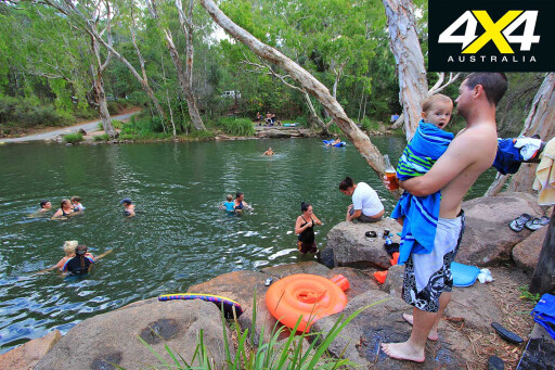 The campground here is set in a tall-timbered area and is next to a picnic area with tables, barbecues, toilets and a freshwater swimming hole. With estuarine crocodiles in Corio Bay, this is the safest swimming hole in the district, despite the freshwater Stonefish or Bullrout that call it home. Queensland Parks and Wildlife Service recommend wearing sandshoes and swimming rather than wading, to avoid making contact with these spikey critters that can dish out a nasty sting.
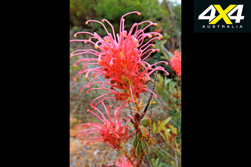
Bushwalks range from 20 minutes to a couple of hours and provide an opportunity to appreciate the flora and fauna. The rare Byfield grevillea is found on the northern side of the picnic area along the Venusta Circuit (20 minutes). Further north, along the Stony Creek Circuit (1.5 hours) the forest is scattered with pockets of grevillea and cycad. Finally, the Caribbean Circuit (2 hours) includes patches of riparian rainforest, grass trees and cycads among mature Caribbean pine and eucalypt forest.
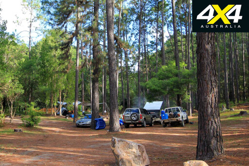
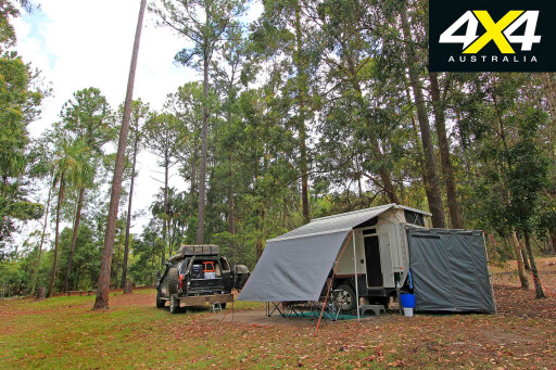
 Backtracking to the Byfield Road junction, turn left and travel 4.8km to the turn-off on the right for the Red Rock camping area, accessed via a rough gravel track. It’s a dog-friendly camping area set among towering pines with wood barbecues, water and flushing toilets. We based ourselves here for the duration of our stay.
A couple of clicks down the road is the Byfield township. As well as the Byfield general store where fuel and compressed air are available, there are a few private accommodation offerings and the Nob Creek Pottery Studio.
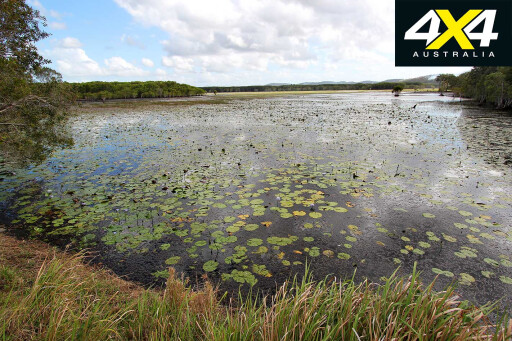
The main access to the northern end of the national park is via Water Park Road found by backtracking to the intersection of the same name. The Water Park Creek campsite is only a few kilometres away and offers toilets, fireplaces, a day-use area and a rainforest walking track. There are estuarine crocodiles in this creek so don’t be tempted to go for a dip.
 Beach access is via Stockyard Point Track, which leads through a canopy of trees to the sandy track within the national park. There’s a tyre-pressure reduction bay before the dune called Big Sandy, which acts as gatekeeper to the beach.
We met a couple of locals there who described the lie of the land and the best strategy for a successful climb. The track is mainly single lane and shrouded in bush which makes for limited visibility as it weaves its way up the extended length of the dune.
![]() Two cutaways, each with a number of holes in alternating wheel tracks, are carved into the dune. The right cutaway is the easiest uphill climb through the deep, dry and soft sand. The caveats are oncoming traffic also using that lane, others bogged part-way up which could see you losing precious momentum, and limited visibility.
Two cutaways, each with a number of holes in alternating wheel tracks, are carved into the dune. The right cutaway is the easiest uphill climb through the deep, dry and soft sand. The caveats are oncoming traffic also using that lane, others bogged part-way up which could see you losing precious momentum, and limited visibility.
Once up Big Sandy, there are several options at track marker seven. Turning left accesses Five Rocks Beach or Death Valley Track. The latter is a one-way track that meanders down the valley on a north-westerly bearing before looping back onto Stockyard Point Track to exit the park.
Five Rocks Beach is named after the five rocks visible out to sea, abutting the Shoalwater Bay Training Area. Vehicles are prohibited north of this point. Proceed straight ahead at track marker seven past the Stockyard Point township to the Five Rocks Camping Area, or you can go via the Stockyard Point headland.
 At the time of writing, there was construction underway to redevelop the headland track, viewing point and nearby walking trails, so check the park alerts before you travel.
The Five Rocks Camping Area is pleasant and sheltered from the beach by trees that screen neighbouring campsites. There are allocated sites, picnic tables, untreated water, some shade, a pit toilet and shower. No fires are permitted so ensure you bring a fuel stove.
There are some good walks from the campground. The first is to Little Five Rocks Beach. This is a pretty, self-guided one-hour-return walk which passes through a wetland area. The second walk continues from the beach and explores the Five Rocks Beach further north for about 900 metres. The walk should only be attempted at low tide with sufficient beach and three to four hours to spare, to return before the tide comes in.
 To access Nine Mile Beach, turn right at track marker seven. The inland tracks are well maintained using woodchips, planks and traction mats on the beach-entry points and other hazardous areas. Once onto the beach at track marker nine, turn right and travel 400 metres to Freshwater Creek. You can park at the mouth of the river and follow the self-guided walk along the creek, stopping for lunch in the shade or to cool off in the creek.
A kilometre up the beach is the Orange Bowl sand blow, coloured by traces of iron oxide. The area was formerly open to vehicles but is now closed due to vehicle accidents and damage to the vegetation. Looking at the steep walls of the sand blow, it is easy to imagine the potential for danger. Follow the walking markers off the beach and climb to the lip of the bowl for panoramic views of the surrounding landscape. It’s a steep climb so take a hat, sunglasses and a bottle of water.
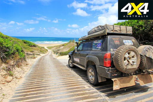 It’s worth noting that while off-road camper-trailers and tinnies on trailers can and do venture to the northern end of the park, it is best suited to high-clearance vehicles and trailers that can safely climb Big Sandy. It only takes one oncoming vehicle to make the climb more interesting, as reversing a trailer in these conditions will be particularly challenging.
Byfield National Park offers a diverse range of landscapes and vegetation. Combined with great fishing and some challenging 4X4 tracks, it can only serve to make a magical destination even better.
Travel Planner
 CAMPING
The state forest and national park are jointly managed. All campgrounds cost $5.30 per person, per night. Bookings can be made online, at the booking office, or by phone. There’s no self-registration and camping permits can only be issued for a maximum of seven consecutive nights.
WHAT TO BRING
Insect repellent, drinking water, fishing gear, binoculars, recovery gear, long-handled shovel, sun protection, fuel stove, firewood, an off-ground fireplace if camping along Nine Mile Beach, as well as compressor and tyre gauge.
SUPPLIES
Rockhampton or Yeppoon. The Byfield Store has general items, takeaway food and fuel.
TRIP STANDARD
Easy to difficult. Four-wheel drive is recommended for the northern end of the national park. Stockyard Point/Five Rocks Beach is considered medium/difficult, Nine Mile Beach is medium, and the state forest roads are generally well formed but are corrugated and potholed in places.
PERMITS & ACCESS
Other than the main roads to the recreation areas, a permit is required to traverse areas of Byfield State Forest. Vehicle access on and off the beach is only by tracks where a 4X4 vehicle symbol is displayed. Penalties apply for using all other vehicle tracks where this symbol is not displayed.

COMMENTS