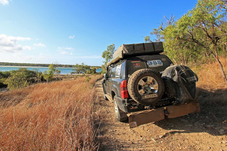
It is a little ironic that the birthplace of Queensland is one of the least developed areas on the state’s coast.
This feature was originally published in 4x4 Australia’s December 2012 issue
Residents of – and visitors to – the town of Seventeen Seventy on Bustard Bay enjoy beautiful beaches and unspoilt wilderness, all without a high-rise in sight. [The town was gazetted in 1936 as ‘Seventeen Seventy’ but is generally referred to as the ‘Town of 1770’.] The region is flanked by pristine national parks to the north and south, providing ideal hideaways for a nature-based family adventure.
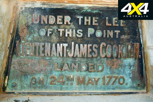 Lieutenant James Cook sailed the HMS Endeavour past the Round Hill Head in May 1770. It is believed that one of his crew shot a large bustard (turkey) on which the crew dined, giving Bustard Bay its name.
Cook’s crew only stayed for a day, but during that time botanist Joseph Banks collected samples of plants said to be common to the north and the south of Queensland, hinting of a subtropical climate. This was Cook’s second landing, but the first in what is now known as Queensland.
Agnes Water, 6km south, is the region’s commercial hub and home to Queensland’s northern-most surf break; there’s even a lifeguard-patrolled area for swimmers. The town works well with Seventeen Seventy; there’s a warm, low-key kind of feel. Services include a supermarket, bakery, visitors information centre, pharmacy, surf shop and a couple of cafés.
Diving into the wilderness, Eurimbula National Park (11,970ha) is accessed from Round Hill Creek Road, 10km out of Agnes Water. Turn into Eurimbula Road, a reasonably wide, gravel surface that cuts through private land before entering the national park.
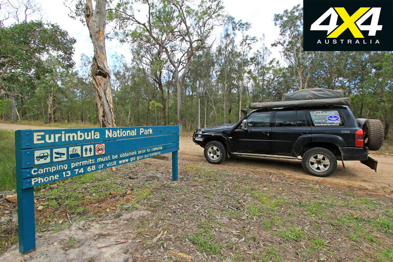
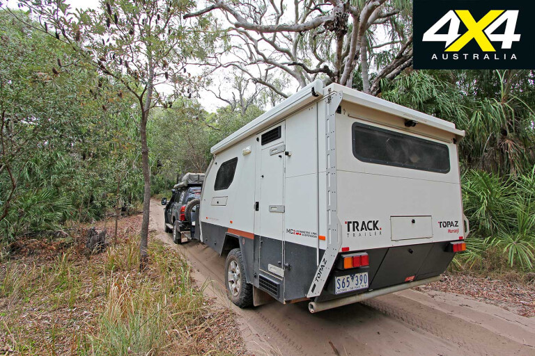
Caravans aren’t recommended within the park and the reason why becomes apparent the further you travel – there are a few tight turns with low clearance that would result in a serious case of bush pinstripes on anything longer and larger than a small camper-trailer.
At the forked track junction, take the right turn that weaves through eucalypts and cabbage palms on its way to Bustard Beach campground, on Eurimbula Creek.
The campground has the park’s best facilities including 17 allocated sites, plenty of shade, compost toilets and a covered eating area with untreated water. The beach is nearby and you can drop a tinnie into the creek or just relax and admire the wildlife.
There are no formal walking tracks in the park, so take a topographical map or GPS if you decide to go walkabout. The vegetation is superb, and includes freshwater paperbark swamps, eucalypt forests and tall rainforest.
Eurimbula Creek is a mud crab sanctuary so it is illegal to use traps of any type. The sandflats are gofisod for flathead, bream and whiting and even queenies and trevally, while a tinnie will help you fish
the upper reaches. As it’s a mud crab sanctuary, it doesn’t see as much action as the other creeks in the area, which can work in your favour.
Backtracking along Bustard Beach Track, you’ll find the carpark for the Ganoonga Noonga Lookout 3km from the main track junction. It’s about a 10-minute climb to the peak via a steep-ish walkway, rewarding walkers with good views in all directions. On a clear day you can see from the Joseph Banks Conservation Park across swamps, heathlands and sand dunes to Rodds Peninsula in the north.
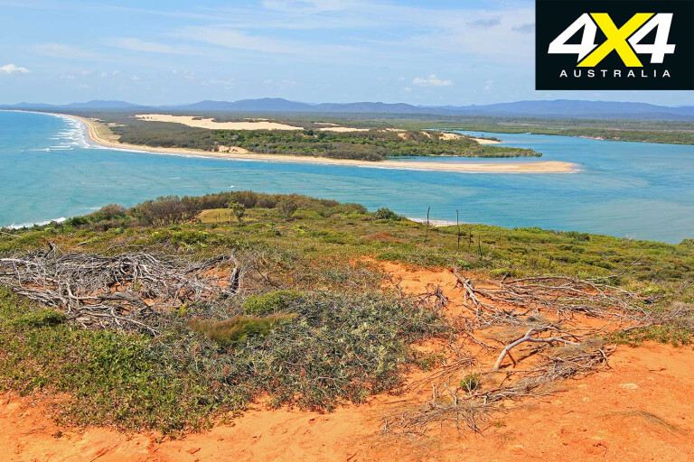
Back in the carpark, return to the main fork in the road and turn right to the 4X4-only Middle Creek campground. The track is subject to seasonal closure and can be closed after rain. There is a constant barrage of spoon drains all the way to the beach and a few creek crossings, but otherwise it is easy-going.
Middle Creek campground is the more isolated of the two, reflected in the facilities, with only a drop toilet. There is no site allocation, so just find a place to prop. As the name suggests, the campground abuts Middle Creek.
Beach-front sites here provide visitors with views across the creek and bay. The camp is a little more exposed than Bustard Beach – meaning more sun for campers – and it suits self-sufficient types, particularly fishermen or wilderness enthusiasts. The boat ramp is sand and rock and best suited to tinnies at anything but low tide.
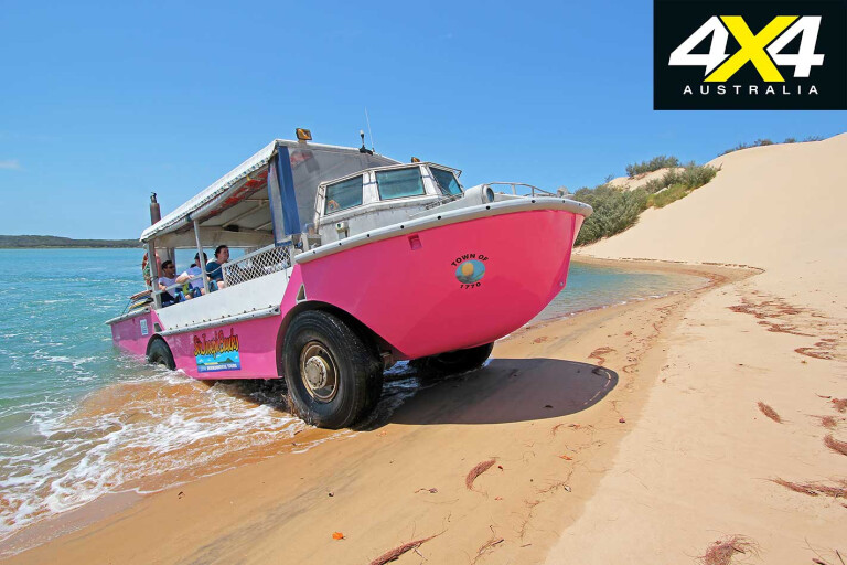
Given the restricted vehicle access to the park and lack of formal walking trails, one of the best ways to explore the geographic boundaries is to join the crew of 1770 Environmental Tours aboard a LARC (Lighter Amphibious Resupply Cargo). You can enjoy a full day, sunset or sandboarding tours, all departing from the marina in Seventeen Seventy.
We jump aboard the Paradise day tour, which starts by driving-diving into Round Hill Creek. The LARC traverses the length of Bustard Bay, crossing four tidal creeks on the way to the lighthouse on Bustard Head.
As we splash through the shallows, stingrays, sharks and other fish dart out of our way. We pass the campgrounds at Bustard Beach and Middle Creek before crossing to Middle Island which is part privately owned, part conservation and part resources reserve, set aside for mining.
Once up the steep track on Bustard Head, enjoy magnificent views back to Seventeen Seventy and across Middle Island. The lighthouse dates back to 1868, when a lightkeeper would light the lamp each evening, to ensure safe passage for passing ships. It was automated in 1986. Lighthouse volunteers still look after the lighthouse reserve.
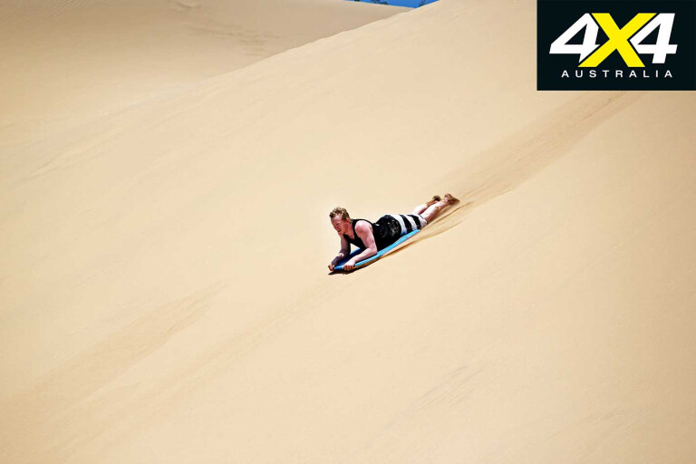
The trip includes a tour of the Bustard Head lightkeeper’s cottage, which has been restored, and a museum within replete with artefacts from the area. The highlight of the afternoon was sandboarding on Middle Island. If you haven’t done this before, it’s pure gold.
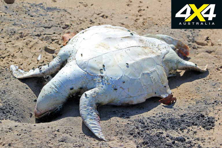
On our return journey to Seventeen Seventy, we spot a dead turtle near the high-water line. The LARC performs a voluntary wildlife rescue and reporting service. Many turtles die each year as a result of ingesting plastic bags, having mistaken them for jellyfish. GPS co-ordinates are provided to the authorities for any dead turtles found, before a burial in the sand.
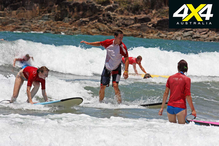
There are snorkelling tours of the Barrier Reef outer coral cays including glass-bottom and semi-submersible boats, starting from $180 per adult. For something a little kinder on the wallet, check out the Reef 2 Beach Surf School in Agnes Water. Meet up at the local surf shop, drop $17 on the counter and you’re in for an entertaining morning of fun.
The other main Discovery Coast wilderness area, in Deepwater National Park, is a short drive south of Agnes Water. Follow Springs Road out of town for about 4km until you see the sign pointing right to the national park. The track gives way to a single lane of deep, soft sand, so drop your tyre pressures as soon as possible, to avoid blocking the track.
Deepwater National Park (4730ha) gets its name from the undisturbed coastal freshwater stream that runs through the park; one of only a handful in Queensland. Sand dunes along the beach shield campgrounds. Vegetation includes lush cabbage palm groves and wetland vegetation around the creeks.
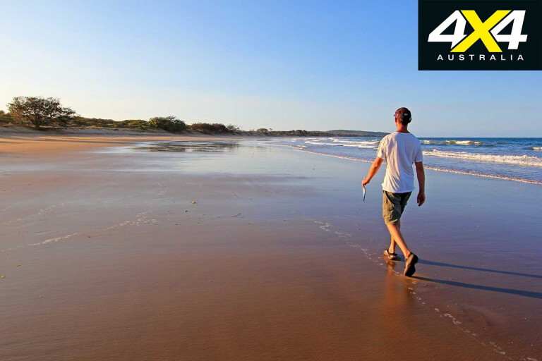
There are three visitor areas. Flat Rock is day-use-only with no facilities; Middle Rock offers bush-camping-only with no allocated sites or facilities; and Wreck Rock has 14 allocated camping sites, compost toilets, a cold outdoor shower, picnic tables, rainwater and bore water. The sites have a sandy base and most get some shade.
There are no formal walking tracks or vehicle tracks other than the main 4X4 access track through the park. There is no authorised access to the beach, although you may see the quad-bike tracks of turtle volunteers. As such, the park is best for those seeking a remote escape among natural surroundings.
Turtles visit each year to nest in the sand from November to March, as they do at Mon Repos further south. They hatch six to eight weeks later. During the egg-laying period, volunteers patrol the beach at night waiting for turtles to appear. Rangers tag turtles, record turtle measurements and assist in relocating eggs above the high-water line if necessary, but otherwise interfere as little as possible.
Their objective is to improve on estimations that only one in 1000 turtle hatchlings will survive to reach reproductive age. If you want to witness the turtle egg-laying and hatching experience, do it at Mon Repos Conservation Park, north of Bundaberg, where the Department of Environment and Resource Management runs nightly turtle tours during the season.
All beaches within Discovery Coast national parks are unpatrolled, so take care in the water. Stonefish are common in creeks, and sharks and/or rips are a danger. Marine stingers are around between October and May.
Research by the QPWS shows that locals – and those from Bundaberg and Gladstone – are the most common visitors to this region’s wilderness camping areas. The Discovery Coast is one of Queensland’s best-kept secrets; it’s one of those few special places where development hasn’t quite caught on yet and that is a beautiful thing. Enjoy it before the word gets out.
Travel Planner
WHERE
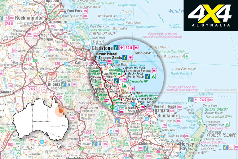
The town of Agnes Water, on the Discovery Coast, is about 120km north of Bundaberg and 480km north of Brisbane.
CAMPING
Deepwater and Eurimbula national parks; Broadwater and Mouth of Baffle Creek conservation parks. Fees are $5.30 per person, per night.
Children under five camp free. A family rebate is offered for families of up to two adults and six children with a flat rate of $21.30 per night. You must select the family rebate checkbox if booking online. Campsites must be booked in advance and there is no self-registration. No fires or generators.
WHAT TO BRING
Insect repellent, drinking water, fishing gear, boogie/surf boards, binoculars, walking shoes, protective waterproof shoes for fishing in the creeks (stonefish) and a fuel stove.
SUPPLIES
Agnes Water, Miriam Vale, Euleilah and Bundaberg.
MAPS AND GUIDES
QPWS Deepwater & Eurimbula National Parks Brochure – available from the information centres or at the campgrounds.
CONTACTS AND INFORMATION
Agnes Water Visitors Information Centre, call 07 4902 1533.
Queensland Parks and Wildlife Service, call 13 74 68. Visit http://tackleworldbundy.com.au/ for angling info.
LARC tours, call 07 4974 9422, or visit www.1770larctours.com.au.
Lady Musgrave Cruises, call 1800 63 1770 or see www.lmcruises.com.au.
Mon Repos Turtle Experience, call 07 4153 8888

COMMENTS