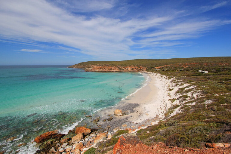
Meandering down Pableup Drive on the western side of Fitzgerald River National Park, you can’t help but feel a buzz of excitement as your eyes follow the corrugated road into the distance, flanked by a sea of green in every direction.
This article was originally published in 4x4 Australia's August 2011 issue.
While not exactly remote by normal standards, the area is sufficiently far away and rough enough to deter the grey nomads, backpacker vans and the general tourist trade, leaving you to appreciate the tranquillity of the surrounding landscape in relative isolation.
 Fitzgerald River NP is roughly midway between Albany and Esperance on the south central coast of Western Australia. Beyond Western Australia’s trademark white sandy beaches and turquoise waters, the park is one of the largest and most botanically significant national parks in Australia.
Over 1800 plant species have been identified, 75 of which cannot be found elsewhere. More species of animals live in this park that any other reserve in south-western Australia. From June to November, southern right and humpback whales shelter close to shore with their newborn calves. September to November is the wildflower season, with hundreds of species coming to bloom. Add to that ocean beach access, good four-wheel drive tracks, and interesting bushwalks and it’s not a bad place to park the camper for a few days or more.
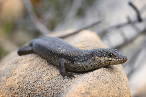 With its abundance of natural splendour, the park is recognised as a Biosphere Reserve, the only one in WA, where ongoing studies evaluate environmental change. Public interest groups such as the Friends of the Fitzgerald River National Park work with land-owners and government agencies to manage the area and minimise potential impacts.
The main points of entry into the park are from Hopetoun, Bremer Bay or off the South Coast Highway between Ravensthorpe and Jerramungup. The eastern side is more attractive offering a scenic drive, varied landscape and plentiful beaches.
It runs along Hamersley Drive, starting from the South Coast Highway, 41km west of Ravensthorpe, and winds its way to East Mt Barren where the eastern ranger is located. It affords excellent views into the heart of the park and access to a string of beaches including Four Mile, Barrens, East Mylies, Mylies and West Beach, which are also accessible from Hopetoun.
 Back on the scenic drive, a four-wheel drive track junction at the 36km mark leads to Quoin Head and Hamersley Inlet camps. A few kilometres in, a track junction separates the two camps but they eventually rejoin as they parallel Whale Bone Beach. Another four-wheel drive track runs off Hamersley Drive heading north out of the park and into Ravensthorpe.
We ventured into the park from Jerramungup, on the western side, via the South Coast Highway and Quiss Road, which borders private property, before diving headlong into the park. An information hut with photos, brochures and general park information is located not far from the highway, providing a convenient location to reduce tyre pressures and scope out road conditions. Quiss Road leads onto Pableup Drive once inside the national park. It is well formed and reasonably wide, but littered with corrugations that deteriorate the further you move off the main thoroughfare. In addition, varying levels of fine surface gravel create an extra hazard to negotiate.
Large on-road vans and motorhomes are not permitted in the park due to the road conditions and the small campsites with limited space to manoeuvre. Any small off-road van with the footprint of a camper trailer would be okay. (As a guide, our 16ft Track Topaz was about the limit.)
It was a magical experience weaving along the dusty tracks without another vehicle in sight and being surrounded by vegetated plains extending to the distant mountains.

A further 20km takes you to the turn-off to Fitzgerald Inlet, near Point Charles. This track lives up to its 4X4-only status with plenty of lumps and bumps, rock steps and soft sand to provide an entertaining drive. The route carves across the bumpy coastal heathland tracks and through pretty woodlands, before tracing the perimeter of the inlet. The campsite is shrouded in tea tree that offers shelter from the wind and sun in the warmer months. The facilities are impressive for such a remote location; gas barbecues, picnic tables and a long-drop toilet. We found the clearances a little tight for the Patrol, with foliage screeching against the paintwork at a number of spots. The camp is best suited to tent-based accommodation or small camper trailers.
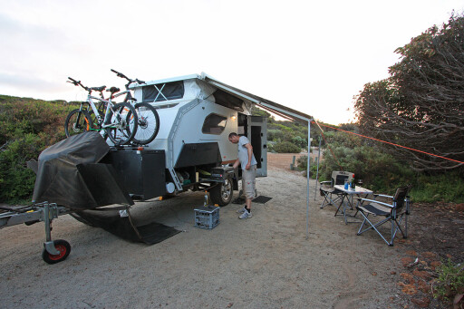 The track continues to the inlet through soft sand with a firm base. There are a few big roots over the track framing nasty holes which could make it a little tricky for low-clearance vehicles, but otherwise the track condition was okay. As you approach the inlet, the track is almost swallowed in a cocoon of tea tree. Our ARB rooftop tent copped a few touches on the way, as did the brush bars, pushing the leafy scrub aside as we gingerly edged through.
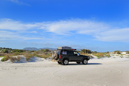
Like many of the inlets along the south coast of Western Australia, Fitzgerald is closed to the sea. Instead, a wide expanse of bare white sand stretches across where water once lapped. Our VMS navigation system warned of quicksand near the track’s exit so we didn’t explore too far from the edge. According to the ranger, it’s okay most of the time…
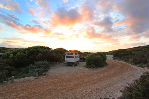 A few big dunes on the far side of the inlet mouth looked good for some dune surfing, but you would need surplus amounts of energy to walk there first, let alone climb the dunes countless times. The track weaves its way onto the beach, with fresh wheel tracks indicating an isolated fishing spot wasn’t too far away.
Retracing our steps, the return journey provided a number of vantage points to photograph the wide expanse of white sand in Fitzgerald Inlet or duck through the tree line and wander out for a closer inspection.
Back on Pableup Drive, another 4km south takes you to the track junction towards Point Ann and the St Mary Inlet campsite, 15km from the main road. The campground is a short distance from the inlet with tree cover providing protection from the sea breeze. Like Fitzgerald, St Mary Inlet is closed to the sea and is none too appealing; the skeleton-like rocks partly submerged in the diminishing water supply. Without the cleansing flush of the tidal surges, the water soon loses its vibrancy, increases the salinity of the water and leaves its inhabitants little option but to adapt or die.
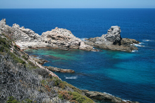 The campsite features drop toilets, gas barbecues and a few picnic tables. Beach access is available from the camp with a boat launching facility at Point Ann for craft under 3m, but only for use outside the whale migration season. Point Ann has viewing platforms from which it’s easy to spot southern right and humpback whales or just enjoy the panoramic views. The Point Ann Heritage Trail (1.2km) provides an opportunity to discover a snippet of the area’s history, including remnants of the Rabbit Proof Fence, with information boards en route.
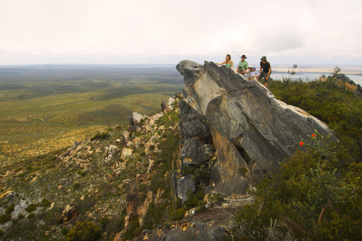
There are a number of other walks throughout the park that range from 1-4hrs and include; West Mt Barren (1-2hrs); Twertup Horrie Dorrie (1-2hrs); East Mt Barren (3hrs); West Beach Point (1hr). The Point Charles Beach Walk is for the fit, at 11km, but a number of shorter walks emanate from the Twertup site.
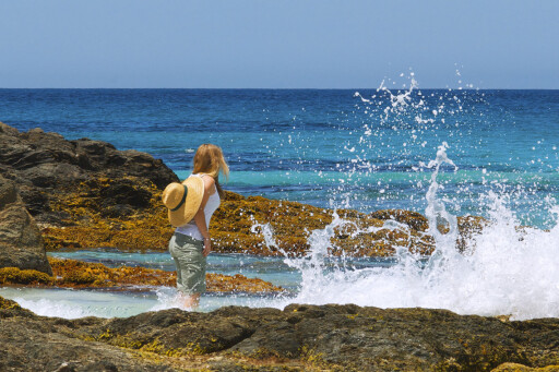
Beach access through soft sand from the campsite runs past St Mary Inlet and up to Point Charles. Beach fishing is popular with herring, salmon and sand whiting frequently succumbing to the temptation of tasty bait. Swimming is also popular, however as idyllic as the turquoise water appears, strong rips and undercurrents are often present, so take care.
 There are a number of privately run accommodation options outside the southern perimeter of the park including Quaalup Homestead, the Gordon Inlet camping area and House Beach camping area. All are accessed by unsealed roads which can be closed after rain. These backroads lead into Bremer Bay, across the dry mouth of the inlet – yep, another one.
With so much on offer, a touring holiday along Western Australia’s south coast is hard to beat, particularly so the Fitzgerald River NP. With its natural beauty, remote wilderness location, rugged cliffs and diverse flora and fauna encounters it will long be remembered as one of our southern highlights of the West Australian coastline.
ADVISORY - DIEBACK
In addition to bushfires, dieback is a serious threat to the parks of Western Australia and the four-wheel tracks that carve through them. Dieback is a plant disease prevalent in the parks along the south coast. The climate favours the spread of the disease, thriving as it does in warm moist soil that can then be easily spread in minute debris that adheres to tyres or walkers’ footwear.
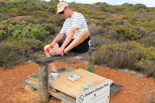 For that reason, it is imperative to clean footwear and vehicle tyres before entering these parks to prevent the spread of the disease. The Point Ann Heritage Trail includes a dieback footwear cleaning station for visitors to use before embarking on the route. Areas affected by dieback are often burnt as a cleansing exercise, which also closes any four-wheel drive tracks in the vicinity. With track closures on the rise, do your bit by obeying any cleaning instructions before entering the parks of the south coast or any areas affected by dieback.
TRAVEL PLANNER
 WHERE
WHERE
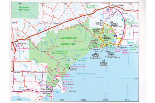
Fitzgerald River National Park is located on the central south coast of Western Australia, between Bremer Bay and Hopetoun, 420km south-east of Perth.
CAMPING
4X4 access: Fitzgerald Inlet, Quoin Head.
Conventional access: Four Mile Beach, Hamersley Inlet and St Mary Inlet.
Long-drop toilets and gas barbecues at all sites. Some picnic tables. No fires or big vans. Generators permitted.
WHAT TO TAKE
Insect repellent, drinking water, fishing gear, binoculars, standard recovery gear, compressor and tyre gauge.
SUPPLIES
Bremer Bay, Ravensthorpe, Hopetoun and Jerramungup can supply fuel and other requirements.
TRIP STANDARD
Easy to medium. The four-wheel drive tracks lead down to soft sandy beaches and require reduced tyre pressures.
MAPS & GUIDES
Hema’s, Goldfields, Esperance & the Southern Coast of WA, 1:750,000.
CONTACT INFORMATION
Department of Environment & Conservation (DEC) 08 9842 4500, website: dec.wa.gov.au.
Rangers: East, 08 9838 3060; West, 08 9837 1022 – check for road and track closures.
Friends of the Fitzgerald River National Park, website: fitzgeraldfriends.org.au/.

COMMENTS