Explore SA
Gallery189
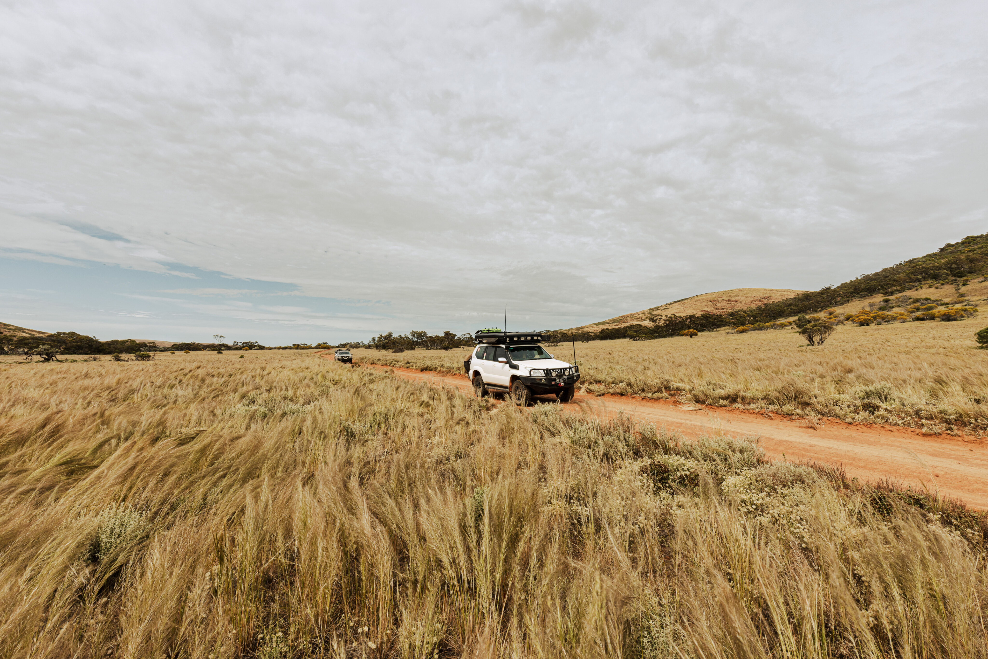
Some of Australia's most stunning 4x4 destinations are located within the state of South Australia. Here are five sensational SA experiences for the adventurous four-wheeler 👇
JUMP AHEAD
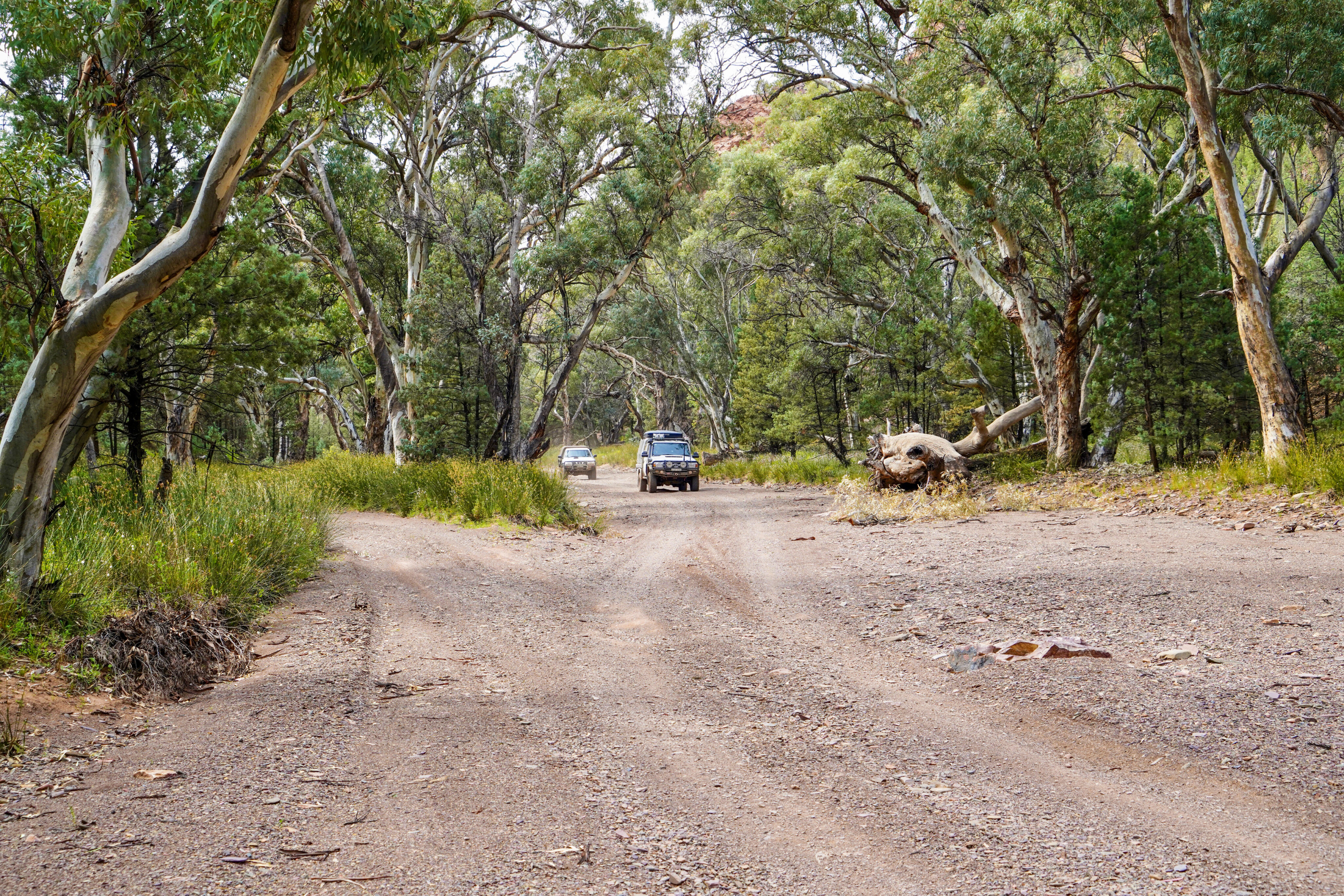
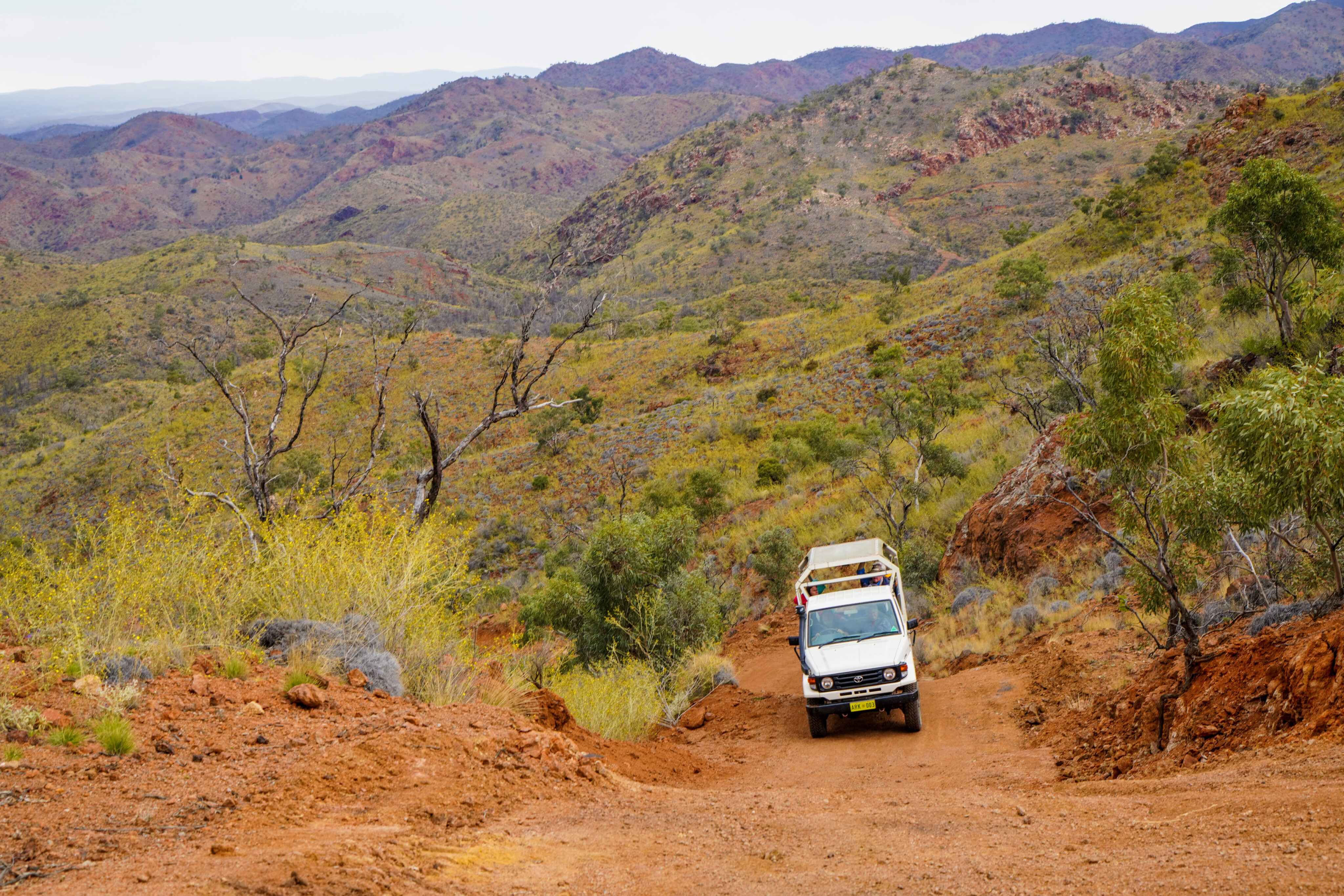
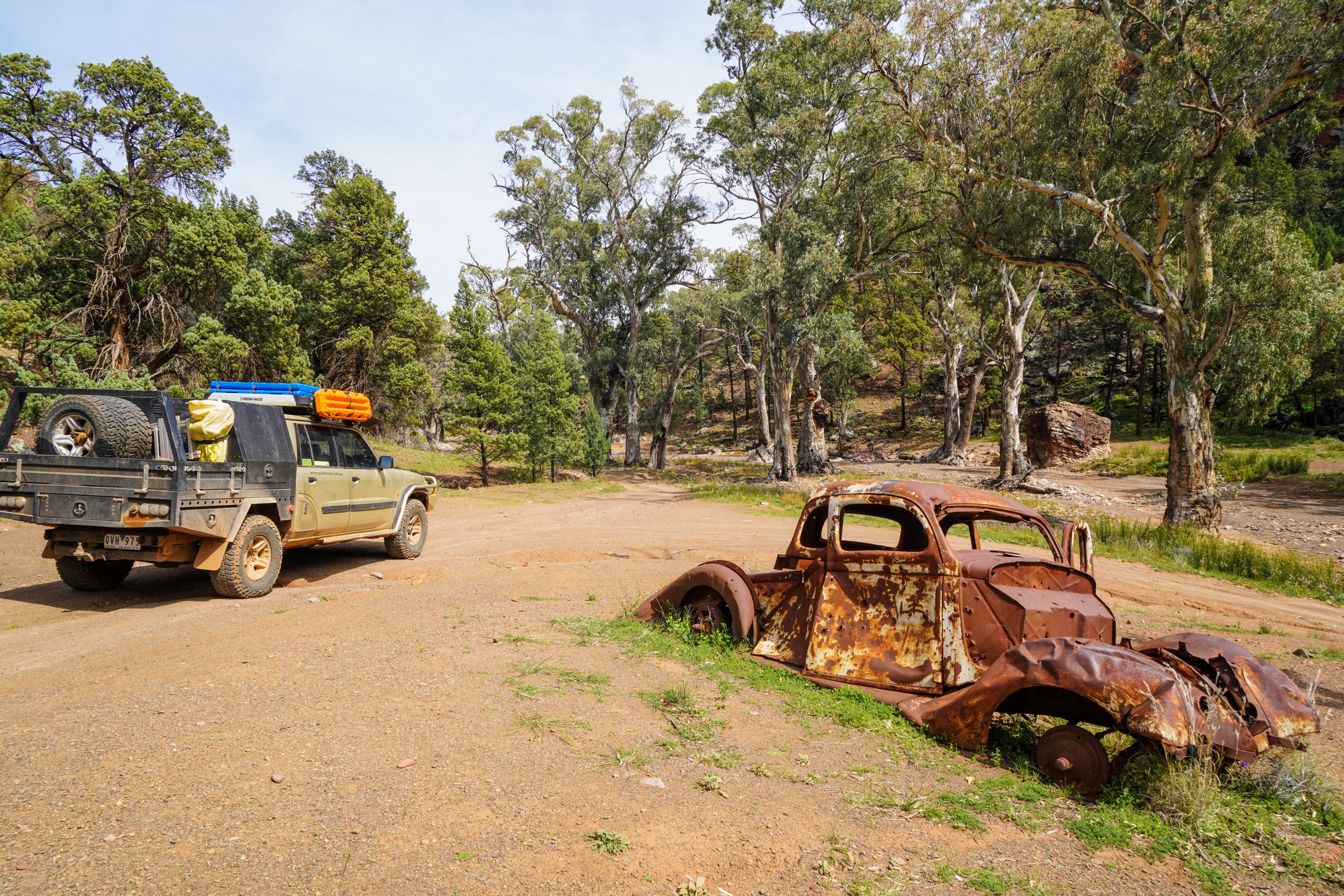
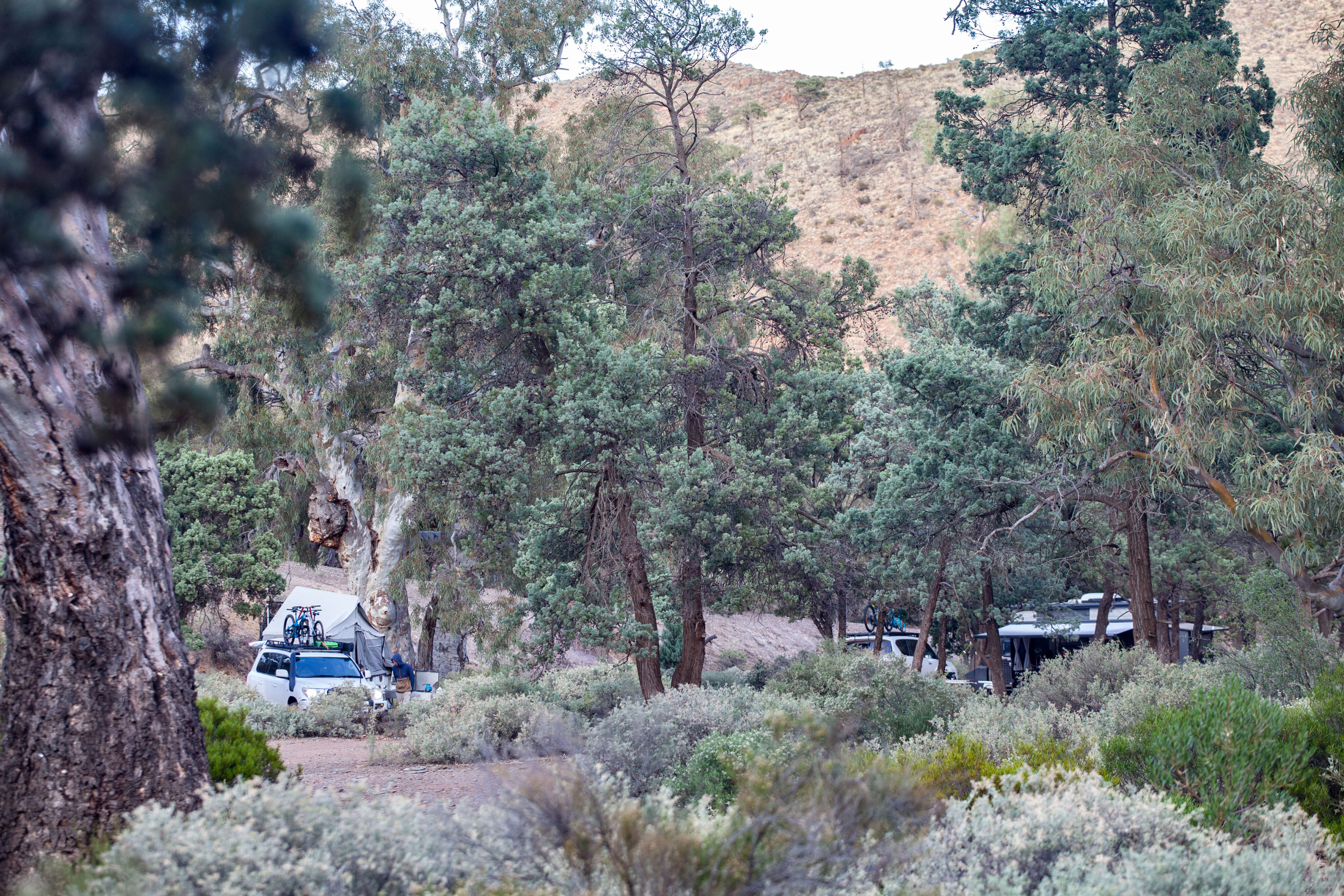
Flinders Ranges
Ron Moon
A 4x4 tour through the spectacular Flinders Ranges offers a rich tapestry of modern and ancient history
A Flinders Ranges adventure can begin from the north, as you turn off the Strzelecki Track and cross the low, rocky plains at the northern fringes of the range. Mt Hopeless, the northernmost point of the Flinders, will barely be visible among the gibber-strewn hills.
Heading south, the ranges grow closer and more rugged near Balcanoona Homestead, now the headquarters of Gammon Ranges National Park. From here, you can continue to Arkaroola Wilderness Sanctuary, nestled in rugged mountains north of the national park.
189
One of Arkaroola’s highlights is the Ridgetop Tour. Driving through expansive, craggy terrain, including the Mawson Plateau and Freeling Heights, you’ll arrive at Sillers Lookout.
From here, sweeping views include Mt Painter Creek’s radioactive source, East Painter Gorge, and the distant flat plains with the glistening Lake Frome.
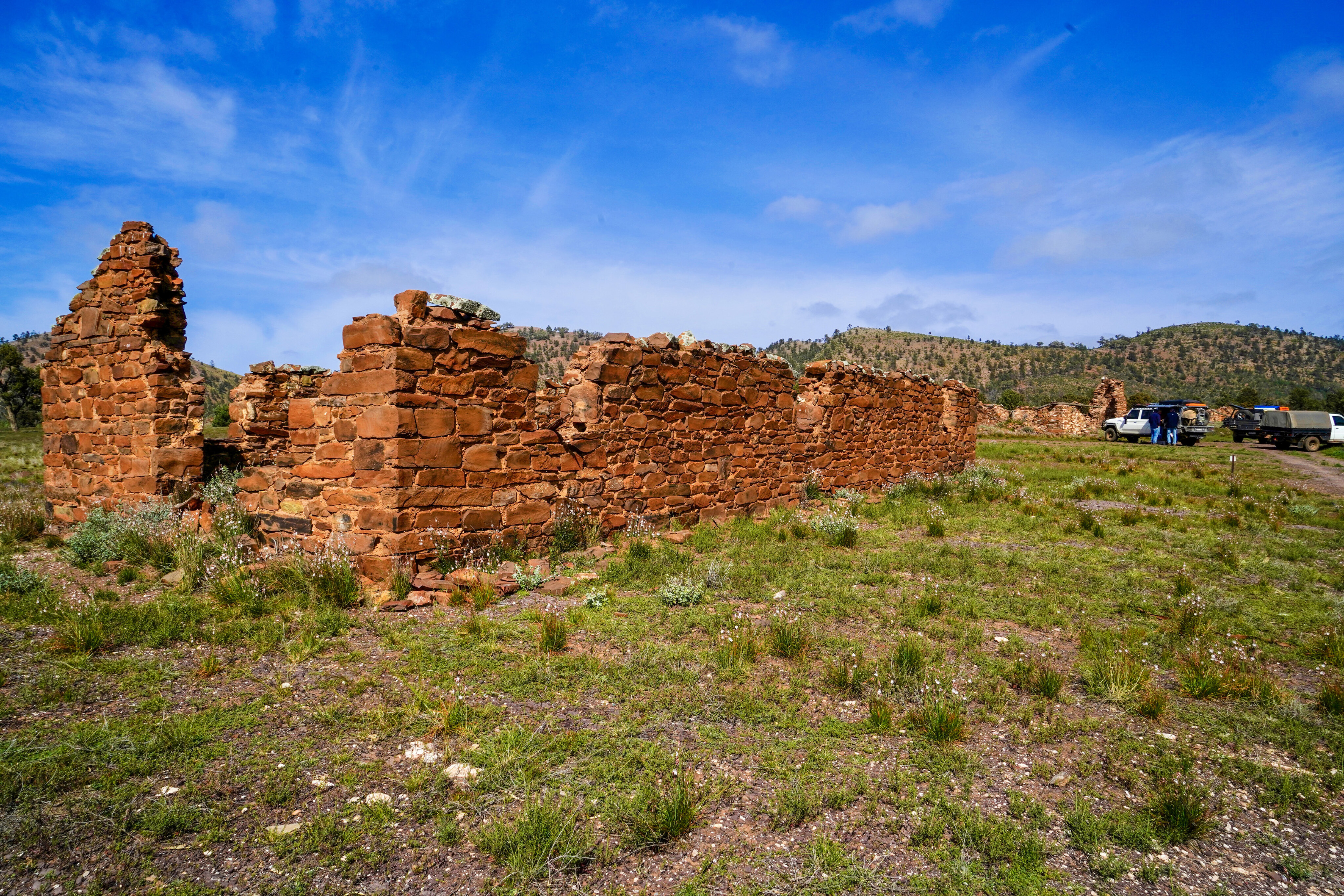
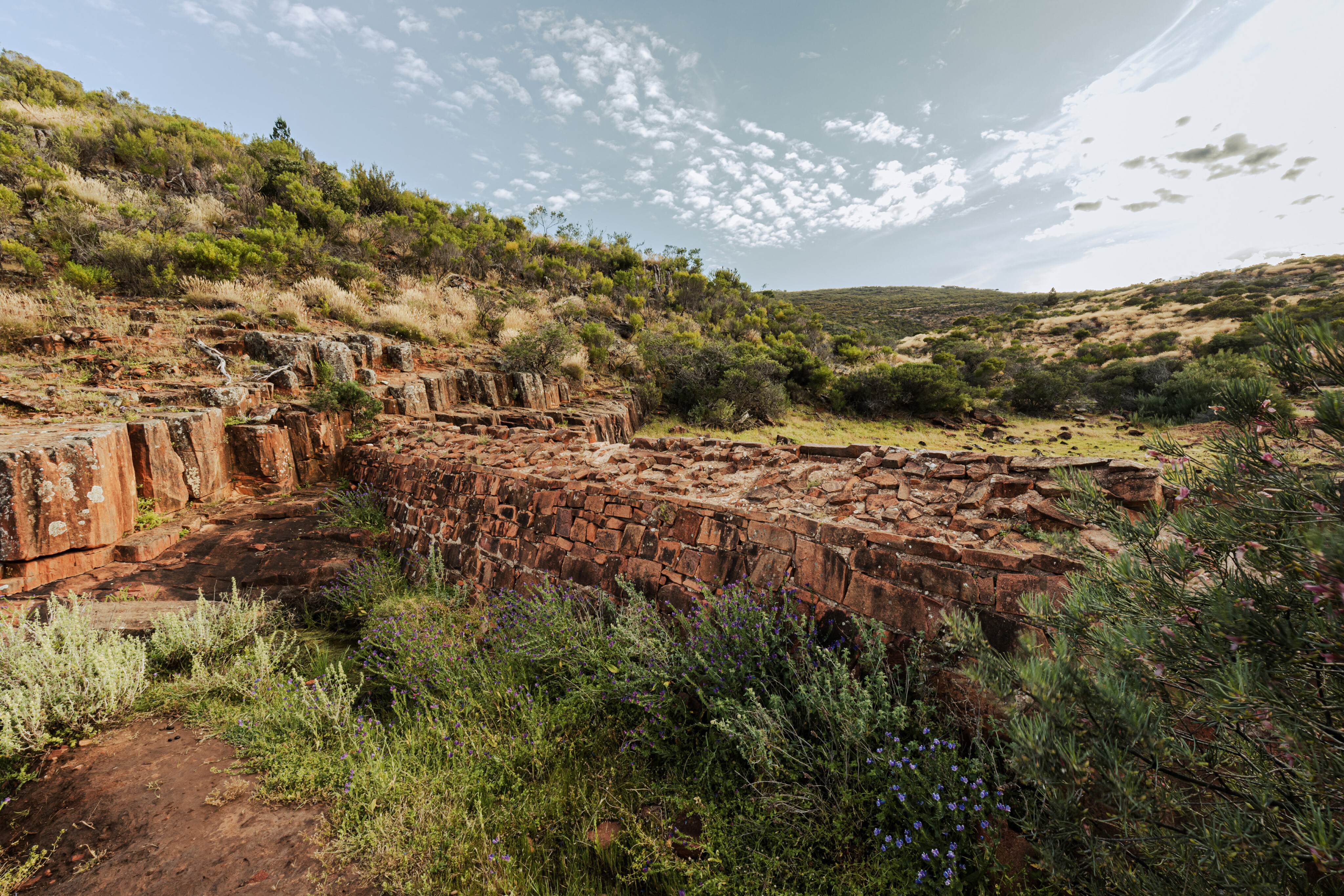
Spend a few nights at Arkaroola and then head south, taking a lesser track into Mount Chambers Gorge. Here, splash through shallow creek crossings and stop at a bluff overlooking the creek bed. A short walk up a narrow feeder creek leads to what is considered the best Aboriginal rock art site open to the public in the Flinders Ranges. The petroglyphs, pre-dating painted art, feature hundreds of designs and provide a glimpse into a once vibrant society.
189
Returning to the main road, continue to Blinman and camp near the creek. There’s also a pub offering camping and accommodation, a nearby cafe, and the Blinman Underground Mine Tour experience, which is a tour of the old mine workings, and well worth doing.
Next on the agenda, explore the Public Access Route, a unique South Australian arrangement allowing access through pastoral properties to points of interest including the historic Artimore ruins. Artimore sheep station, once prosperous, lies in a secluded valley dominated by Patawarta Hill, famously depicted in Hans Heysen’s 1929 painting The Land of the Oratunga, displayed at the Art Gallery of South Australia.
The track to Artimore is usually in reasonable condition but can be challenging after rain, with small but sharp run-off gullies and steep, eroded creek banks. The drive is worth it for soaking in the history and views of Patawarta Hill. Unfortunately, invasive native cypress pine is overtaking the region, depriving it of its former open valleys.
189
From the ruins, continue through picturesque country, zig-zagging through Hannigan Gap and passing south of Moolooloo Hill before reaching the Glass Gorge Road. Then head south through Flinders Ranges National Park.
Spectacular drives through Bunyeroo and Brachina Gorges remain breathtaking, and once back on the blacktop, you can visit the impressive grave of Douglas Bruce, who died in 1873 when his horse fell on him. His friends erected a grand tomb near Wonoka Creek, once a busier area than today. Nearby are other graves re-interred in Adelaide when the town of Wonoka was abandoned.
Further along Wonoka Creek lies the site of Hookina, a small town established in the late 1850s on the route between Blinman’s copper mines and Port Augusta. By 1862, it had a blacksmith shop and a 12-room inn. The town declined when the railway bypassed it in 1896, leading to Wonoka’s rise. Nearby are more lonely graves.
189
From Wonoka, head west to skirt the range’s edge or south on Bobby Creek Road, passing deserted homesteads like Wild Dog Glen, which begs for further exploration.
The route south crosses Kanyaka Creek and leads to the ruins of Simmonston, another failed venture of the 1870s, established for the railway that ultimately passed eastward. Nearby, Hugh Proby’s grave marks the spot where he died while mustering cattle in a flooded creek. Proby’s expansive Kanyaka run, which once covered 94,500ha and employed over 70 families, is worth visiting.
After paying respects to Proby, continue south and the dirt road improves as you near Warren Gorge. This favourite spot, popular with tourists, has been enhanced with fences, a camping fee, and added amenities, but the grandeur of the rugged red bluffs and occasional yellow-footed rock wallabies at dawn or dusk remain unmatched.
Nearby private properties offer 4x4 trails through spectacular country, including Mount Arden, named by Matthew Flinders in 1802.
189
Back to top ⬆️
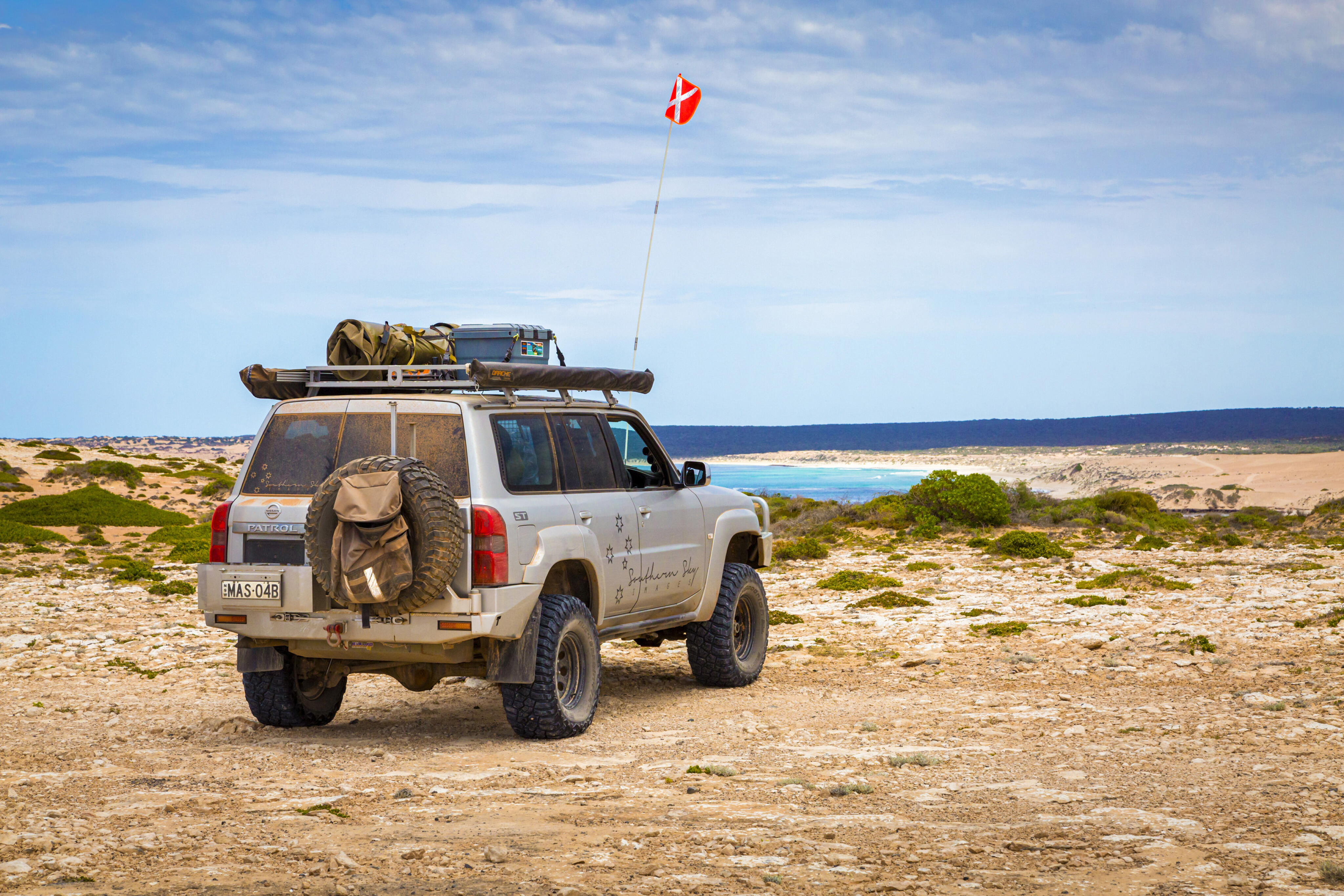
Gawler Ranges
Glenn Marshall
Gawler Ranges National Park is packed with spectacular sites
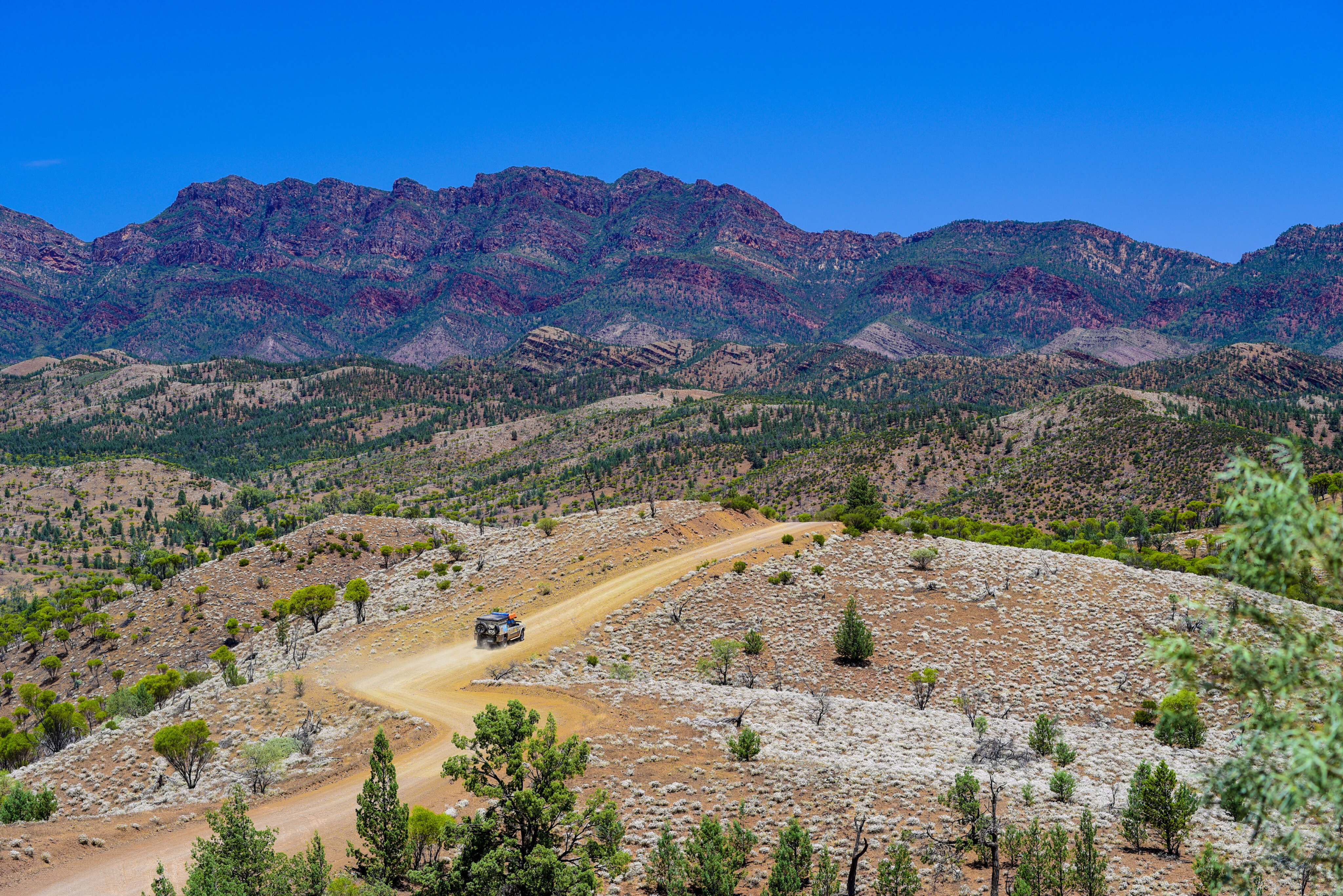
Gawler Ranges National Park is located 40km north of the Eyre Highway, accessible from Iron Knob, Kimba, Wudinna or Minnipa. The cooler months from April to September are the best times to visit, but access can be restricted after rain.
A vehicle entry pass is required, costing $13.50 per vehicle per day, and camping fees are $21.60 per night. All fees must be paid online before entering. Essential items to bring include an air compressor, tyre gauge, tyre repair kit, first aid kit, firewood, food and water. A 4x4 is recommended to fully explore the park, although the roads are generally well-maintained.
189
The trip can begin at Kingoonya, a remote one-pub town. The caravan park here is charming and well-managed, perfect for refuelling before or after tackling Googs Track.
The Kingoonya Hotel is a welcoming spot with friendly owners, locals and fellow travellers. The beer is cold, and the food is excellent. It’s also an ideal starting point for exploring Lake Gairdner and the Gawler Ranges.
Heading south along Gawler Ranges Road, and after crossing a few dunes, will reach Skull Camp Tanks Road, where you can check out the old wells at the junction before continuing along the side road. Skull Camp Tanks Road is smooth and comfortable, reminiscent of a bitumen road.
189
Within 90 minutes or so you’ll reach Waltumba Campground beside Lake Gairdner, where a drive to the end of the track and a hike up a nearby hill will lead to spectacular views over the lake.
Continuing south on Skull Camp Tanks Road will lead to the Pondanna Ruins, where there are remnants of a shearing shed, quarters and cookhouse from around 1880. The harshness of life in this remote area is evident. Following Hiltaba Road towards the Gawler Ranges, the flat plains give way to hills. Turning southwest will lead past the homestead and enter Gawler Ranges National Park, where you can settle at Yandinga Campground.
Within the park, venture to the Organ Pipes, famous for their rhyolite columns formed over 1.5 billion years ago from volcanic eruptions. The easy 1.4km walk from the carpark provides a chance to see these geological wonders, with an optional climb for panoramic views. Yandinga Falls also offers several walking trail options along the watercourse at the right time of year.
189
Peterby Rockhole is an important Indigenous site for hunting kangaroos and euros. Nearby Stone Dam, a relic of early 1900s European water-trapping techniques, provides some historical context.
Old Paney Homestead, built in the 1870s by William Crawford, is also a fascinating visit. Once prosperous, it fell into decline due to drought, low wool prices, and other hardships, and Crawford abandoned it by the 1900s. Exploring the site and its informative boards offers insights into pastoral life and its challenges.
Continuing along the Old Paney Scenic Route, divert onto Mattera Track to see Mattera Campground and the steep, unmarked route to Mattera Bluff. The bluff offers extensive views across the ranges.
189
The easier base walk is popular with bird watchers. The dispersed campsites at Mattera are flat, with fire pits and a clean drop toilet.
Mattera Track ends at the LP Track junction. Turn right and cross the plains before climbing over the range near Kolay Mirica Falls. The Kolay waterhole is hard to spot, and Mirica Falls is spectacular when flowing well. Nearby shelter can be had at Mt Ive Station, a comfortable refuge with accommodation options and a bar.
Gawler Ranges National Park offers a great experience, especially with running creeks and flowing falls. An excellent time to explore is after rainfall, and it’s a visit you won’t regret.
189
Back to top ⬆️
Bendleby Station
Robert Norman
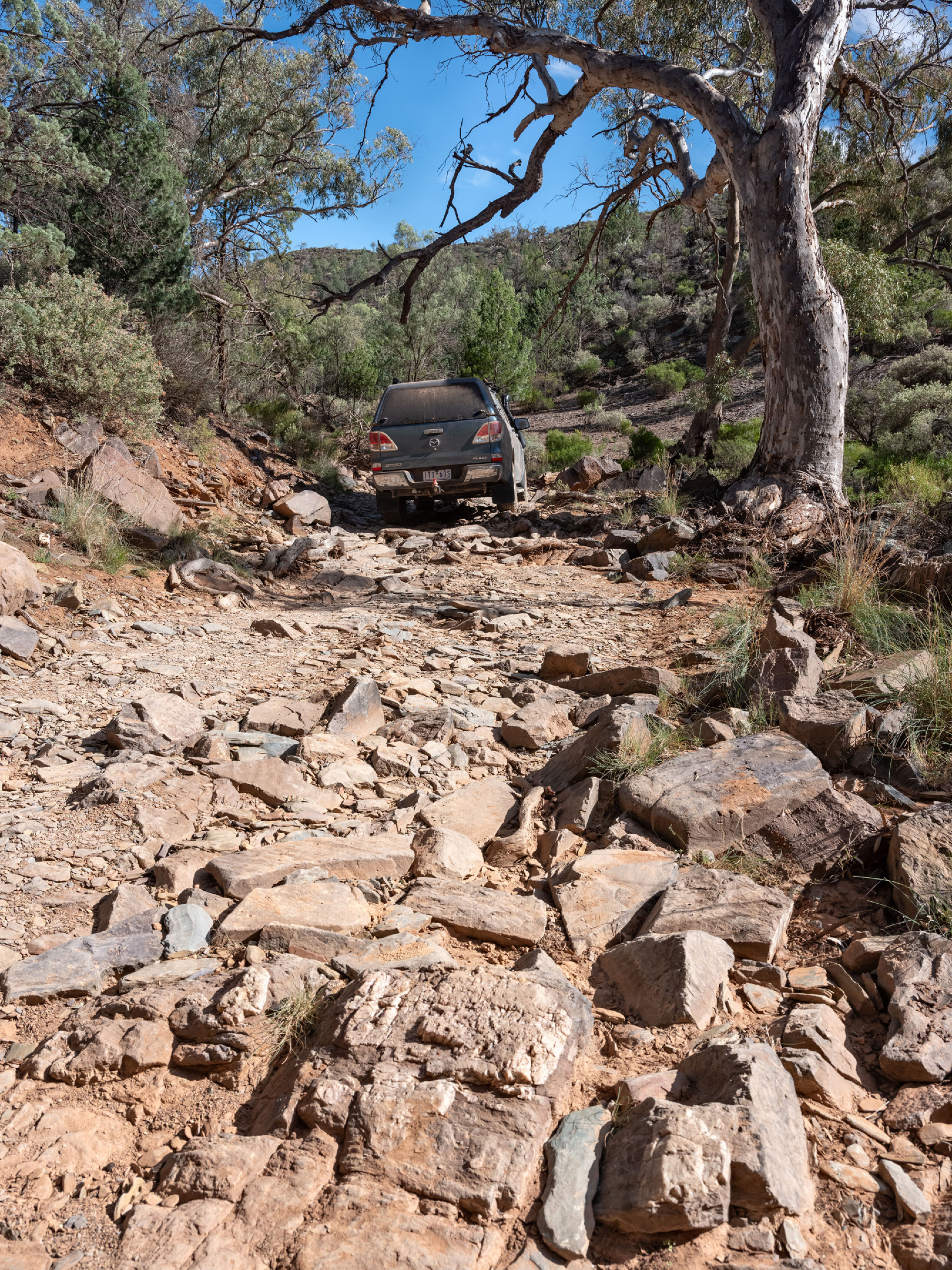
Bendleby Station is a must-visit destination for anyone keen on polishing their off-road driving skills
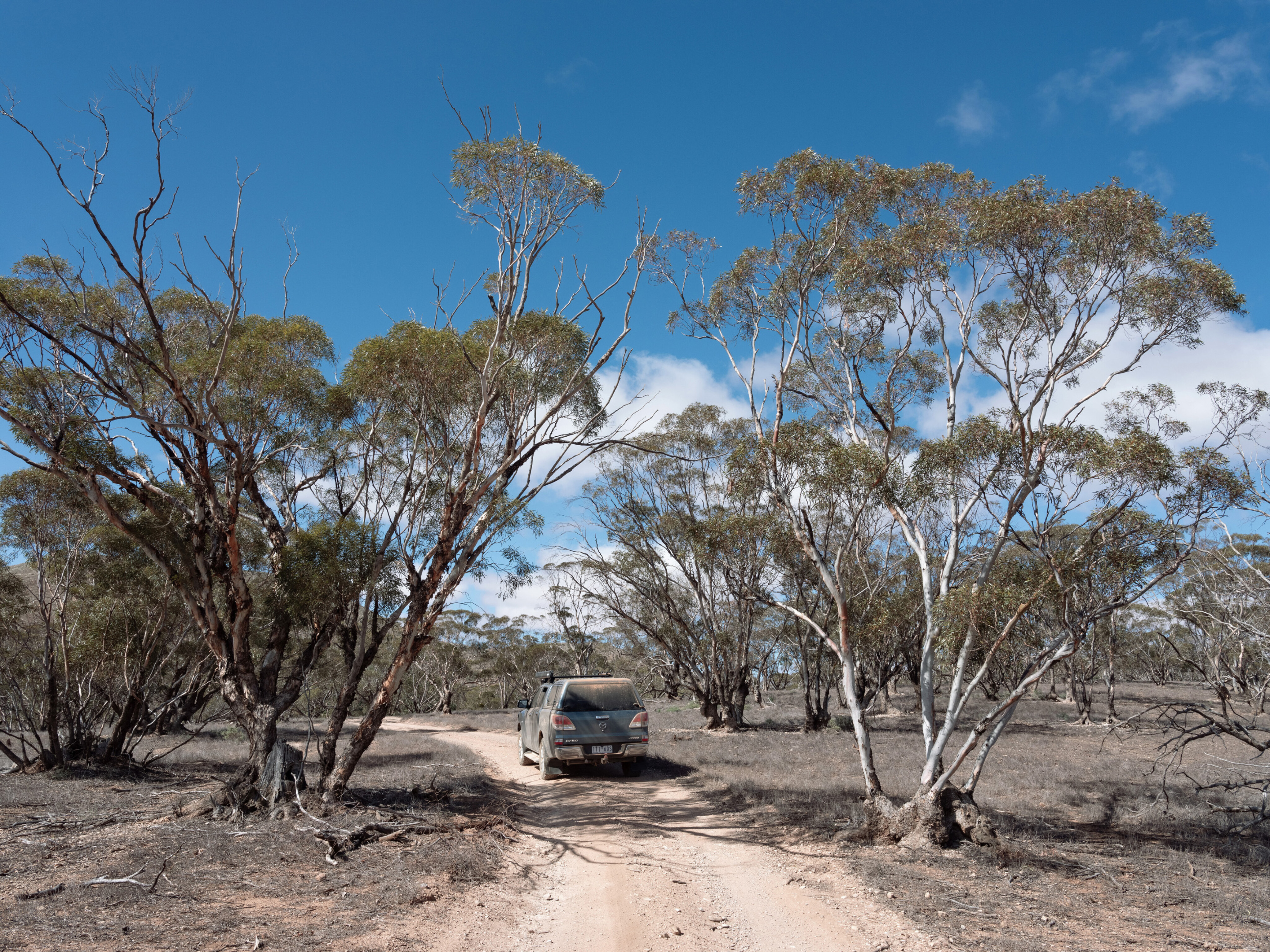
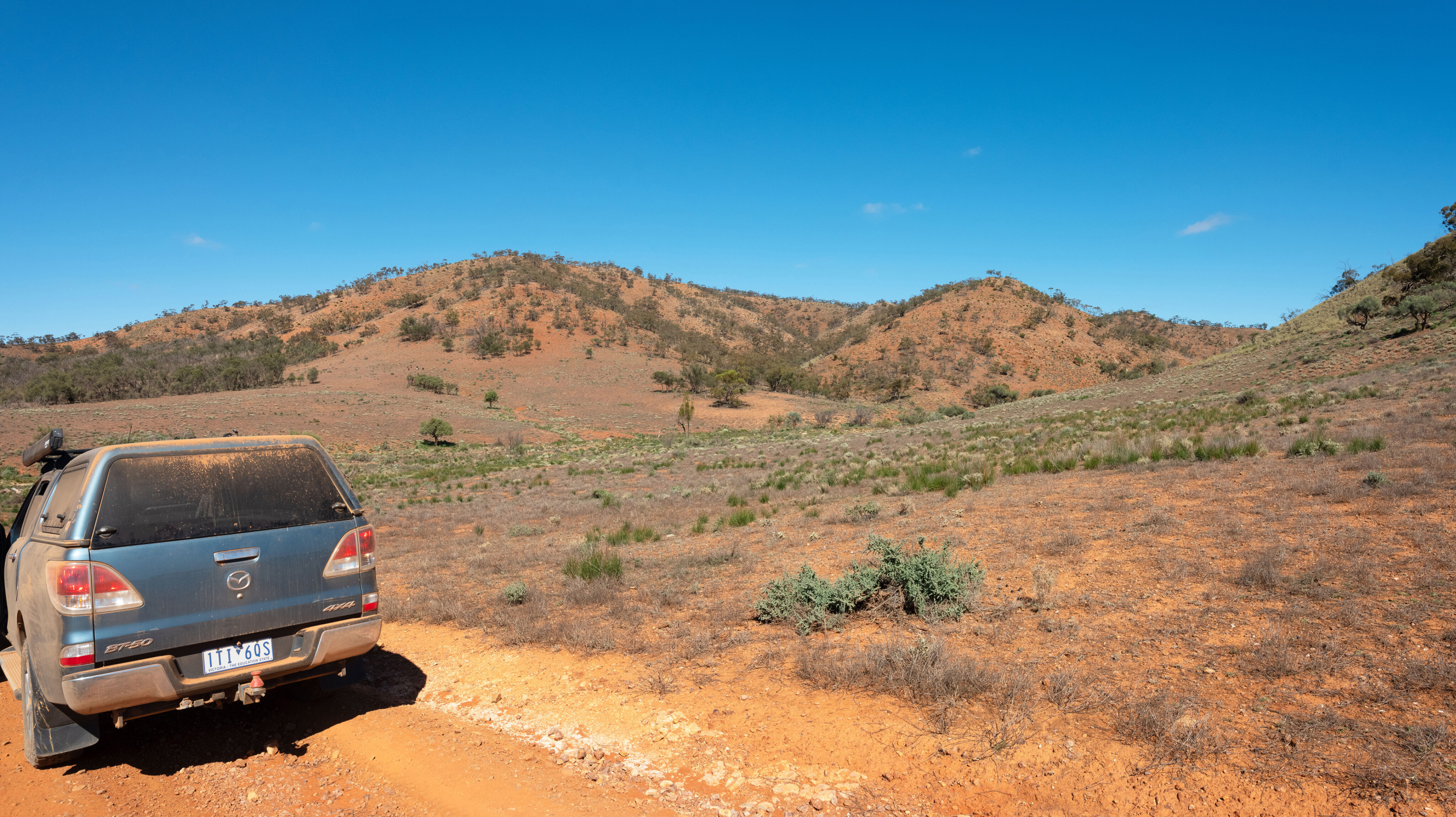
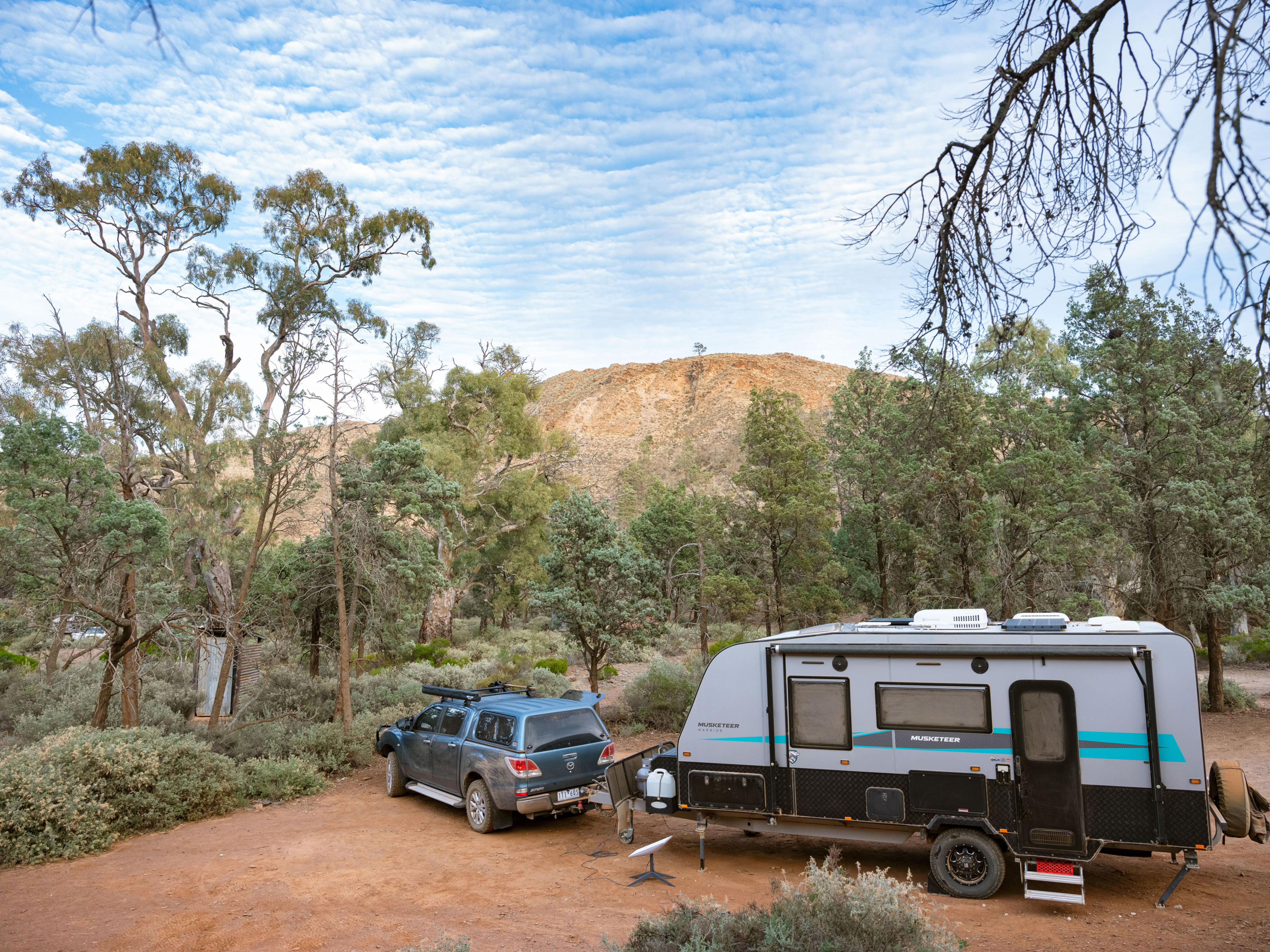
Bendleby Station, a sprawling 15,000ha property near South Australia’s Flinders Ranges, has evolved from a sheep-grazing station into a premier destination for 4x4 enthusiasts. Located about 50km north of Orroroo, it has been under the ownership of the Luckcraft family for more than 50 years. In the past five years, the fourth-generation owners, Charlie and Kylie Luckcraft, have transformed it into an award-winning adventure spot.
The station’s main attraction is its 200km of diverse 4x4 tracks, catering to all levels of experience from novice to expert. Each track has a difficulty rating, and Charlie and Kylie personally welcome guests, providing maps and advice on which tracks suit their vehicle and skill level.
189
The difficulty ratings are accurate, so a track rated 10 out of 10 is extremely challenging.
Visitors should be prepared for potential mechanical issues, which are usually the result of inadequate vehicle maintenance or overconfidence. The station offers emergency recovery services at a cost, so a thorough vehicle check before setting out is advisable.
Camping at Bendleby requires a 4x4 vehicle. The Hidden Valley area, in particular, offers some of the most picturesque campsites, nestled along a dry creek bed surrounded by ancient red gums. The sites are secluded and come with complimentary firewood. After a long drive, the serene environment is perfect for relaxing and enjoying the natural beauty, which includes rolling foothills and rugged ranges.
189
Camper trailers are popular among visitors, though there are also options for caravans.
Bendleby Station is pet-friendly, allowing dogs on leads, and offers activities like mountain biking, bushwalking, and horse riding. The walking trails vary in difficulty, with some following narrow gorges and others climbing into the surrounding hills. Guides are available at the station’s reception.
Historical ruins of the original Gumdale Homestead from the 1800s provide insight into the property’s past. Initially used for cereal growing and dairy cattle, the land’s agricultural potential diminished due to droughts and changed weather patterns. This led to a shift from cropping to grazing and the amalgamation of properties. Nearby, Johnberg, a ghost town with a population of just two, offers a glimpse of the area’s history.
189
The buildings are in varying states of repair, and a stop here provides a chance to see original structures from a bygone era.
Bendleby’s tracks include a variety of experiences. The Gum Creek Drive, rated medium, features steep climbs, rocky sections, and beautiful scenery. It culminates in a lookout with panoramic views. North South Ridge Track starts with a challenging climb to Sunset Lookout, offering stunning vistas and ends with the one-way Kokoda Trail back to Hidden Valley.
Gum Gorge Road is a gentler drive, following a wide gum-lined creek and connecting to Monument Loop. This track offers scenic views and some steep ascents and descents. Monument Loop ultimately leads back to Kokoda Trail.
189
For more challenging terrain, the Hungry Ranges to the south provide rugged tracks. Lantern Gate and Back Track are particularly rough, with rocky sections and expansive views.
Back Track meets North Fence Track, which features rocky conditions and significant elevation changes. The difficult Billy Goat Ridge should only be attempted by those with highly capable vehicles and advanced driving skills.
The East Fence Track and Aeroplane Gorge, named for a forced landing by a Flying Doctor in 1927, add historical interest to the visit. The challenging tracks and rugged landscapes make Bendleby a destination for those seeking both adventure and natural beauty.
189
Whether you’re a seasoned 4x4 driver or an occasional enthusiast, Bendleby Station offers a range of experiences. From challenging tracks and scenic drives to serene campsites and historical insights, it’s worth the drive, despite its remoteness.
With its focus on providing a memorable experience, Bendleby Station has earned its place as a top 4x4 destination, reflected in its numerous tourism awards and accolades.
189
Back to top ⬆️
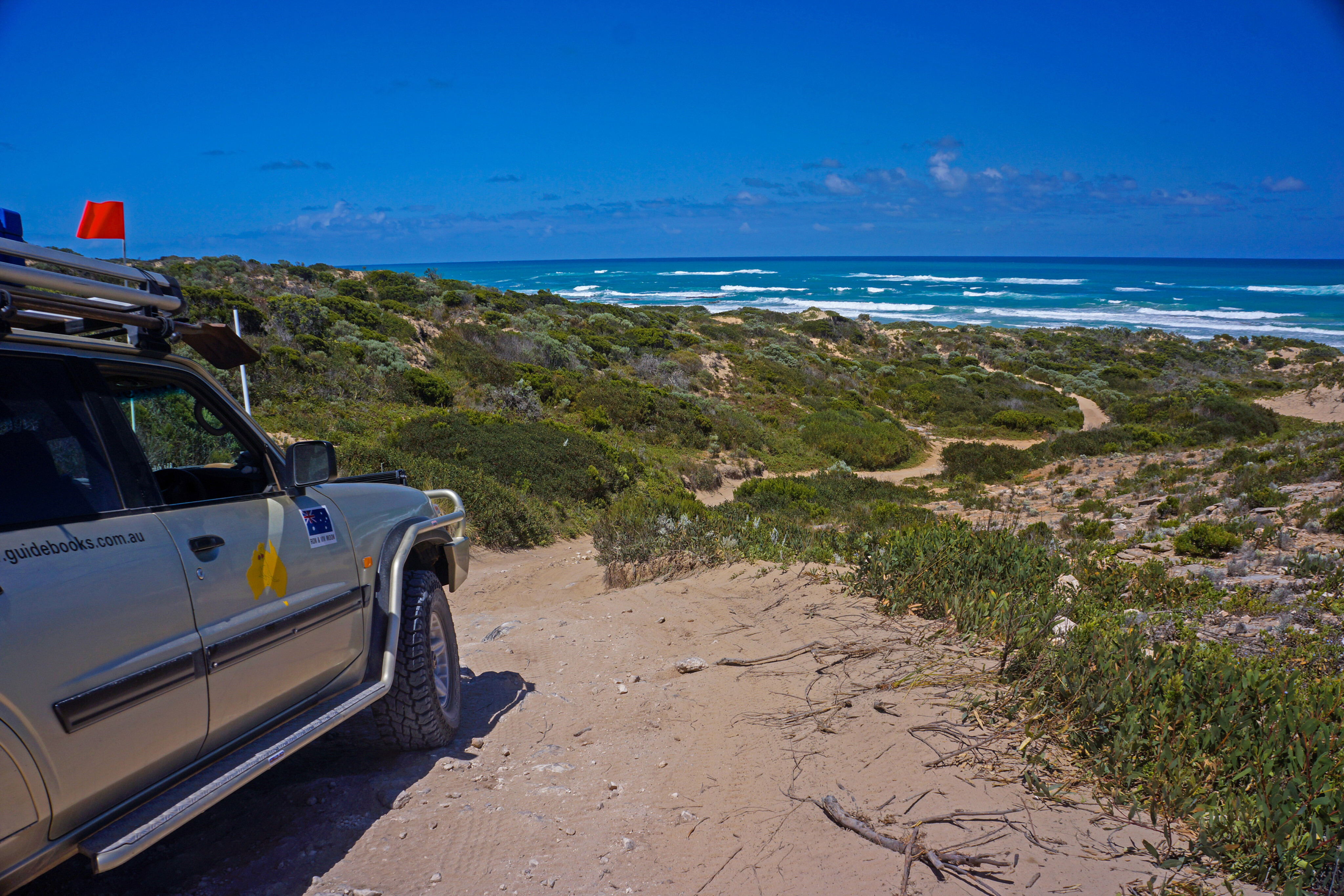
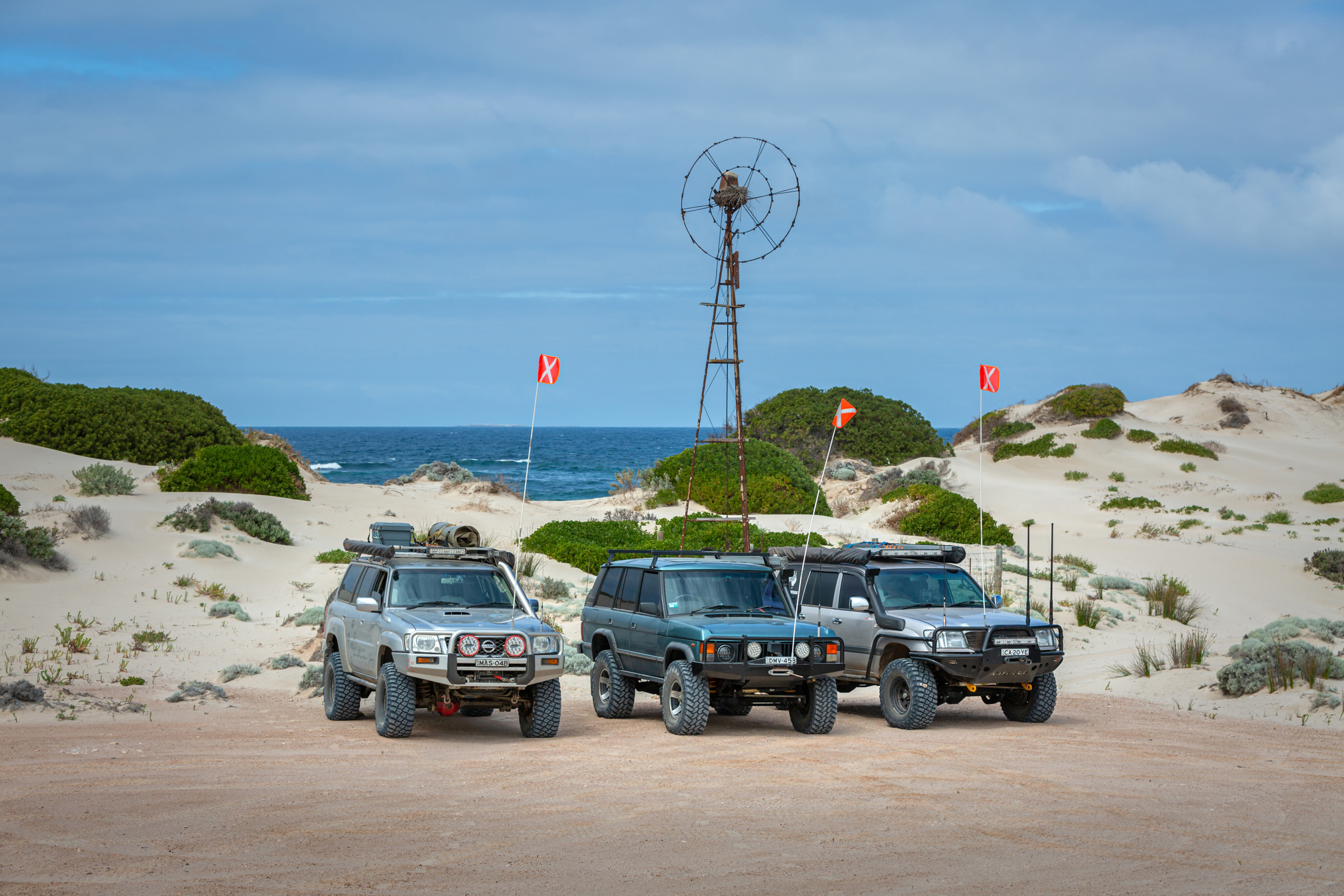
Wider Robe area
Ron Moon
Wandering the dunes and beaches of the south-east of South Australia.
Robe is evolving into a trendy tourist destination with around 50 historic buildings, stylish cafes, and several good pubs. Historically a haven for fishermen, divers, and four-wheel drivers, Robe’s protected marina supports a crucial crayfishing fleet. The area was visited in the 1960s for abalone and crayfishing, though the challenging seas often thwarted plans.
Aboriginal people have long inhabited this coastline, with shell middens scattered on rocky headlands marking their historical presence. The Bungandidj clan lived from Robe south to the Victorian border, while the Meintangk group lived north to Cape Jaffa.
189
The town was officially settled in 1846 and quickly became South Australia’s second busiest port.
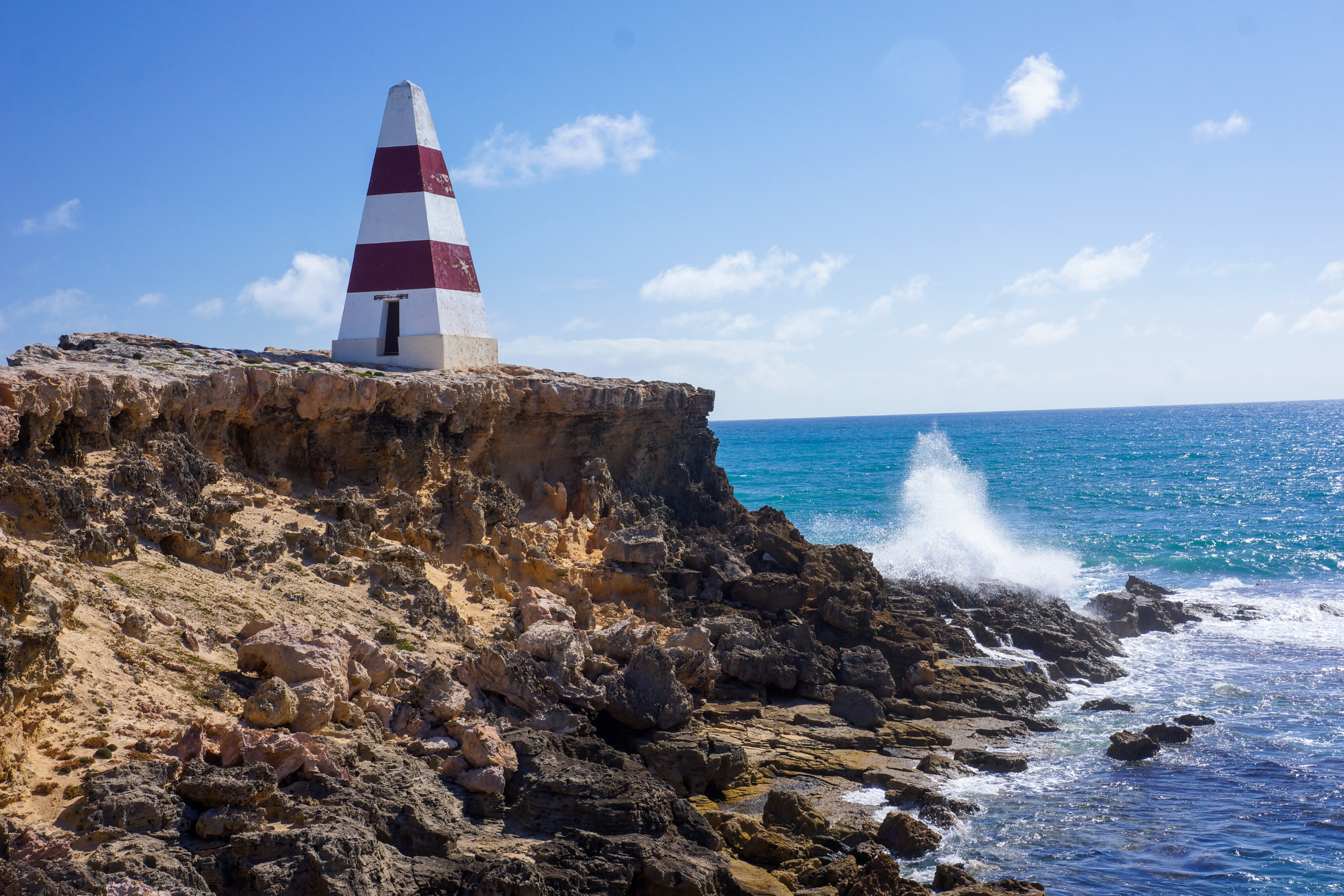
The famous Cape Dombey obelisk, built in 1852, guided ships into the port. Chinese gold miners began arriving around 1854, bypassing Victorian taxes, and the town saw significant activity with 15,000 Chinese and 32 foreign ships from the USA, Holland, and England.
By the 1930s, Robe had become a key crayfishing base, a role it continues to play. Tourism and a couple of well-situated caravan parks make it an ideal base for exploring the coast and hinterland.
189
South of the Stony Rises the route alternates between beaches and dunes, passing over rocky headlands, with limestone bluffs and reefs becoming more frequent as the Bishops Pate area approaches.
Bishops Pate is a prominent headland and bay with a track leading east out of the park. This area includes Lake Robe, a game reserve attracting waders, waterbirds, and other wildlife. The melaleuca scrub and samphire flats are ideal for birdwatching, with kangaroos and occasional emus adding variety.
The southern route mirrors previous conditions with steep pinches and tricky side slopes. On these slopes, stopping can lead to difficulties in regaining momentum, often requiring a reverse down the dune to start over.
Errington Beach is located about 20km from Robe. Here, turning east along the southern access track leads to the main dirt road and Nora Creina, a small bay with fishing and holiday shacks. The route then continues to Stinky Beach for a challenging drive south to Beachport. With luck, arriving before sunset allows for a drink and meal at the pub before returning to Robe.
189
Further south, the challenging beaches continue through Canunda National Park to Carpenter Rocks. The soft sand here demands high experience, proper equipment, and travelling with others for safety.
The nearby Long Beach is known for its firm sand and ideal conditions for swimming and kiteboarding. The northern end of the beach, about 10km from Robe, offers a quieter experience. Just south of Boatswain Point, a low bluff marks an exit point from the beach. Inland, dirt roads lead to Wright Bay, where a popular campground offers a serene spot for those in the know.
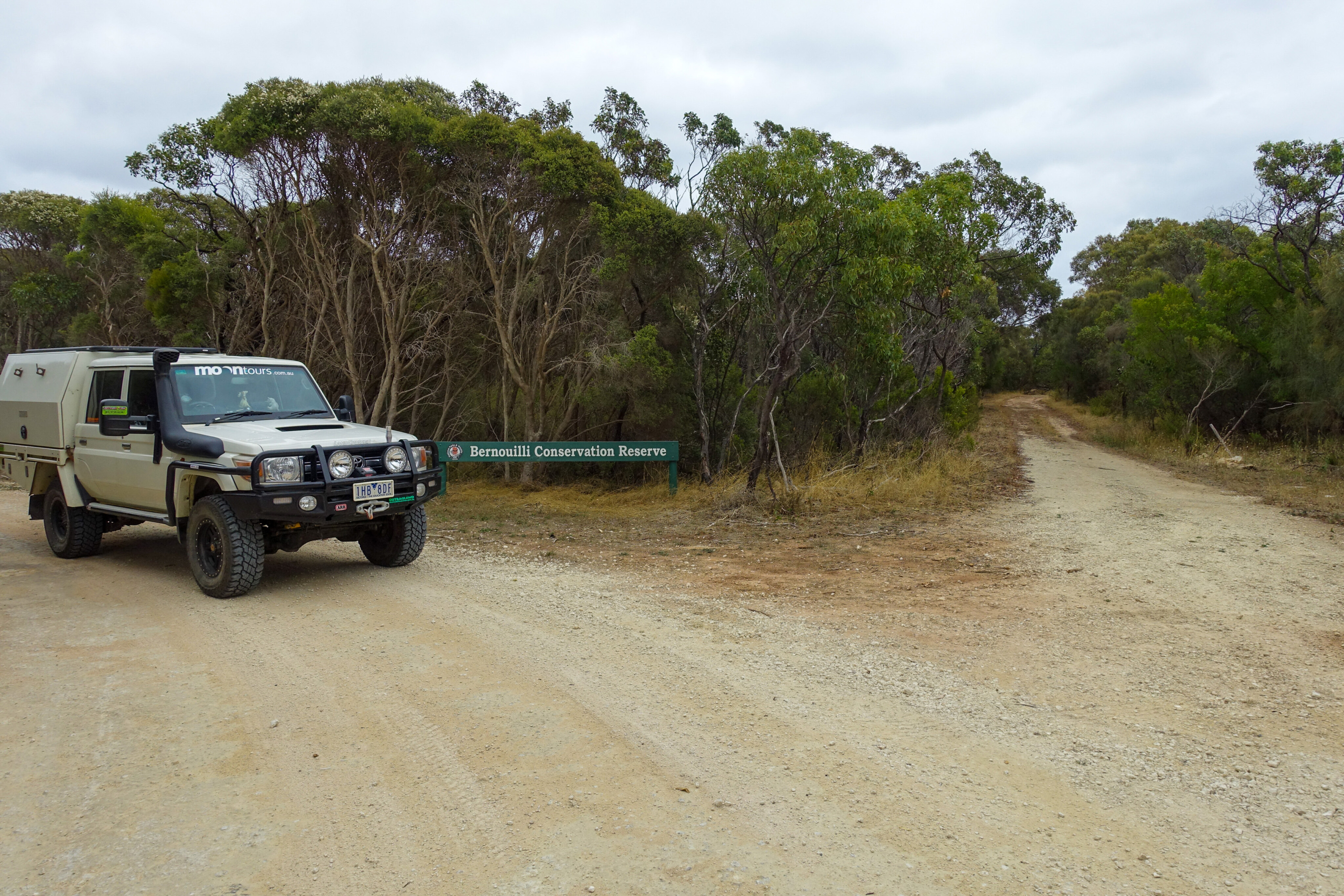
From Wright Bay, a farm road leads north into the Bernoulli Conservation Reserve, eventually becoming a sandy track toward Cape Jaffa. Near the tip of the headland, the remains of the Cape Jaffa Lighthouse cottages can be found. Built in 1872 for lightkeepers’ families, the cottages were abandoned in 1929.
189
The lighthouse continued operating until the 1970s when it was replaced by an automatic light on the reef and the original structure was moved to the Cape Jaffa Lighthouse Museum in Kingston SE.
From the cottages, a drive along the beach northward is possible, but deep seaweed can make it impractical. Opting for inland tracks will lead to Cape Jaffa’s small town, where a new marina has struggled to attract boats and activity.
A stop in Kingston SE should include a visit to the bakery for coffee. That’s one of the great attractions of the beaches around Robe: there is always something new to discover and places to explore!
189
Back to top ⬆️
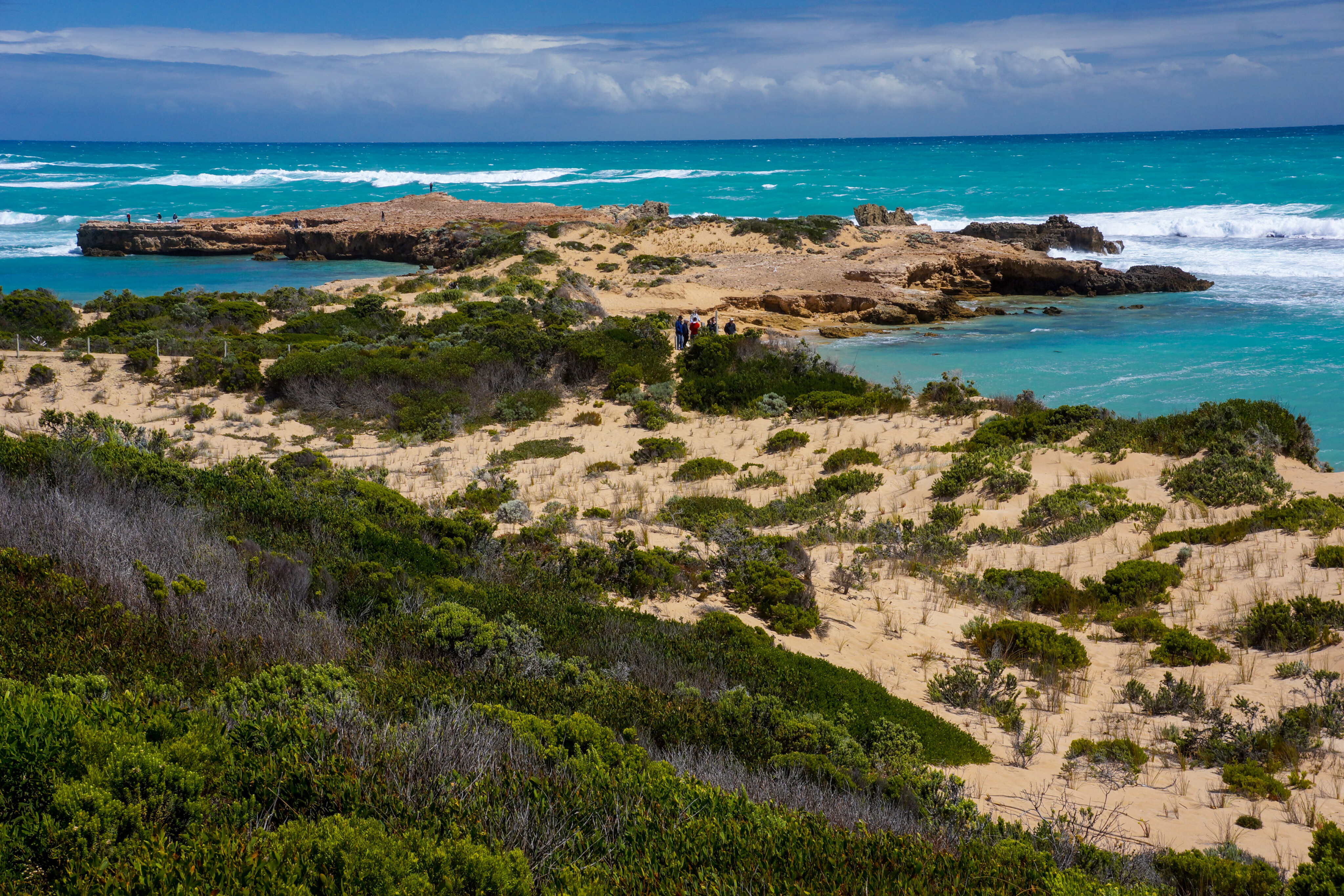
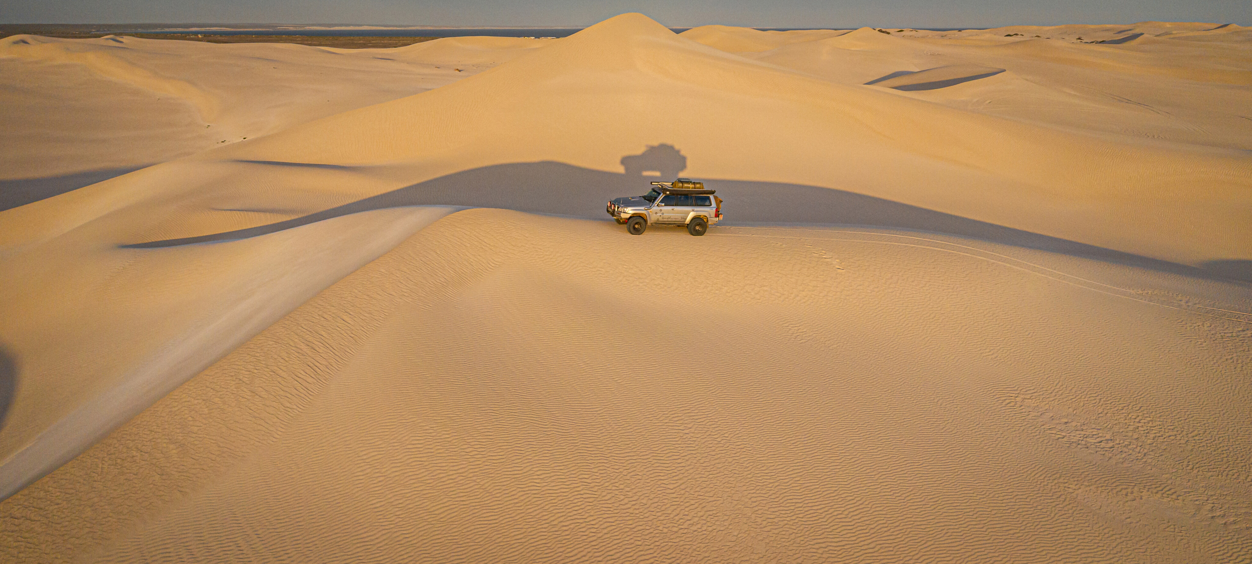
Fowler's Bay
Scott Mason
With isolated beaches, cliff-top single tracks and stunning dunes, Fowler’s Bay is home to some of the best hidden off-roading in Australia.
Crystal-clear water, stunning beaches teeming with fish, secluded coves, rocky headlands with cliff-top tracks, and some of the best sand-dune driving imaginable – without the crowds. Fowlers Bay is a near-perfect four-wheel-drive destination that should definitely be on any adventurer’s list.
A drive along the Eyre Highway leads to the small township of Fowlers Bay. The area offers little more than a basic caravan park, a small store, and a cafe, while the long jetty is famous for southern right whale watching tours. However, the ascent into the dune system behind the town marks the start of an incredible 4x4 adventure.
189
Within minutes of starting, the camera will be out to capture panoramic views from the dunes above the town. This is a prime example of why owning a 4x4 is so rewarding.
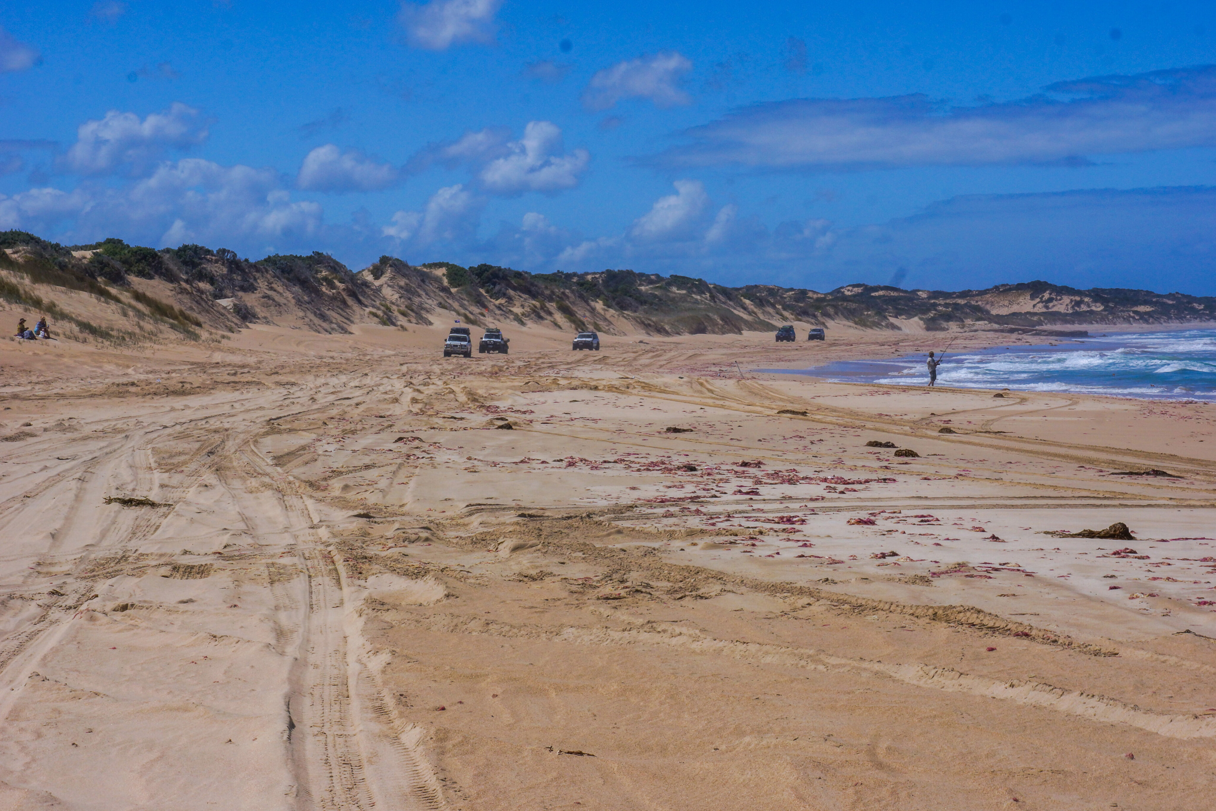
The route continues through the dunes and soon reaches a stunning beach. To get to the first camp, the entire length of this beach has to be travelled. A crucial warning here: seasonal ribbon seaweed can blanket the shore, creating a deceptive thin crust over rotting seaweed.
It may appear as hard-packed sand, but underneath could be a treacherous layer prone to bogging down vehicles. A well-worn beach track above the high-tide mark is safer but can be hard on a 4x4 and may disturb nesting shorebirds. This is quite different from driving on the more stable beaches of Fraser Island.
189
Once past this challenge, you’ll reach a golden beach with stunning water clarity and no other people in sight.
Campsites behind the next beach offer basic facilities, and the Great Australian Bight’s coastline lacks tall trees due to frequent high winds, so bringing a sturdy shelter for hot months is essential.
The clifftop, beach and dune driving in the area is some of the best off-roading to be experienced, ranking among the top three touring experiences in Australia. The absence of other travellers adds to the charm.
Secluded beaches surrounded by steep headlands provide opportunities to fish or relax in the sun.
189
Each evening brings the reward of an idyllic bush camp, often found along inland tracks among thicker vegetation for wind protection, though always close to the coast.
From here, punters can travel to the end – or start – of the Dog Fence, a historical landmark tracing back to the late 19th century. Initially constructed by pastoralists to keep dingoes out, the fence was later extended following a Royal Commission on vermin’s impact on grazing lands.
With this endpoint in mind, the journey continues past one final notable landscape: the Wanginya Sandhills. This area, rarely visited, features overgrown tracks and fallen timber. Clearing the path through dense vegetation and shifting sand can be challenging but rewarding, with one last stunning bush camp before reaching the famous fence.
Fowlers Bay always leaves a lasting impression. It truly is incredible.
Back to top ⬆️
COMMENTS